Home
States
Colorado
Connecticut
Maine
Massachusetts
New Hampshire
New York
Rhode Island
Utah
Vermont
View All
Lists
NE 4,000 Footers
NE 100 Highest
NH 4,000 Footers
NH 100 Highest
NH 52 With A View
NH Belknap Range
NH Ossipee 10
Links
Trail Conditions
Trip Log
Sunrises
Sunsets
About
|
Blueberry Mountain
Benton, NH
Trailheads, measurements, times, distances, and maps are all approximate and relative to the hike(s) as shown below.
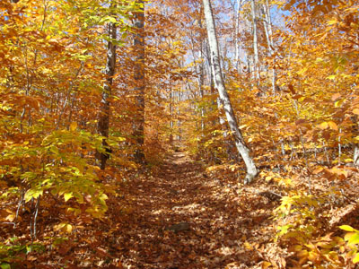
Looking up the golden Blueberry Mountain Trail
Route: Blueberry Mountain Trail, spur path, (Blueberry Mountain), spur path, Blueberry Mountain Trail
On my way back from Massachusetts, I decided to do a brief hike. While it had seemed to be a bit far to drive to, Blueberry Mountain seemed like a perfect fit in transit.
Arriving at a full parking lot, I had to park on the side of the road. The first portion of the Blueberry Mountain was basically a gradual walk along some inactive logging roads. With the golden leaves, it was very scenic.
After awhile, the trail reached some ledges, and ended up on ledges of some sort for pretty much the balance of the easy to moderate ascent. Much of this portion was very scenic.
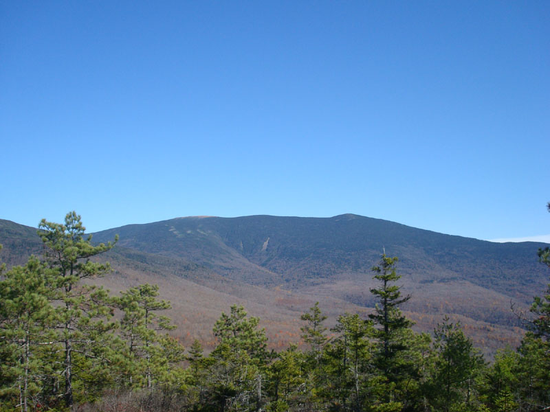
Reaching the highpoint of the trail, I followed the obvious spur trail to the summit. Though obscured by trees, there were still some halfway decent views of Mt. Moosilauke from the highpoint. Looking around for a better viewpoint (but not finding one, though I didn't spend too much time doing so), I suspect I may have found the old trail that leads to Jeffers Mountain.
After hanging out at the summit for awhile, I went back to the Blueberry Mountain Trail and enjoyed the views a bit more. While it is a very scenic hike, perhaps the one thing missing is a single dynamite viewpoint (the view of Moosilauke near the trail a bit below the summit is nice though).
One surprising thing was the volume of mountain bikers on the trail - not something I'm used to encountering in my travels in the trails of the White Mountains!
| Hike Ratings |
|
Getting To Trailhead: |
Easy |
| Destination: |
Blueberry Mountain |
|
Length: |
Moderate |
|
Steepness: |
Moderate |
|
Navigation: |
Easy |
|
Views: |
Excellent |
|
Crowds: |
Moderate |
|
| Hike Stats |
|
Date Hiked: |
Sunday, October 19, 2008 |
| Hike Commenced: |
12:43 PM |
| Parking Elevation: |
1,550' |
| Destination: |
Blueberry Mountain |
| Ascent Commenced: |
12:43 PM |
| Summit Reached: |
1:23 PM |
| Time Elapsed: |
00:40 |
| Trailhead Elevation: |
1,558' |
| Summit Elevation: |
2,662' |
| Vertical Gain: |
1,129' |
|
|
| Hike Vertical Gain: |
1,162' |
|
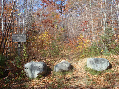
The Blueberry Mountain Trail trailhead

Looking at Mt. Moosilauke from near the Blueberry Mountain summit


Directions to trailhead: Take Route 25 west from Plymouth to Glencliff. Take a right onto High Street, then shortly thereafter take a left onto Long Pond Road. Shortly after passing the Tunnel Brook Trail on the right, the Blueberry Mountain Trail parking area and trailhead will be on the left.
Back to Blueberry Mountain Profile
|