Home
States
Colorado
Connecticut
Maine
Massachusetts
New Hampshire
New York
Rhode Island
Utah
Vermont
View All
Lists
NE 4,000 Footers
NE 100 Highest
NH 4,000 Footers
NH 100 Highest
NH 52 With A View
NH Belknap Range
NH Ossipee 10
Links
Trail Conditions
Trip Log
Sunrises
Sunsets
About
|
Blueberry Mountain
Benton, NH
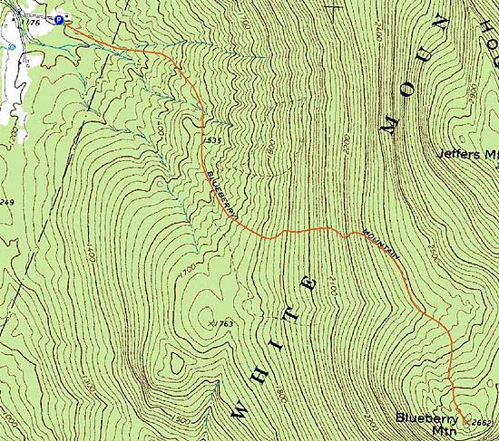
Trailheads, measurements, times, distances, and maps are all approximate and relative to the hike(s) as shown below.
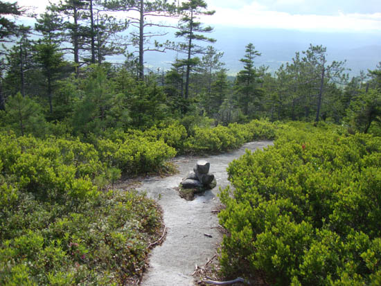
Looking down the Blueberry Mountain Trail
Route: Blueberry Mountain Trail, spur path, (Blueberry Mountain), spur path, Blueberry Mountain Trail
Trail was a bit grown in up high, but generally pretty tame. Mediocre views from the summit, but some nice vistas from the upper portion of the trail.
| Hike Ratings |
|
Getting To Trailhead: |
Easy |
| Destination: |
Blueberry Mountain |
|
Length: |
Moderate |
|
Steepness: |
Moderate |
|
Navigation: |
Moderate |
|
Views: |
Moderate (due to weather) |
|
Crowds: |
Minimal |
|
| Hike Stats |
|
Date Hiked: |
Friday, July 1, 2011 |
| Parking Elevation: |
1,200' |
| Destination: |
Blueberry Mountain |
| Time Elapsed: |
01:07 |
| Trailhead Elevation: |
1,200' |
| Summit Elevation: |
2,662' |
| Distance: |
2.8 miles |
| Vertical Gain: |
1,522' |
|
|
| Hike Time Elapsed: |
02:17 |
| Hike Vertical Gain: |
1,582' |
|
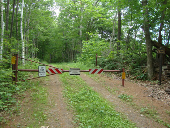
The Blueberry Mountain Trail trailhead

Wood lily on the lower Blueberry Mountain Trail
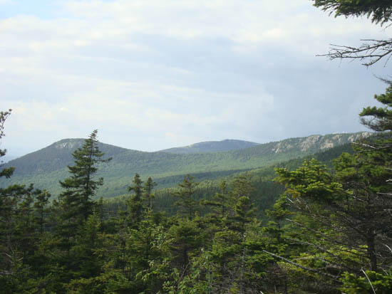
The Hogback as seen from one of the Blueberry Mountain Trail vistas

Directions to trailhead: From Route 25 in East Haverhill, take Lime Kiln Road north. Bear right onto Page Road. Blueberry Mountain Road will eventually be on the left. The Blueberry Mountain Trail starts at the gate on this road.
Back to Blueberry Mountain Profile
|

