Home
States
Colorado
Connecticut
Maine
Massachusetts
New Hampshire
New York
Rhode Island
Utah
Vermont
View All
Lists
NE 4,000 Footers
NE 100 Highest
NH 4,000 Footers
NH 100 Highest
NH 52 With A View
NH Belknap Range
NH Ossipee 10
Links
Trail Conditions
Trip Log
Sunrises
Sunsets
About
|
Brier Hill
Tuftonboro, NH
Trailheads, measurements, times, distances, and maps are all approximate and relative to the hike(s) as shown below.
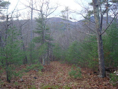
Looking down the woods rood to Brier Hill
Though the forecast looked pretty poor, the satellite imagery nonetheless looked more promising. Thus, I decided to take my chances with a somewhat local sunset hike.
Arriving at the beginning of the woods road, I didn't have much room to park (even with my tires in the ditch). Perhaps in the future I'll try the other side of the road.
The woods road at first cuts through the large field, at a slight angle, before taking a sharp turn to the right (south, just before entering the woods). From there, the road takes a turn to the left (another woods road exits right) and heads uphill at a moderate pace, soon passing a communication tower and then narrowing a bit.
After climbing at a barely moderate pace, the road takes a dip into a wet area, prior to climbing again and then taking another small dip. Just after that dip, I took a right onto another woods road that headed up to the summit at a gradual to moderate pitch. As I ascended, I could see, through the trees, Big Ball Mountain behind me (I have eyes in the back of my head apparently) and Dan Hole Pond to my left (I have eyes in the side of my head too, apparently).
Reaching the somewhat ledgy summit area, I was just about ready to be let down by partially obstructed views of the lake. However, I followed a short, feint herd path downhill (southwesternish) to a wide open ledge area.
From here, the views were tremendous - a good 180 degrees worth, ranging from south to north. The Belknaps were particularly impressive from this angle and elevation.
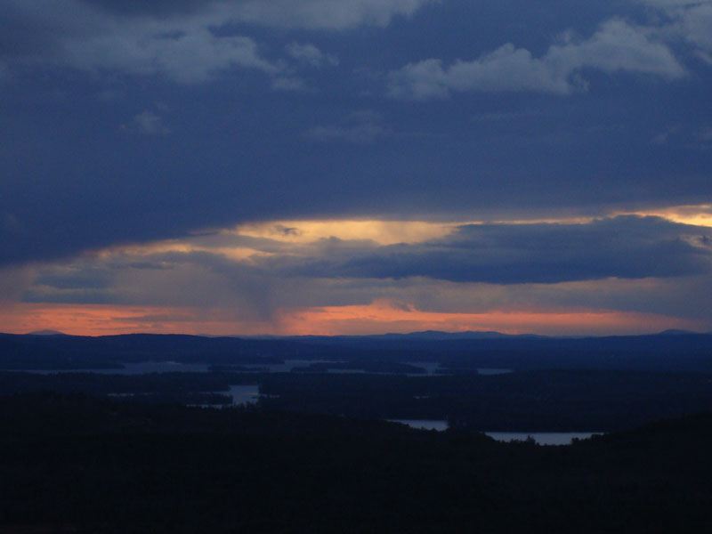
The sunset, though not spectacular, was nonetheless decent considering the weather forecast. While there were some dark clouds and snow flurries obstructing it a bit, there were still some decent colors along the horizon.
Not a bad little hike - if snowbanks don't appear soon, I may check it out again.
| Hike Ratings |
|
Getting To Trailhead: |
Easy |
| Destination: |
Brier Hill |
|
Length: |
Easy |
|
Steepness: |
Moderate |
|
Navigation: |
Moderate |
|
Views: |
Excellent |
|
Crowds: |
Minimal |
|
| Hike Stats |
|
Date Hiked: |
Monday, November 11, 2008 |
| Hike Commenced: |
3:31 PM |
| Parking Elevation: |
750' |
| Destination: |
Brier Hill |
| Ascent Commenced: |
3:31 PM |
| Summit Reached: |
3:52 PM |
| Time Elapsed: |
00:21 |
| Trailhead Elevation: |
750' |
| Summit Elevation: |
1,319' |
| Vertical Gain: |
589' |
|
|
| Hike Ended: |
4:37 PM |
| Hike Time Elapsed: |
01:06 |
| Hike Vertical Gain: |
609' |
|
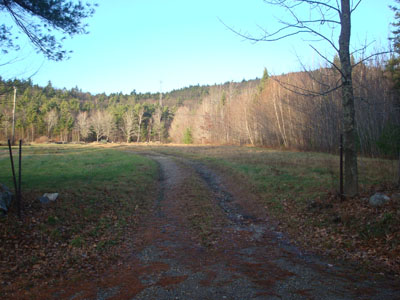
Trailhead to the woods road to Brier Hill
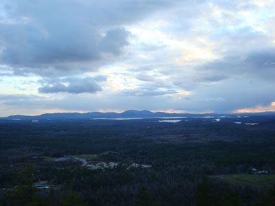
The Belknap Range as seen from Brier Hill
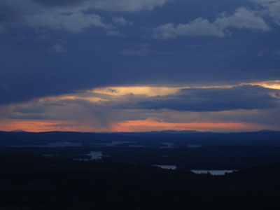
Sunset colors as seen from near the summit of Brier Hill
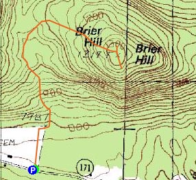

Directions to trailhead: Take Route 171 south from Route 109 in Moultonboro. Shortly after passing the Mt. Shaw Trail trailhead (which is south of the Castle in the Clouds entrance and the Bald Knob Trail trailhead at the Tuftonboro border), there will be a large field with two houses in it on the left (and a communications tower visible a bit above the field). The woods road begins at the southern end of the field at a break in the stonewall. Route 171 is rather narrow in this area, so roadside parking is very tight.
Back to Brier Hill Profile
|