Home
States
Colorado
Connecticut
Maine
Massachusetts
New Hampshire
New York
Rhode Island
Utah
Vermont
View All
Lists
NE 4,000 Footers
NE 100 Highest
NH 4,000 Footers
NH 100 Highest
NH 52 With A View
NH Belknap Range
NH Ossipee 10
Links
Trail Conditions
Trip Log
Sunrises
Sunsets
About
|
Burleigh Mountain
New Hampton, NH
Trailheads, measurements, times, distances, and maps are all approximate and relative to the hike(s) as shown below.
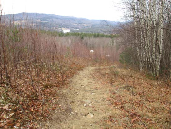
Looking down the hiking trail, prior to entering the woods
Route: Burleigh Mountain Trail
Trail was ice free and generally dry with a very slight dusting of snow up high.
There is some private road/no trespassing on ropes course signage, however I don't think that applies for hikers using the hiking trail. There is a hiking trail sign at the base of the old ski area. The view panorama sign is unfortunately gone.
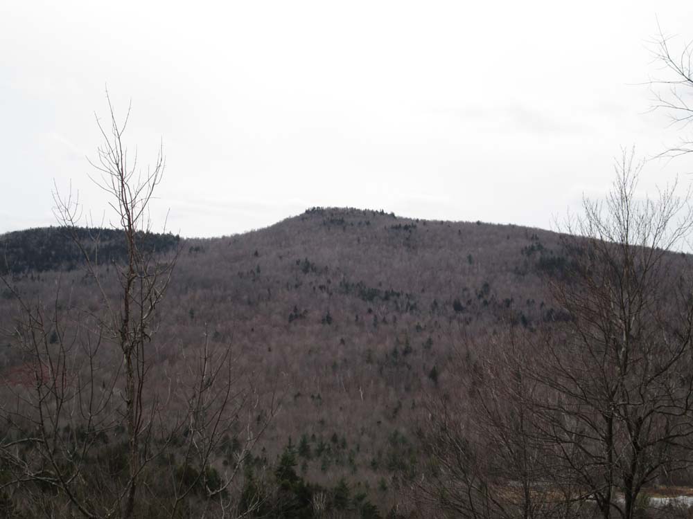
Not much in way of views from the summit (the sign is not at the highpoint). However, where the trail reaches the ridge (in a small saddle), if one bushwhacks another 350 feet or so, dropping maybe 2 dozen vertical feet, one will come out at a small rock slide, from where there are good directional views toward Hersey Mountain.
| Hike Ratings |
|
Getting To Trailhead: |
Easy |
| Destination: |
Burleigh Mountain |
|
Length: |
Easy |
|
Steepness: |
Difficult |
|
Navigation: |
Easy |
|
Views: |
Excellent |
|
Crowds: |
Minimal |
|
| Hike Stats |
|
Date Hiked: |
Sunday, December 8, 2013 |
| Time to Trailhead: |
00:08 |
| Parking Elevation: |
897' |
| Destination: |
Burleigh Mountain |
| Time Elapsed: |
00:14 |
| Trailhead Elevation: |
970' |
| Summit Elevation: |
1,462' |
| Vertical Gain: |
502' |
|
|
| Hike Time Elapsed: |
00:57 |
| Hike Vertical Gain: |
585' |
|
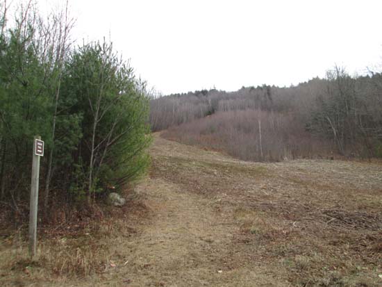
The Burleigh Mountain hiking trail
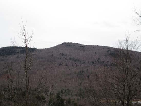
Looking at Hersey Mountain from the small rock slide on the back of Burleigh Mountain
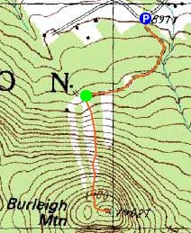

Directions to trailhead: From I-93 in New Hampton, take Route 104 West. Take a left onto Route 132. Shortly after passing through New Hampton, take a right onto Gordon Hill Road. After heading up this road briefly, it reaches a T-intersection with Burleigh Mountain Road (on left). There is limited room to park at the junction. Continue on foot up Burleigh Mountain Road, then take a right near the end onto a gated road. The Burleigh Mountain hiking trail will be near the end of this road, on the left at a somewhat clear ski slope.
Back to Burleigh Mountain Profile
|