Home
States
Colorado
Connecticut
Maine
Massachusetts
New Hampshire
New York
Rhode Island
Utah
Vermont
View All
Lists
NE 4,000 Footers
NE 100 Highest
NH 4,000 Footers
NH 100 Highest
NH 52 With A View
NH Belknap Range
NH Ossipee 10
Links
Trail Conditions
Trip Log
Sunrises
Sunsets
About
|
Cannon Mountain
Franconia, NH
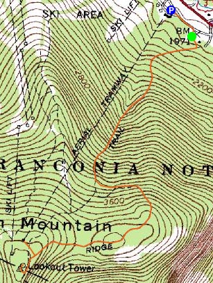
Trailheads, measurements, times, distances, and maps are all approximate and relative to the hike(s) as shown below.
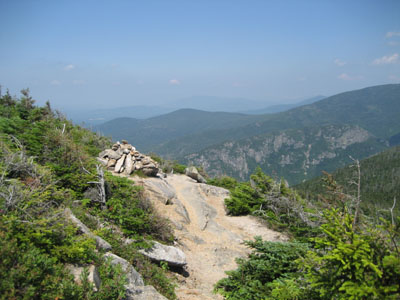
Kinsman Ridge Trail near the Cannon Mountain summit
After having bailed on Mt. Isolation after only two miles due to the knee the day before, I decided to try something a bit shorter. Time for Cannon Mountain.
I arrived at the trailhead just a bit after lunch time. Though the topography up the tram side of Cannon Mountain is rather steep, the Kinsman Ridge Trail has many cutbacks. The trail maintains a decent pitch, nonetheless, and is fairly challenging in some places (wet, large, steep rock slaps).
Once the gladed ski trail veers off to the right, things level out considerably. Once the trail reaches the top of the ridge, things become interesting - the vegetation here is maybe waist high, giving it a nice alpine zone like feel. This is also where the crowds start - thank you Mr. Tramway.
Despite the haze, the views from the summit observation deck were great - the Franconia Ridge and the Kinsmans were scenic as always.
After leaving the tower, I decided to take a quick walk over to the tram station and grab some french fries - having a full service cafeteria - as well as a bathroom where you can throw cold water on your face in the near 90 degree temperatures - makes the summit crowds bearable.
The descent was somewhat challenging - as expected - due to the wet rock.
Nice to be back out on the trails - I think I might try to get back up to this summit when there are less tourists around, as it's a nice one!
| Hike Ratings |
|
Getting To Trailhead: |
Easy |
| Destination: |
Cannon Mountain |
|
Length: |
Moderate |
|
Steepness: |
Very Difficult |
|
Navigation: |
Easy |
|
Views: |
Excellent |
|
Crowds: |
Heavy |
|
| Hike Stats |
|
Date Hiked: |
Thursday, July 26, 2007 |
| Hike Commenced: |
12:29 PM |
| Parking Elevation: |
1,965' |
| Destination: |
Cannon Mountain |
| Ascent Commenced: |
12:32 PM |
| Summit Reached: |
1:58 PM |
| Time Elapsed: |
01:26 |
| Trailhead Elevation: |
1,975' |
| Summit Elevation: |
4,100' |
| Vertical Gain: |
2,270' |
|
|
| Hike Ended: |
4:01 PM |
| Hike Time Elapsed: |
03:32 |
| Hike Vertical Gain: |
2,460' |
|
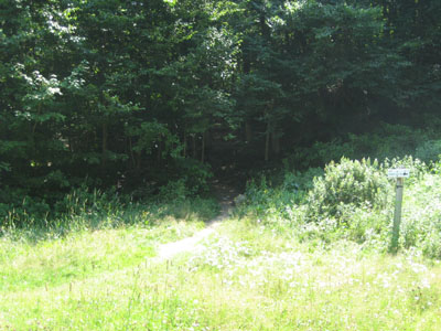
Kinsman Ridge Trail trailhead near the base of the tramway
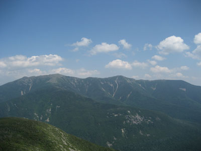
Looking east at the Franconia Ridge from the Cannon Mountain observation deck

Directions to trailhead: Take I-93 North to the Cannon Mountain Tramway exit. The dirt road to the trailhead is to the left when looking at the mountain from the parking lot.
Back to Cannon Mountain Profile
|


