Home
States
Colorado
Connecticut
Maine
Massachusetts
New Hampshire
New York
Rhode Island
Utah
Vermont
View All
Lists
NE 4,000 Footers
NE 100 Highest
NH 4,000 Footers
NH 100 Highest
NH 52 With A View
NH Belknap Range
NH Ossipee 10
Links
Trail Conditions
Trip Log
Sunrises
Sunsets
About
|
Cannon Mountain
Lincoln, NH, Franconia, NH
Trailheads, measurements, times, distances, and maps are all approximate and relative to the hike(s) as shown below.
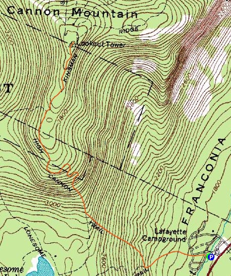
The Hi-Cannon Trail
Route: Lonesome Lake Trail, Hi-Cannon Trail, Kinsman Ridge Trail, (Cannon Mountain), Kinsman Ridge Trail, Hi-Cannon Trail, Lonesome Lake Trail
With the mostly sunny forecast, I decided to head up to Franconia Notch and Cannon Mountain. Arriving at the Lafayette Place trailhead, things were looking pretty cloudy and hazy. Great forecast!
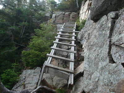
The first portion of the trail was fairly tame, soon branching off the Lonesome Lake Trail onto the Hi-Cannon Trail. I found the latter to be pretty rough - heavily eroded in places, rocky in others. While there were lots of switchbacks, there were also many short, steep pitches (including one that had a wobbly ladder).
The trail became fairly scenic just prior to the ladder - looking across the notch at the Franconia Ridge, then later looking down at Lonesome Lake.
After the Lonesome Lake views, the trail became a bit more gradual, soon reaching the Kinsman Ridge Trail and eventually the summit.
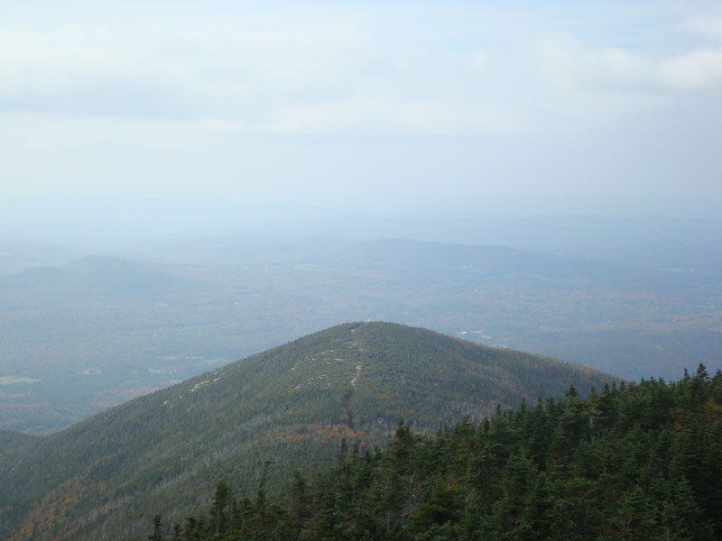
The views from the summit tower were rather limited - the peaks of the Franconia Ridge were obscured by clouds and the Kinsman Ridge was barely visible. Nonetheless, it was nice to be on the summit for awhile.
The descent wasn't too bad - I expected it to drag on more than it did.
| Hike Ratings |
|
Getting To Trailhead: |
Easy |
| Destination: |
Cannon Mountain |
|
Length: |
Moderate |
|
Steepness: |
Very Difficult |
|
Navigation: |
Easy |
|
Views: |
Moderate (due to weather) |
|
Crowds: |
Moderate |
|
| Hike Stats |
|
Date Hiked: |
Thursday, August 25, 2008 |
| Hike Commenced: |
2:04 PM |
| Parking Elevation: |
1,750' |
| Destination: |
Cannon Mountain |
| Ascent Commenced: |
2:04 PM |
| Summit Reached: |
3:35 PM |
| Time Elapsed: |
01:31 |
| Trailhead Elevation: |
1,750' |
| Summit Elevation: |
4,100' |
| Distance: |
2.8 miles |
| Vertical Gain: |
2,460' |
|
|
| Hike Ended: |
5:25 PM |
| Hike Time Elapsed: |
03:21 |
| Hike Vertical Gain: |
2,570' |
|
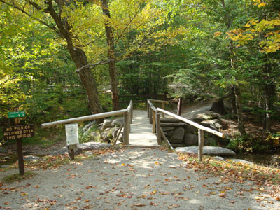
The Lonesome Lake Trail trailhead at Lafayate Place
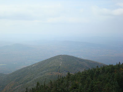
Looking at the peak above the old Mittersill ski area from the Cannon Mountain summit tower
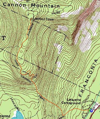

Directions to trailhead: Take I-93 South to the Lafayette Place exit. The Lonesome Lake Trail starts on the foot bridge at the hiker parking lot.
Back to Cannon Mountain Profile
|