Home
States
Colorado
Connecticut
Maine
Massachusetts
New Hampshire
New York
Rhode Island
Utah
Vermont
View All
Lists
NE 4,000 Footers
NE 100 Highest
NH 4,000 Footers
NH 100 Highest
NH 52 With A View
NH Belknap Range
NH Ossipee 10
Links
Trail Conditions
Trip Log
Sunrises
Sunsets
About
|
Cannon Mountain
Franconia, NH
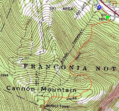
Trailheads, measurements, times, distances, and maps are all approximate and relative to the hike(s) as shown below.
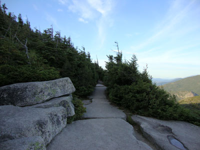
Kinsman Ridge Trail near the Cannon Mountain summit
With a crisp, clear day, I headed up to Cannon Mountain for a late afternoon hike. Though the ascent up the nasty Kinsman Ridge Trail was somewhat crowded, I had the summit and the descent to myself. Despite some dry weather, the trail had some wet slabs as well as typical mud pits.
The views from the summit tower were tremendous, as late day sun cast some very interesting shadows on the Osceolas and Scar Ridge.
| Hike Ratings |
|
Getting To Trailhead: |
Easy |
| Destination: |
Cannon Mountain |
|
Length: |
Moderate |
|
Steepness: |
Very Difficult |
|
Navigation: |
Moderate |
|
Views: |
Excellent |
|
Crowds: |
Heavy |
|
| Hike Stats |
|
Date Hiked: |
Thursday, August 27, 2009 |
| Hike Commenced: |
5:21 PM |
| Parking Elevation: |
1,965' |
| Destination: |
Cannon Mountain |
| Ascent Commenced: |
5:24 PM |
| Summit Reached: |
6:28 PM |
| Time Elapsed: |
01:04 |
| Trailhead Elevation: |
1,975' |
| Summit Elevation: |
4,100' |
| Vertical Gain: |
2,270' |
|
|
| Hike Ended: |
8:02 PM |
| Hike Time Elapsed: |
02:41 |
| Hike Vertical Gain: |
2,425' |
|
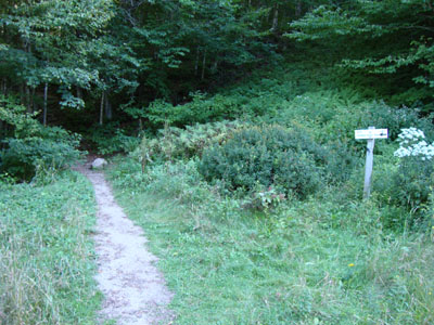
Kinsman Ridge Trail trailhead near the base of the tramway
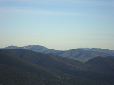
Looking at the Osceolas and Scar Ridge from the Cannon Mountain observation deck

Directions to trailhead: Take I-93 North to the Cannon Mountain Tramway exit. The dirt road to the trailhead is to the left when looking at the mountain from the parking lot.
Back to Cannon Mountain Profile
|


