Home
States
Colorado
Connecticut
Maine
Massachusetts
New Hampshire
New York
Rhode Island
Utah
Vermont
View All
Lists
NE 4,000 Footers
NE 100 Highest
NH 4,000 Footers
NH 100 Highest
NH 52 With A View
NH Belknap Range
NH Ossipee 10
Links
Trail Conditions
Trip Log
Sunrises
Sunsets
About
|
Carter Dome
Bean's Purchase, NH
Trailheads, measurements, times, distances, and maps are all approximate and relative to the hike(s) as shown below.
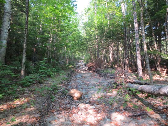
The Irene-washed-out Wild River Trail
Route: Wild River Trail, Black Angel Trail, Carter-Moriah Trail, (Carter Dome), Carter-Moriah Trail, Black Angel Trail, Wild River Trail
Northern section of Wild River Trail has taken a beating - portions resemble a brook bed, while one or two others may have been taken out by the river (there is a herd path at the top of the embankment). Other than getting over a few blowdowns, it's passable, though slower going than one would hope for what would otherwise be a flat, smooth trail.
Black Angel Trail was mostly dry (with a few minor mud patches that probably grow when wet) with plenty of quasi-annoying blowdowns to step over.
Carter-Moriah Trail to the Dome seems a lot more eroded now than I remember a few years ago (haven't been up there much outside of snow season in recent years).
| Hike Ratings |
|
Getting To Trailhead: |
Easy |
| Destination: |
Carter Dome |
|
Length: |
Difficult |
|
Steepness: |
Difficult |
|
Navigation: |
Easy |
|
Views: |
Excellent |
|
Crowds: |
Minimal |
|
| Hike Stats |
|
Date Hiked: |
Saturday, July 14, 2012 |
| Parking Elevation: |
1,150' |
| Destination: |
Carter Dome |
| Time Elapsed: |
05:49 |
| Trailhead Elevation: |
1,150' |
| Summit Elevation: |
4,832' |
| Distance: |
8 miles |
| Vertical Gain: |
3,732' |
|
|
| Hike Time Elapsed: |
10:49 |
| Hike Vertical Gain: |
3,782' |
|
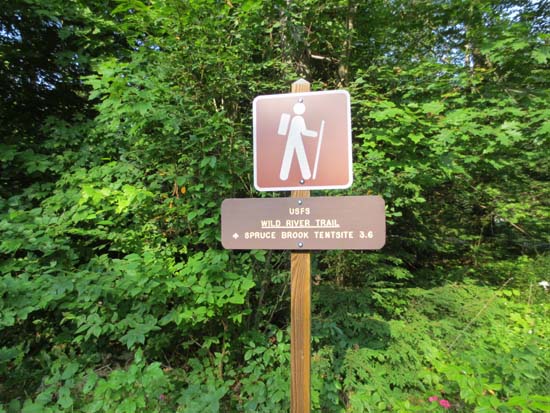
The Wild River Trail trailhead
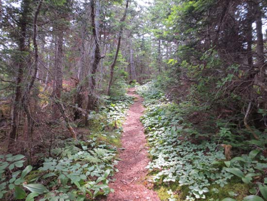
Looking up the Black Angel Trail
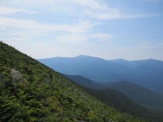
Looking at Mt. Washington from near the Carter Dome summit
Directions to trailhead: From US 2, take Route 113 south, then take a right onto Wild River Road. The Wild River Trail WMNF fee parking area and trailhead are located on the left just before entering the campground.
Back to Carter Dome Profile
|

