Home
States
Colorado
Connecticut
Maine
Massachusetts
New Hampshire
New York
Rhode Island
Utah
Vermont
View All
Lists
NE 4,000 Footers
NE 100 Highest
NH 4,000 Footers
NH 100 Highest
NH 52 With A View
NH Belknap Range
NH Ossipee 10
Links
Trail Conditions
Trip Log
Sunrises
Sunsets
About
|
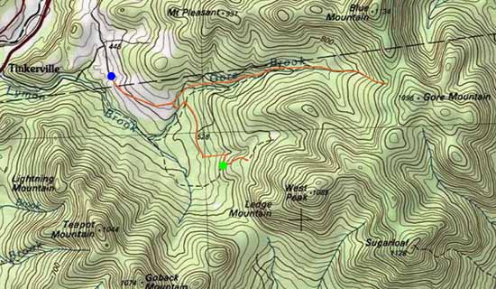
Castle Mountain (West Peak), Sugarloaf, Castle Mountain, Notch Mountain, Gore Mountain
Stratford, NH
Trailheads, measurements, times, distances, and maps are all approximate and relative to the hike(s) as shown below.
Bushwhacking to West Castle
Route: Brown Road, snowmobile trails, logging roads, bushwhack (West Castle), bushwhack, Sugarloaf Mountain Trail, (Sugarloaf), Sugarloaf Mountain Trail, bushwhack, (Castle Mountain), bushwhack, (Notch Mountain), bushwhack, (Gore Mountain), bushwhack, logging roads, Brown Road
Initial Brown Road walk had about 2-3" of fresh overnight powder on top of ice. Like Savage, little to snowpack prior to the overnight powder in the lower elevations.
Continuing beyond the camps through a recently logged area to the gate at the snowmobile trail, we turned left and headed northeast on the snowmobile/logging road. Where the road starting to go north, we hopped into the woods with snowshoes and bushwhacked up to West Castle. So so woods as we may have been a tad bit too south (there is a very old logging road that helps ascend, but it would have been filled with snowloaded spruce). Snowpack was 6-12" of hardpack (generally no sinking with snowshoes) with half an inch to two inches of fresh powder on top.
From West Castle, we headed northeast toward Castle, initially in some pretty crappy woods. Things opened up once we climbed out of the col. Snowpack also started to increase to 1-2 feet. We skirted Castle initially, but gained the ridge perhaps around 3,550 feet and had pretty good going all the way to Sugarloaf, staying a little northeast of the col and hitting the trail (no recent non-moose traffic, as expected with Nash Stream Road closed for the winter) maybe a tenth of a mile below the summit. Snow flurries limited the views, but we still had looks at the Percy Peaks, Savage, and the wind farm eyesore.
We then retraced our tracks and continued to the summit of Castle (no sign of a canister), then descended in so so woods toward Notch. Okay woods headed over Notch (no views, but I suspect one could poke around for some looks at adjacent peaks), and down to the col in so so woods. Nice open col. Above there, horribly thick spruce. In hindsight, we may have looked to descend below the col to the north, shoot across one of the old logging roads, then climb Gore from the northwest. But, from the south, the woods we had were thick spruce with some blowdown. Slow going.
From Gore, it was a pretty quick drop to the northwest, skirting occasional spruce and generally staying in decent woods until we finally made it to the long chain of logging roads (on the north side of Gore Branch) back out to Brown Road. Initially pretty good snow depths, but as we neared Brown Road, it became much the same of minimal base with 2-3 inches on top.
| Hike Ratings |
|
Getting To Trailhead: |
Difficult |
| Destination: |
Castle Mountain (West Peak) |
|
Length: |
Moderate |
|
Steepness: |
Moderate |
|
Navigation: |
Very Difficult |
|
Views: |
Moderate (due to weather) |
|
Crowds: |
Minimal |
| Destination: |
Sugarloaf |
|
Length: |
Difficult |
|
Steepness: |
Moderate |
|
Navigation: |
Very Difficult |
|
Views: |
Excellent |
|
Crowds: |
Minimal |
| Destination: |
Castle Mountain |
|
Length: |
Difficult |
|
Steepness: |
Moderate |
|
Navigation: |
Very Difficult |
|
Views: |
Minimal |
|
Crowds: |
Minimal |
| Destination: |
Notch Mountain |
|
Length: |
Difficult |
|
Steepness: |
Difficult |
|
Navigation: |
Very Difficult |
|
Views: |
Minimal |
|
Crowds: |
Minimal |
| Destination: |
Gore Mountain |
|
Length: |
Very Difficult |
|
Steepness: |
Difficult |
|
Navigation: |
Very Difficult |
|
Views: |
Minimal |
|
Crowds: |
Minimal |
|
| Hike Stats |
|
Date Hiked: |
Friday, January 2, 2015 |
| Parking Elevation: |
1,459' |
| Time to Trailhead: |
00:56 |
| Destination: |
Castle Mountain (West Peak) |
| Time Elapsed: |
01:23 |
| Trailhead Elevation: |
1,900' |
| Summit Elevation: |
3,590' |
| Vertical Gain: |
1,790' |
| Destination: |
Sugarloaf |
| Time Elapsed: |
02:11 |
| Trailhead Elevation: |
3,590' |
| Summit Elevation: |
3,710' |
| Vertical Gain: |
610' |
| Destination: |
Castle Mountain |
| Time Elapsed: |
00:54 |
| Trailhead Elevation: |
3,710' |
| Summit Elevation: |
3,567' |
| Vertical Gain: |
267' |
| Destination: |
Notch Mountain |
| Time Elapsed: |
00:34 |
| Trailhead Elevation: |
3,567' |
| Summit Elevation: |
3,402' |
| Vertical Gain: |
112' |
| Destination: |
Gore Mountain |
| Time Elapsed: |
00:59 |
| Trailhead Elevation: |
3,402' |
| Summit Elevation: |
3,610' |
| Vertical Gain: |
350' |
|
|
| Hike Time Elapsed: |
09:40 |
| Hike Vertical Gain: |
3,720' |
|
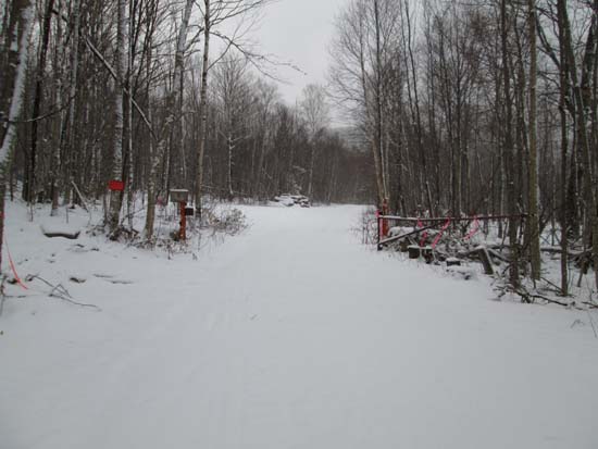
The gate at the far end of Brown Road
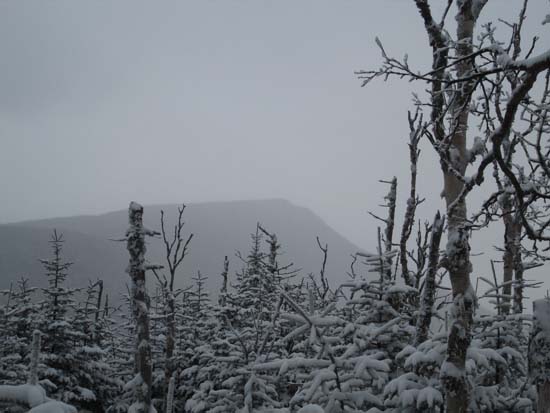
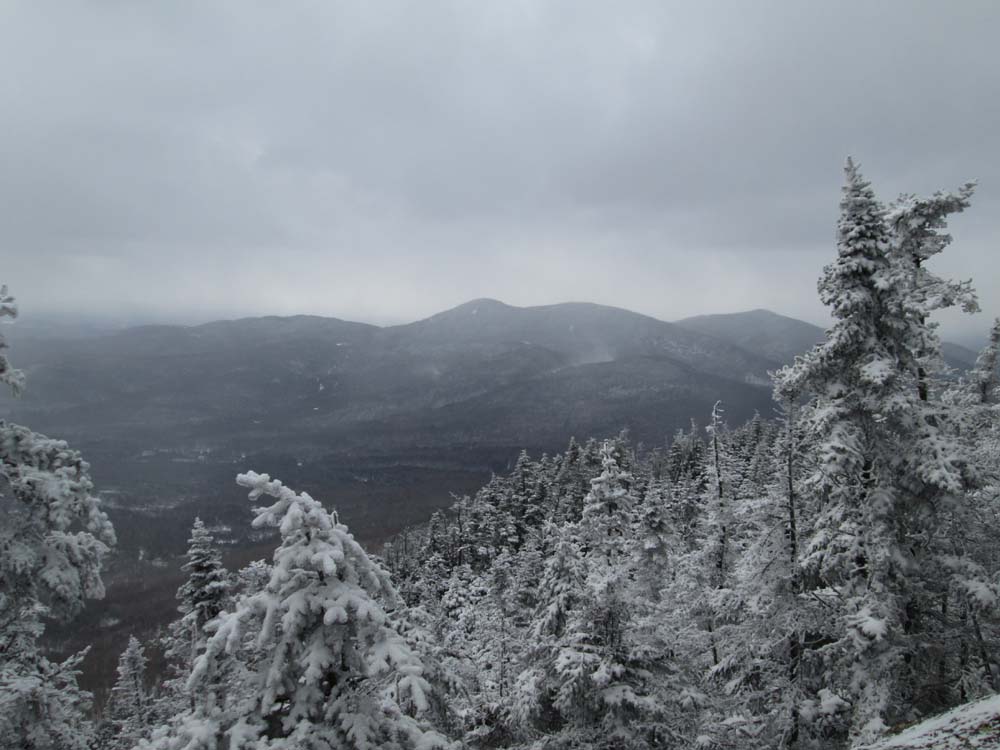
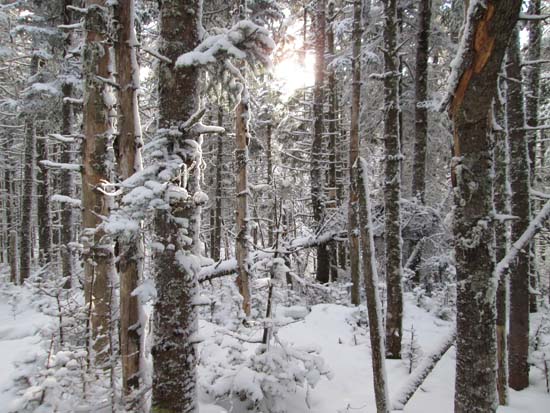
Looking at Sugarloaf from near the summit of West Castle
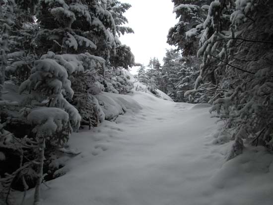
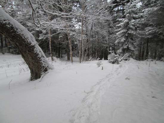
The Sugarloaf Mountain Trail
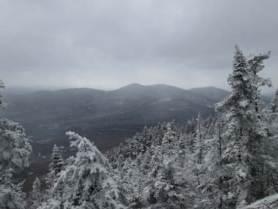
Savage Mountain as seen from Sugarloaf
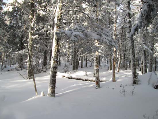
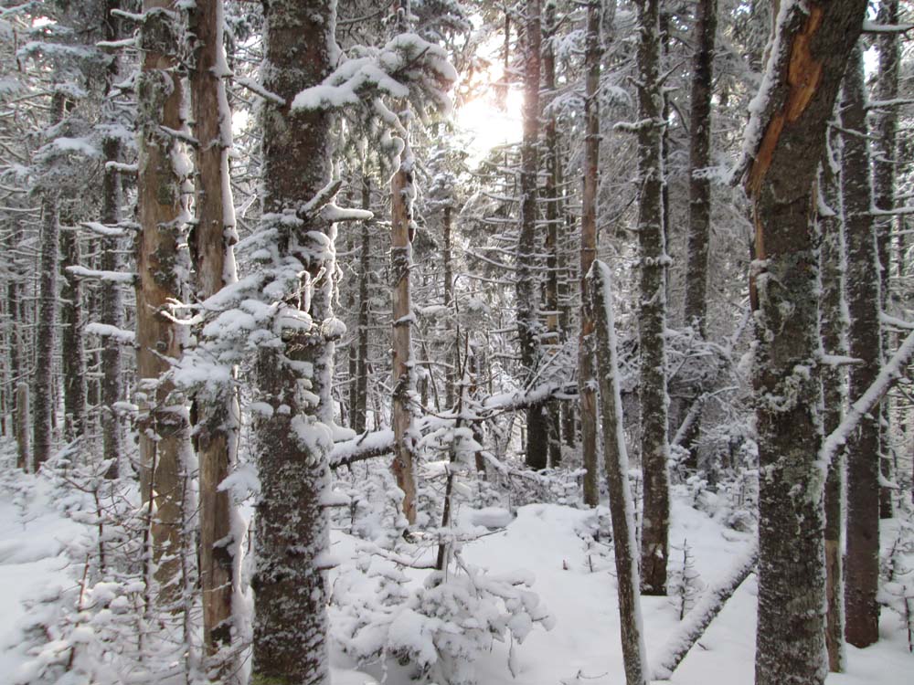
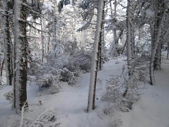
Bushwhacking to Castle
A lack of views on Castle Mountain
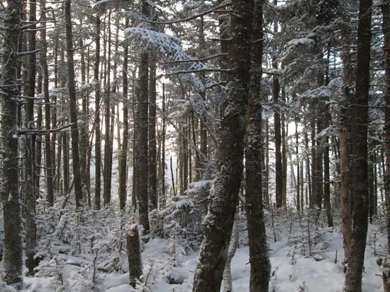
Bushwhacking to Notch Mountain
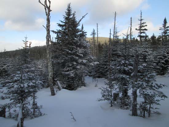
Notch Mountain
The Notch-Gore col
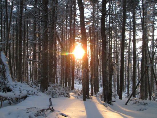
Sunset on Gore Mountain
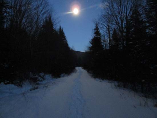
A moonlit walk out from Gore Mountain

Directions to trailhead: Take US 3 North from North Stratford, then take a right onto Meriden Hill Road. Bear left at a junction (gated road right). Take a right onto Brown Road. In winter, there may be some room to pull off the road near the quarry entrance (about half a mile before the last plowed house)
Back to Castle Mountain (West Peak) Profile
Back to Sugarloaf Profile
Back to Castle Mountain Profile
Back to Notch Mountain Profile
Back to Gore Mountain Profile
|