Home
States
Colorado
Connecticut
Maine
Massachusetts
New Hampshire
New York
Rhode Island
Utah
Vermont
View All
Lists
NE 4,000 Footers
NE 100 Highest
NH 4,000 Footers
NH 100 Highest
NH 52 With A View
NH Belknap Range
NH Ossipee 10
Links
Trail Conditions
Trip Log
Sunrises
Sunsets
About
|
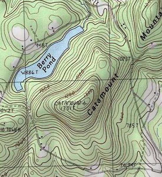
Catamount Mountain
Pittsfield, NH
Trailheads, measurements, times, distances, and maps are all approximate and relative to the hike(s) as shown below.
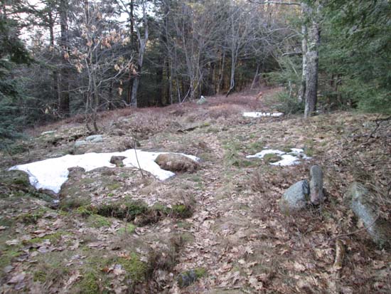
A herd path near the summit of Catamount Mountain
Route: Bushwhack, herd path, (Catamount Mountain)
Catamount Mountain in Pittsfield.
Initially attempted to ascend via the tower access road off Governors Road, but it was gated and posted. Instead, I parked at the pull off at the height of land on Route 107 and followed a woods road briefly, which petered out. From there, I bushwhacked just east of the ridge in mostly open woods. The west side of the ridge had some cliff bands and older logging, so the east side seemed better. The woods were mostly snow free and dry, with the exception of a few small patches of snow or muck.
Just north of the summit, I picked up a path marked with cairns. It looks like it has seen some use this month, but I'm not sure where it goes. I suspect it may come up from Berry Pond.
I found three viewpoints near the summit, providing views in multiple directions (but not to the northwest). One was just north of the tower, another just south of the highpoint, and another just off the top switchback on the access road.
| Hike Ratings |
|
Getting To Trailhead: |
Easy |
| Destination: |
Catamount Mountain |
|
Length: |
Moderate |
|
Steepness: |
Moderate |
|
Navigation: |
Difficult |
|
Views: |
Excellent |
|
Crowds: |
Minimal |
|
| Hike Stats |
|
Date Hiked: |
Sunday, April 13, 2014 |
| Parking Elevation: |
1,030' |
| Destination: |
Catamount Mountain |
| Time Elapsed: |
00:20 |
| Trailhead Elevation: |
1,030' |
| Summit Elevation: |
1,331' |
| Vertical Gain: |
351' |
|
|
| Hike Time Elapsed: |
00:48 |
| Hike Vertical Gain: |
401' |
|
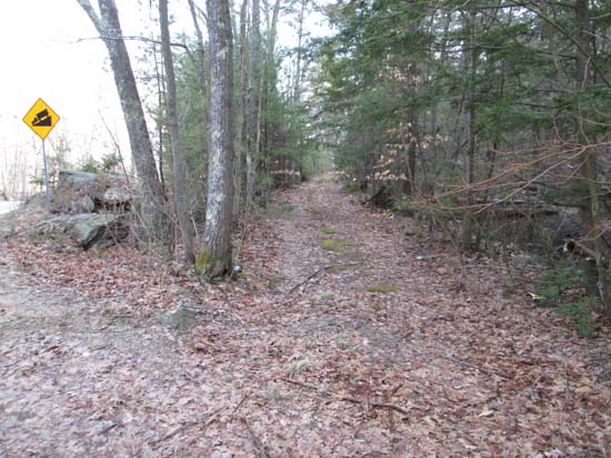
A woods road at the height of land on Route 107
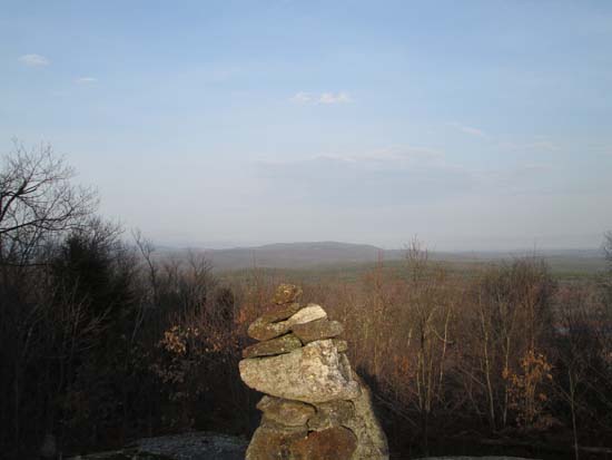
Looking northeast toward Parker Mountain from Catamount Mountain

Directions to trailhead: Catamount Mountain is located southeast of Pittsfield, near the height of land on Route 107. There is a pulloff at the height of land.
Back to Catamount Mountain Profile
|

