Home
States
Colorado
Connecticut
Maine
Massachusetts
New Hampshire
New York
Rhode Island
Utah
Vermont
View All
Lists
NE 4,000 Footers
NE 100 Highest
NH 4,000 Footers
NH 100 Highest
NH 52 With A View
NH Belknap Range
NH Ossipee 10
Links
Trail Conditions
Trip Log
Sunrises
Sunsets
About
|
Caverly Mountain
New Durham, NH
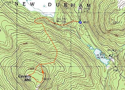
Trailheads, measurements, times, distances, and maps are all approximate and relative to the hike(s) as shown below.
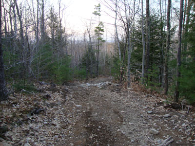
Looking down the Mt. Caverly Loop
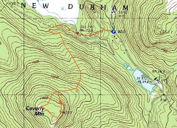
Route: Caverly Road, Mt. Caverly Loop, herd path, (Caverly Mountain), bushwhack, Mt. Caverly Loop, Caverly Road
Though on my to do list for a few years, I had never made it over to Caverly Mountain. With a decent forecast, we headed up for the sunset.
Starting at the orange gate, we took Caverly Road to a four way junction, marked with snowmobile signs. Taking a left at this junction onto the Mt. Caverly Loop, the road started to steepen a bit, though never becoming overly difficult. Some areas were a bit muddy. In addition, from logging and offroad traffic, the hike up wasn't overly scenic.
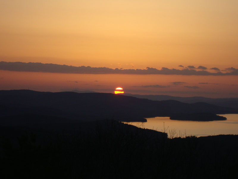
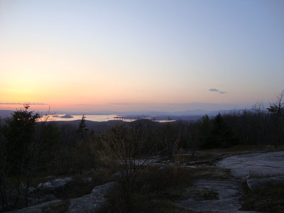
The summit, however, was a different story. Reaching the western ledges just at sunset, we had a great display of the sun setting with some clouds in the foreground and the lake lighting up. From this vista, views ranged from Prospect Mountain to the south to the eastern Sandwich Range to the north and everything in between.
After the sunset, we continued around the fairly open summit area, curving around to the highpoint (with views of Merrymeeting Lake). From there we bushwhacked (in the interest of time, and to the delight of a tick trying to catch a ride) back down to the Mt. Caverly Loop and down to Caverly Road, walking the last few minutes under moonlight.
| Hike Ratings |
|
Getting To Trailhead: |
Moderate |
| Destination: |
Caverly Mountain |
|
Length: |
Moderate |
|
Steepness: |
Moderate |
|
Navigation: |
Moderate |
|
Views: |
Excellent |
|
Crowds: |
Minimal |
|
| Hike Stats |
|
Date Hiked: |
Tuesday, April 20, 2010 |
| Hike Commenced: |
6:53 PM |
| Parking Elevation: |
802' |
| Destination: |
Caverly Mountain |
| Ascent Commenced: |
6:53 PM |
| Summit Reached: |
7:43 PM |
| Time Elapsed: |
00:50 |
| Trailhead Elevation: |
805' |
| Summit Elevation: |
1,433' |
| Vertical Gain: |
828' |
|
|
| Hike Ended: |
8:22 PM |
| Hike Time Elapsed: |
01:29 |
| Hike Vertical Gain: |
968' |
|
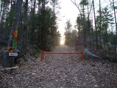
The gated Caverly Road off Kings Highway
Lake Winnipesauke and the southern White Mountains as seen from Caverly Mountain

The sunset as seen from Caverly Mountain

Directions to trailhead: From Wolfeboro, take Route 28 south, then bear left onto Middleton Road. Middleton Road becomes Kings Highway a few minutes later. Shortly after passing Shaws Pond on the right, Kings Highway will curve left. Just before the end of this curve, the orange gated Caverly Road (offset from the road a bit) will be on the right. There is some room to park just off Kings Highway adjacent some utility poles without blocking the gate or nearby driveways.
Back to Caverly Mountain Profile
|