Home
States
Colorado
Connecticut
Maine
Massachusetts
New Hampshire
New York
Rhode Island
Utah
Vermont
View All
Lists
NE 4,000 Footers
NE 100 Highest
NH 4,000 Footers
NH 100 Highest
NH 52 With A View
NH Belknap Range
NH Ossipee 10
Links
Trail Conditions
Trip Log
Sunrises
Sunsets
About
|
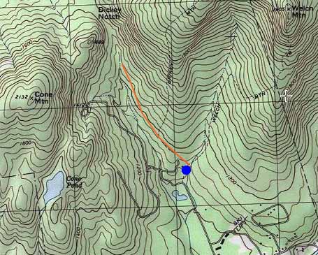
Cone Mountain
Thorton, NH
Trailheads, measurements, times, distances, and maps are all approximate and relative to the hike(s) as shown below.
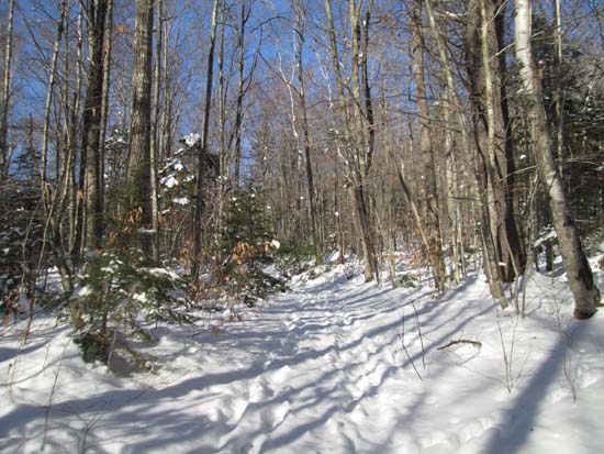
The Brown Ash Swamp Trail
Route: Welch-Dickey Loop Trail, Brown Ash Swamp Bike Trail, bushwhack, (Cone Mountain), bushwhack, Brown Ash Swamp Bike Trail, Welch-Dickey Loop Trail
Brown Ash Swamp Trail had had some boot traffic, but wasn't terribly well packed. We opted to bareboot and had no issues. Adequate snow cover to snowshoe the trail as well.
Just prior to the first marsh, we bushwhacked toward the col between Cone and its northern subpeak in generally open woods. Snow depth was about 6-8 inches and barebooting seemed ideal. Had to weave around a few cliffbands above the col, but nothing too bad. Other than a few tiny pockets of scrubby stuff in between ledges, we never had any issues with thick bushwhacking. Some care had to be used ascending the ledges due to melting snowcover and concealed ice.
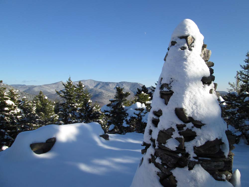
Nice directional views from the near-summit viewpoint (neat cairn and rock bench are still there). Trees are continuing to grow up, so there's a chance that one day there won't be much left to see.
No sign of any recent traffic from the bootleg trail from the Cone Pond side.
| Hike Ratings |
|
Getting To Trailhead: |
Easy |
| Destination: |
Cone Mountain |
|
Length: |
Moderate |
|
Steepness: |
Very Difficult |
|
Navigation: |
Difficult |
|
Views: |
Excellent |
|
Crowds: |
Minimal |
|
| Hike Stats |
|
Date Hiked: |
Saturday, November 29, 2014 |
| Parking Elevation: |
1,080' |
| Destination: |
Cone Mountain |
| Time Elapsed: |
01:14 |
| Trailhead Elevation: |
1,090' |
| Summit Elevation: |
2,132' |
| Vertical Gain: |
1,151' |
|
|
| Hike Time Elapsed: |
02:29 |
| Hike Vertical Gain: |
1,191' |
|
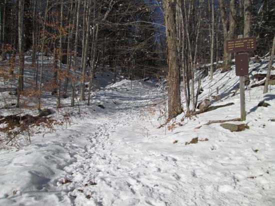
The Welch-Dickey Loop Trail (Dickey Branch) trailhead

Cone Mountain
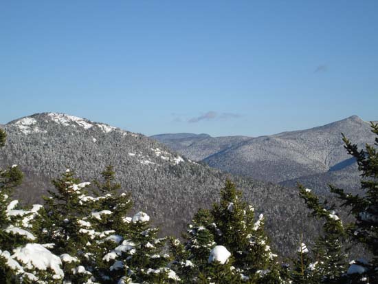
Welch, Whiteface, and Sandwich Dome as seen from Cone Mountain

Directions to trailhead: Take Route 49 to Six Mile Bridge - take a left there and go up the hill. Take a right onto Orris Road. National Forest pay parking lot will be on the right after a short drive.
Back to Cone Mountain Profile
|