Home
States
Colorado
Connecticut
Maine
Massachusetts
New Hampshire
New York
Rhode Island
Utah
Vermont
View All
Lists
NE 4,000 Footers
NE 100 Highest
NH 4,000 Footers
NH 100 Highest
NH 52 With A View
NH Belknap Range
NH Ossipee 10
Links
Trail Conditions
Trip Log
Sunrises
Sunsets
About
|
Copple Crown Mountain
Brookfield, NH, New Durham, NH
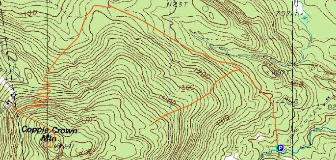
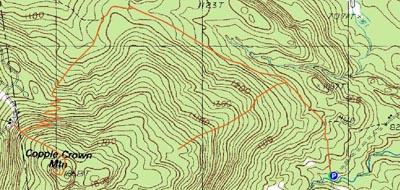
Trailheads, measurements, times, distances, and maps are all approximate and relative to the hike(s) as shown below.
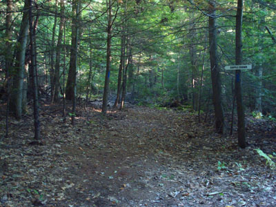
Looking up the trail to Copple Crown Mountain
Copple Crown Mountain is something I have looked at for a long time - as a little kid, I used to spend some time on nearby Rust Pond - the mountain was visible from the water.
I read a lot about how the trail can be hard to follow. Half true!
Being the only vehicle at the parking lot, I knew I'd be a quiet day. Without a map (or any markings on the topographic maps), I only had the hints from online trip reports to go by.
After following the road for awhile, I saw a decent sized blow down ahead with a bunch of ribbon marking it off. Looking to the left, I saw ribbon going up the hill on a rather well travelled road of sorts. Thinking I had found a shorter, more direct trail, I took this.
And then it started splitting and getting less travelled. I topped out a few hundred vertical feet higher in somewhat of a flat - I debated bushwacked across the flat to the other side of the mountain, but decided that between the thicker growth, retreating sun, and lack of knowledge of the destination and return trail, I would be better off backtracking and trying to find a proper trail.
Back on the road after this detour, I followed it for awhile longer, before seeing a flat, grassy road depart to the left. I followed this and saw some blazes! My guess is that the actual trailhead was a big further up the first road I was following.
Up to this point, the ascent was very gradual. From here, the ascent was a little bit steeper, but nothing more than moderate. Ironically, the trail was marked like crazy - blue blazes every few feet and signs at pretty much every turn.
After going through a series of switchbacks, I saw what looked to be the trail to the old Copple Crown ski area. Noted.
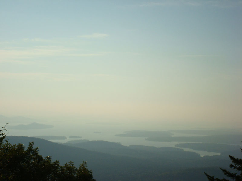
Arriving at the junction near the summit, I decided to forget about the East Peak and just do the main peak. While there is a nice view ledge, the hazy limited the visibility. Nonetheless, Lake Wentworth, Rust Pond, and the big lake were all easily seen.
On the way back, I took the old ski area spur trail down to the old T-Bar (just a little under 100 vertical feet below the beginning of the top switchback). Not too much to see, but certainly interesting.
Back on the trail, I continued down, racing the retreated sun. There was quite a lot of wildlife - thus, I wanted to get back before things were too dark. Along the way up and back, I saw a porcupine and a whole bunch of turkey.
Once I reached the old road, Nick Drake's Five Leaves Left album helped to hasten an otherwise dull, flat walk.
All in all, a neat peak, but a somewhat long hike considering. Might be a nice winter possibility, however.
| Hike Ratings |
|
Getting To Trailhead: |
Easy |
| Destination: |
Copple Crown Mountain |
|
Length: |
Moderate |
|
Steepness: |
Moderate |
|
Navigation: |
Difficult |
|
Views: |
Excellent |
|
Crowds: |
Minimal |
|
| Hike Stats |
|
Date Hiked: |
Thursday, September 20, 2007 |
| Hike Commenced: |
4:14 PM |
| Parking Elevation: |
850' |
| Destination: |
Copple Crown Mountain |
| Ascent Commenced: |
4:15 PM |
| Summit Reached: |
5:37 PM |
| Time Elapsed: |
01:22 |
| Trailhead Elevation: |
850' |
| Summit Elevation: |
1,868' |
| Vertical Gain: |
1,563' |
|
|
| Hike Ended: |
7:27 PM |
| Hike Time Elapsed: |
03:13 |
| Hike Vertical Gain: |
1,693' |
|
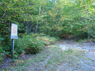
The trailhead to the old road to the trail to Copple Crown Mountain
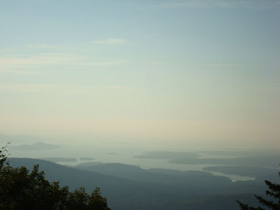
Looking west from the Copple Crown Mountain summit

Directions to trailhead: Take Route 109 West from Route 16, then take a left onto Governors Road. Shortly thereafter, take a right onto Moose Mountain Road. Continue down this - it will turn to dirt - going straight (there will be a Dead End sign - don't go right!). There will be a parking lot at the end of this somewhat rough road, with a Copple Crown sign pointing to the right to the trailhead.
Back to Copple Crown Mountain Profile
|