Home
States
Colorado
Connecticut
Maine
Massachusetts
New Hampshire
New York
Rhode Island
Utah
Vermont
View All
Lists
NE 4,000 Footers
NE 100 Highest
NH 4,000 Footers
NH 100 Highest
NH 52 With A View
NH Belknap Range
NH Ossipee 10
Links
Trail Conditions
Trip Log
Sunrises
Sunsets
About
|
Cranmore Mountain
Conway, NH
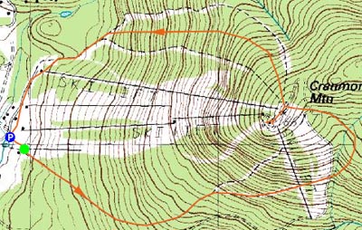
Trailheads, measurements, times, distances, and maps are all approximate and relative to the hike(s) as shown below.
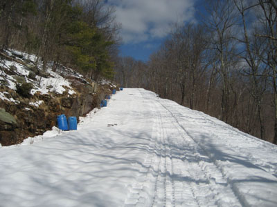
Heading up the Gibson ski trail
After finishing Kearsarge North faster than I had budgetted, I headed over to Cranmore for some additional exercise. Cranmore is one of the few alpine ski areas in the state I have yet to ski, so I decided to do the next best thing and hike it.
I took an easy route, following ski and then snowcat tracks, up Beginner's Luck to Gibson to Easy Street. After finishing off a bag of trail mix on the deck of the Meister Hut, I descended down Rattlesnake to Skimeister - stepping out of both Stablicers while downing jump kicks down a steep section (what a pain in the neck it was to go back up a few hundred feet once I noticed them missing from my feet).
| Hike Ratings |
|
Getting To Trailhead: |
Easy |
| Destination: |
Cranmore Mountain |
|
Length: |
Moderate |
|
Steepness: |
Moderate |
|
Navigation: |
Easy |
|
Views: |
Excellent |
|
Crowds: |
Minimal |
|
| Hike Stats |
|
Date Hiked: |
Saturday, April 14, 2007 |
| Hike Commenced: |
3:12 PM |
| Parking Elevation: |
535' |
| Destination: |
Belknap Mountain |
| Ascent Commenced: |
3:16 PM |
| Summit Reached: |
4:14 PM |
| Time Elapsed: |
00:58 |
| Trailhead Elevation: |
570' |
| Summit Elevation: |
1,667' |
| Vertical Gain: |
1,097' |
|
|
| Hike Ended: |
5:18 PM |
| Hike Time Elapsed: |
02:06 |
| Hike Vertical Gain: |
1,217' |
|
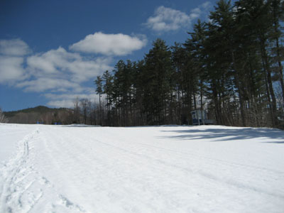
The beginning (or end if you're skiing) of Beginner's Luck
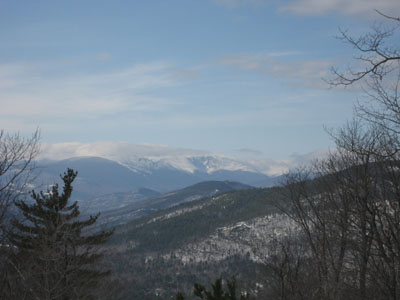
Looking northwest at Mt. Washington from Cranmore Mountain

Directions to trailhead: Follow the Cranmore signs from Route 16 in North Conway.
Back to Cranmore Mountain Profile
|

