Home
States
Colorado
Connecticut
Maine
Massachusetts
New Hampshire
New York
Rhode Island
Utah
Vermont
View All
Lists
NE 4,000 Footers
NE 100 Highest
NH 4,000 Footers
NH 100 Highest
NH 52 With A View
NH Belknap Range
NH Ossipee 10
Links
Trail Conditions
Trip Log
Sunrises
Sunsets
About
|
Downing Mountain
Ellsworth, NH
Trailheads, measurements, times, distances, and maps are all approximate and relative to the hike(s) as shown below.
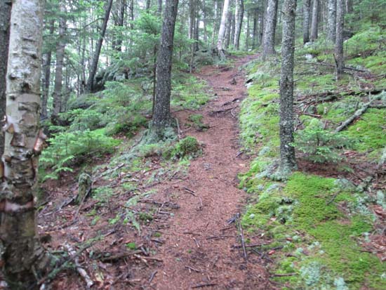
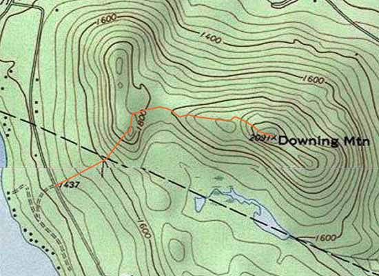
The herd path to Downing Mountain
Route: Snowmobile trail, herd paths
This had been on my return-to list for awhile, after bushwhacking it from the north side years ago.
Started from a somewhat marked snowmobile trail (which appears to double as a 4 wheeler trail in the off season) across from Shore Road on Doetown Road. The snowmobile trail goes generally straight up to near the town line. Around this point, there is a USFS red boundary cairn and yellow sign about 100 feet above the snowmobile trail (where the snowmobile trail starts cutting diagonally across the fall line). (If you miss the start of this path, the snowmobile trail eventually heads over to near the shore of the swamp/pond below Downing, where a short spur goes to the southwest shore of the swamp. Use caution if you decide to go out toward the pond, as there is a shooting range south and west of the snowmobile trail (there are signs around the perimeter).)
From the USFS boundary cairn, there is a faint herd path that leads up to the unnamed peak west of Downing. There is a tricky section where it scrambles up to the first view ledge on southeastern side of the unnamed peak.
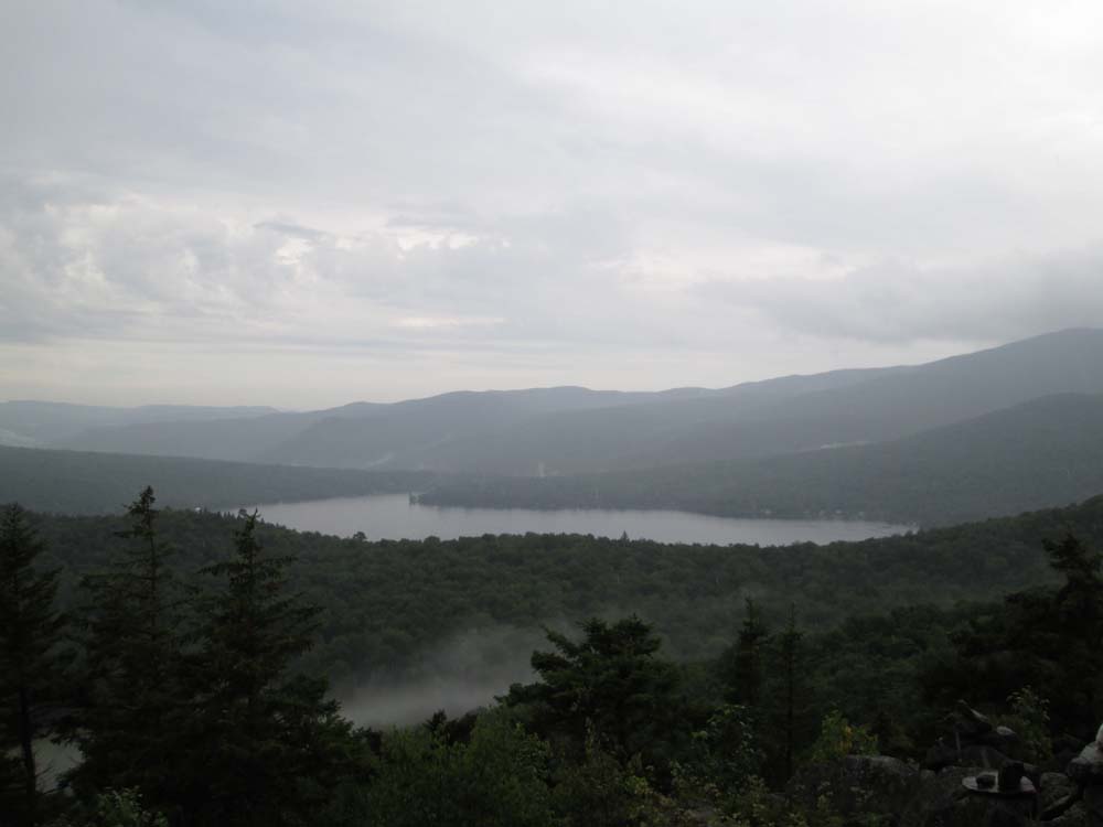
From there, the herd path heads northeast into the col, then gradually heads up the west side of Downing, eventually climbing up to the excellent view ledge (ranging from Stinson Mountain, Cardigan, Stinson Lake, Carr Mountain, and I think Black Hill). From Doetown Road to this view ledge is 0.95 miles.
From the view ledge, it's a short open woods bushwhack over a false peak to the recognized highpoint.
The snowmobile trail was initially dry, however a pop up downpour made it a little muddy (not too bad). The herd path was wet/slippery in places from the downpour as well, but very little mud to contend with.
| Hike Ratings |
|
Getting To Trailhead: |
Easy |
| Destination: |
Downing Mountain |
|
Length: |
Moderate |
|
Steepness: |
Very Difficult |
|
Navigation: |
Difficult |
|
Views: |
Excellent |
|
Crowds: |
Minimal |
|
| Hike Stats |
|
Date Hiked: |
Sunday, July 19, 2015 |
| Parking Elevation: |
1,437' |
| Destination: |
Downing Mountain |
| Time Elapsed: |
00:48 |
| Trailhead Elevation: |
1,437' |
| Summit Elevation: |
2,091' |
| Vertical Gain: |
904' |
|
|
| Hike Time Elapsed: |
01:21 |
| Hike Vertical Gain: |
1,054' |
|
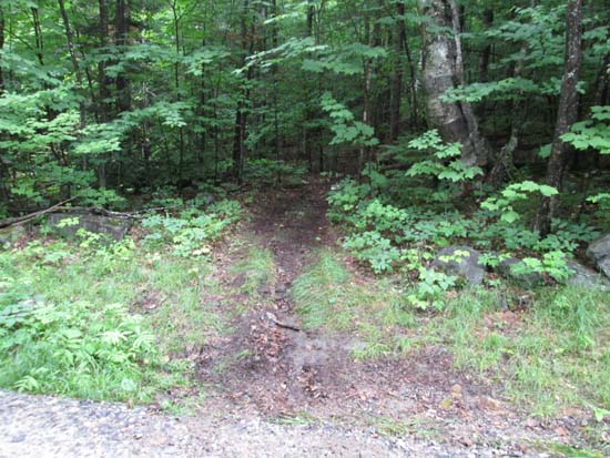
The start of the snowmobile trail off Doetown Road
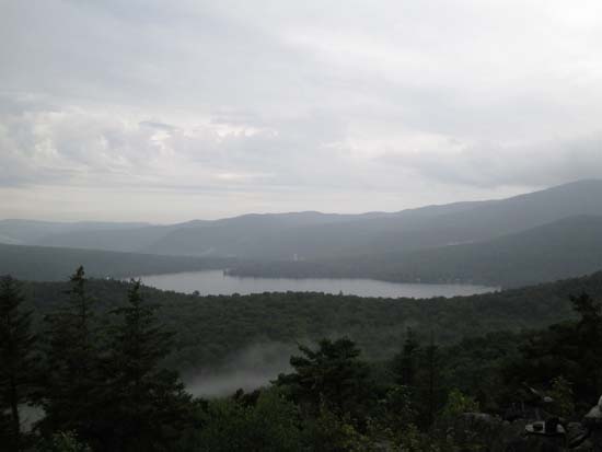
Looking southwest at Stinson Lake from near the summit of Downing Mountain

Directions to trailhead: There is no formal parking on Doetown Road in Rumney near the junction of Shore Road.
Back to Downing Mountain Profile
|