Home
States
Colorado
Connecticut
Maine
Massachusetts
New Hampshire
New York
Rhode Island
Utah
Vermont
View All
Lists
NE 4,000 Footers
NE 100 Highest
NH 4,000 Footers
NH 100 Highest
NH 52 With A View
NH Belknap Range
NH Ossipee 10
Links
Trail Conditions
Trip Log
Sunrises
Sunsets
About
|
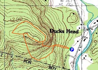
Duck's Head
Jackson, NH
Trailheads, measurements, times, distances, and maps are all approximate and relative to the hike(s) as shown below.
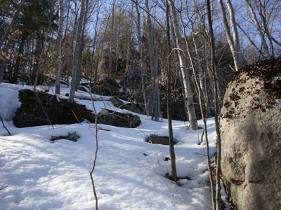
Looking up the ledgy shoulder of Duck's Head
For quite some time, I've wondered what Duck's Head in Jackson is like. Having driven by it so many times, I almost attempted it after hiking Mt. Moriah. On my way to Mt. Madison and Adams this particular morning, I decided I'd check it out on the way back - warm weather, fairly firm snow - why not?
The only disadvantage to this approach was that I hadn't studied the terrain too thoroughly (I only knew there used to be a trail to Iron Mountain, as well as a spur to Duck's Head, initially on the south side of the road) and didn't have a map with me. Nonetheless, I wasn't too concerned about navigation.
Leaving the dirt portion of the Red Fox parking lot, I followed what looked to be a somewhat clear trail up the gentle initial slope. Things began to thicken, however, so I started to work my way to the south a bit. Soon, I encountered an old shack. Noticing an odd shaped window hole of sorts, I went a bit closer and realized I was looking at the engine house of an old alpine ski area rope tow! I don't study small lost rope tow areas too closely, so I didn't know the details of this one at the time, but I was pretty sure it had been well documented in the past (and it has been, it was the old Iron Mountain Slope, which has been closed for a good three decades).
Continuing west-southwest, I soon developed a craving for a McDonald's Shamrock Shake. This led me to expedite my trek - my original plan was to roughly follow the bottom of the ledges, then ascend via the more gentle west side of the peak. Instead, I found a small gully, strapped my snowshoes to my pack, and started some minor rock climbing.
After climbing a dozen or two vertical feet, I reached a nice shelf and followed it gradually to the height of land, soon reaching the highpoint. While the views are probably minimal with foliage, there were decent views through the trees from the ridge. Superior views could probably be attained by descending a bit. Nonetheless, I wanted to check out the top of the ridge and look for any signs of old trails. As I worked my way west, I saw a decent opening that looked like it could be the top of the old spur trail. Noting that, I continued west, then worked my way north and around that side of the ridge, running a bit lower in hopes of perhaps hitting the other ledges. Finding some old logging roads, I worked my way back around, not bothering to descend any further to find the other ledges (since I hadn't studied this peak ahead of time, I wasn't sure how low I'd have to go, and I was ready to call it a day).
Back at the high point, I worked my way back west to where I thought the spur trail may have gone. Sure enough, as I descended a few dozen vertical feet, I saw a cairn sticking up through the snow - not bad! I may have also seen an old axe blaze below it, but I wasn't positive. In hindsight, I should have started working my way east from here, but instead I continued downhill, hoping to perhaps hit an obvious trailbed (which I never did). As I neared a homesite, I worked my way back uphill a bit, perhaps seeing another cairn (or, maybe just a pile of rocks, as the terrain was quite rocky in this particular area). Cutting back to the ski area (and finding a cairn at the top of it that likely belonged to the Duck's Head Trail), I descended down the old rope tow lift line and back to the parking lot.
| Hike Ratings |
|
Getting To Trailhead: |
Easy |
| Destination: |
Duck's Head |
|
Length: |
Moderate |
|
Steepness: |
Very Difficult |
|
Navigation: |
Difficult |
|
Views: |
Moderate |
|
Crowds: |
Minimal |
|
| Hike Stats |
|
Date Hiked: |
Sunday, March 15, 2009 |
| Hike Commenced: |
3:18 PM |
| Parking Elevation: |
760' |
| Destination: |
Duck's Head |
| Ascent Commenced: |
3:18 PM |
| Summit Reached: |
3:53 PM |
| Time Elapsed: |
00:35 |
| Trailhead Elevation: |
760' |
| Summit Elevation: |
1,311' |
| Vertical Gain: |
551' |
|
|
| Hike Ended: |
4:59 PM |
| Hike Time Elapsed: |
01:41 |
| Hike Vertical Gain: |
751' |
|
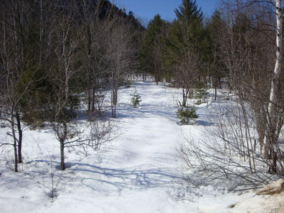
The bottom of the old Duck's Head Trail at the Red Fox Bar and Grille parking lot

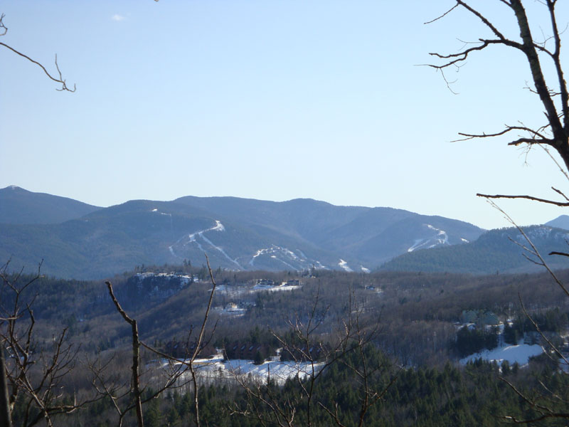
Looking at the Attitash ski area from near the Duck's Head summit

Directions to trailhead: Take Route 16 North from Glen, the take a left into the Red Fox Bar and Grille parking lot (before the Jackson covered bridge). The old Duck's Head Trail started somewhere near the dirt parking lot.
Back to Duck's Head Profile
|