Home
States
Colorado
Connecticut
Maine
Massachusetts
New Hampshire
New York
Rhode Island
Utah
Vermont
View All
Lists
NE 4,000 Footers
NE 100 Highest
NH 4,000 Footers
NH 100 Highest
NH 52 With A View
NH Belknap Range
NH Ossipee 10
Links
Trail Conditions
Trip Log
Sunrises
Sunsets
About
|
Durgin Hill
Freedom, NH
Trailheads, measurements, times, distances, and maps are all approximate and relative to the hike(s) as shown below.
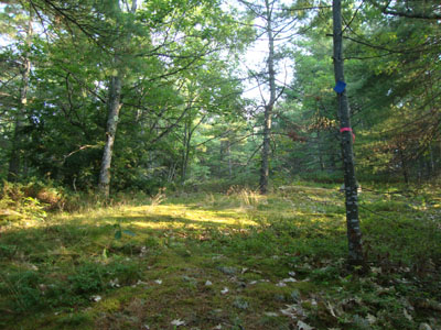
Looking up the Scarboro Ridge Trail on the way to Durgin Hill
Route: Scarboro Ridge Trail, (Durgin Hill), Scarboro Ridge Trail
After some rain had passed through on a hot, hazy afternoon, I headed to Durgin Hill for a quick jog.
The relatively new Scarboro Ridge Trail had recently been blazed in a southbound direction with blue plastic diamonds. The footbed on this section of trail has yet to get well established. Though there was the occasional deer fly and mosquito, the bugs were generally not too bad.
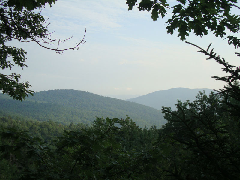
The views from the summit were decent (not nearly as good as some of the unnamed peaks on the ridge), looking south on the ridge and at Green Mountain.
| Hike Ratings |
|
Getting To Trailhead: |
Difficult |
| Destination: |
Durgin Hill |
|
Length: |
Easy |
|
Steepness: |
Moderate |
|
Navigation: |
Moderate |
|
Views: |
Moderate |
|
Crowds: |
Minimal |
|
| Hike Stats |
|
Date Hiked: |
Thursday, August 5, 2010 |
| Hike Commenced: |
5:59 PM |
| Parking Elevation: |
880' |
| Destination: |
Durgin Hill |
| Ascent Commenced: |
5:59 PM |
| Summit Reached: |
6:15 PM |
| Time Elapsed: |
00:16 |
| Trailhead Elevation: |
880' |
| Summit Elevation: |
1,466' |
| Vertical Gain: |
591' |
|
|
| Hike Ended: |
6:42 PM |
| Hike Time Elapsed: |
00:43 |
| Hike Vertical Gain: |
596' |
|
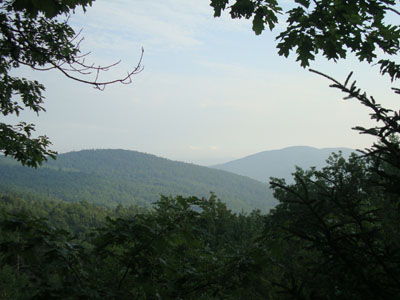
Prospect Mountain and Green Mountain as seen from Durgin Hill
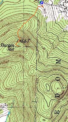

Directions to trailhead: To get to the northern trailhead, take Moulton Road north from Freedom. Eventually at T intersection, take a right onto Rice Hill Road (labelled as Cold Brook Road on some maps). Shortly after passing over a height of land (a house will be on the left), the northern trailhead of the Scarboro Ridge Trail will be on the right - a grassy road (a white pipe and red reflector are near it). There is limited room to park roadside.
Back to Durgin Hill Profile
|