Home
States
Colorado
Connecticut
Maine
Massachusetts
New Hampshire
New York
Rhode Island
Utah
Vermont
View All
Lists
NE 4,000 Footers
NE 100 Highest
NH 4,000 Footers
NH 100 Highest
NH 52 With A View
NH Belknap Range
NH Ossipee 10
Links
Trail Conditions
Trip Log
Sunrises
Sunsets
About
|
Eagle Cliff
Sandwich, NH
Trailheads, measurements, times, distances, and maps are all approximate and relative to the hike(s) as shown below.
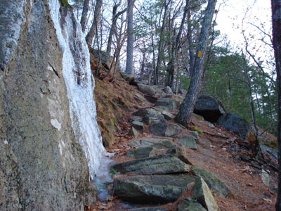
Looking up the cliffs bypass portion of the Eagle Cliff Trail
Route: Eagle Cliff Trail, (Eagle Cliff), Eagle Cliff Trail
With the days growing ever so short, my after work hike options are very limited. As a result, today I did a quick hike up Eagle Cliff.
About two weeks earlier I took the Eagle Cliff Trail up the cliffs - this time, to mix things up a bit, I took the bypass around the cliffs. The bypass is about a tenth of a mile longer, significantly easier, and offers some additional views.
The trail above the bypass/cliffs area was a bit icy, but still doable without Stablicers.
I arrived at the summit just before the sunset, allowing me some time to find the right ledge to watch it from. I ended up watching it from a few feet below the summit cairn.
With a heavy bank of clouds moving in from the northwest, the northern portion of the horizon was dark, however the southern portion was a very nice orange. The sun ended up dipping behind some clouds, before emerging again just before setting. Not bad. Not bad at all.
| Hike Ratings |
|
Getting To Trailhead: |
Easy |
| Destination: |
Eagle Cliff |
|
Length: |
Easy |
|
Steepness: |
Difficult |
|
Navigation: |
Easy |
|
Views: |
Excellent |
|
Crowds: |
Moderate |
|
| Hike Stats |
|
Date Hiked: |
Friday, November 30, 2007 |
| Hike Commenced: |
3:32 PM |
| Parking Elevation: |
590' |
| Destination: |
Eagle Cliff |
| Ascent Commenced: |
3:32 PM |
| Summit Reached: |
3:52 PM |
| Time Elapsed: |
00:20 |
| Trailhead Elevation: |
580' |
| Summit Elevation: |
1,270' |
| Distance: |
.7 miles |
| Vertical Gain: |
695' |
|
|
| Hike Ended: |
4:33 PM |
| Hike Time Elapsed: |
01:01 |
| Hike Distance: |
1.4 miles |
| Hike Vertical Gain: |
730' |
|
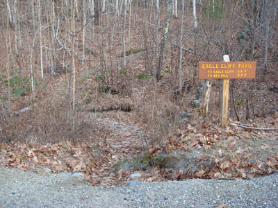
The Eagle Cliff Trail trailhead on Squam Lake Road
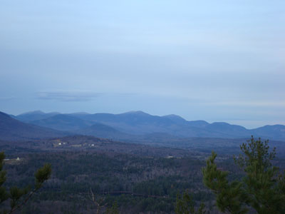
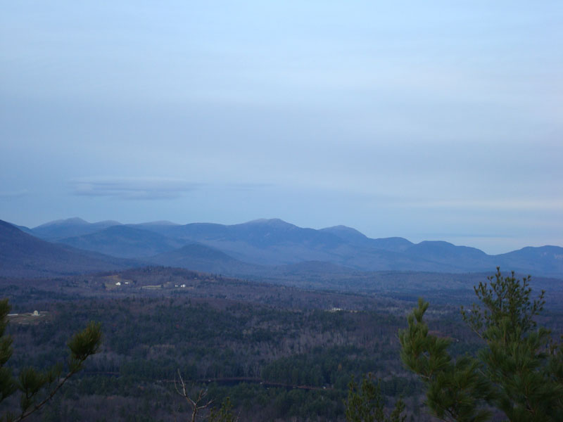
Looking at the Sandwich Range from one of the ledges near the Eagle Cliff summit

The sunset over Squam Lake
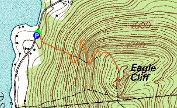

Directions to trailhead: From Route 113 in Center Sandwich, take Squam Lake Road west. The Eagle Cliff Trail trailhead is just around the corner from where Squam Lake gets close to the road for the second time. Parking available alongside the road.
Back to Eagle Cliff Profile
|