Home
States
Colorado
Connecticut
Maine
Massachusetts
New Hampshire
New York
Rhode Island
Utah
Vermont
View All
Lists
NE 4,000 Footers
NE 100 Highest
NH 4,000 Footers
NH 100 Highest
NH 52 With A View
NH Belknap Range
NH Ossipee 10
Links
Trail Conditions
Trip Log
Sunrises
Sunsets
About
|
Eagle Cliff
Sandwich, NH
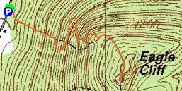
Trailheads, measurements, times, distances, and maps are all approximate and relative to the hike(s) as shown below.
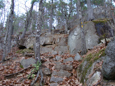
Looking up the cliffs portion of the Eagle Cliff Trail
Route: Eagle Cliff Trail, (Eagle Cliff), Eagle Cliff Trail
With a cloudy afternoon, I was tempted to cancel my plan to do a quick sunset hike. Seeing a bit of blue to the north, however, I figured there might be a chance of some color.
The Eagle Cliff Trail was snow and ice free, however it was still a bit tricky nonetheless, due to freshly fallen leaves. Reaching the top of the ledges, I had some color visible in the horizon.
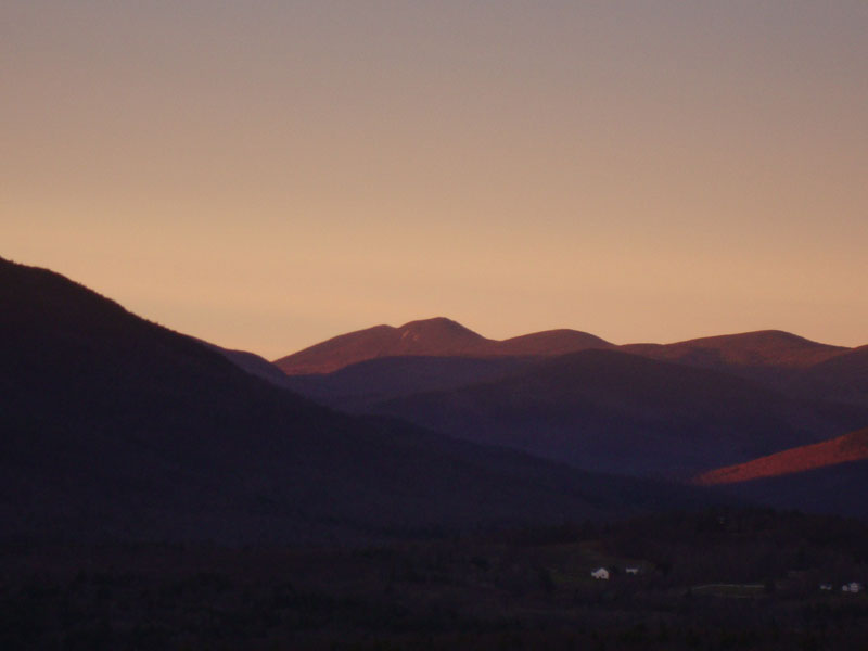
After a few minutes of halfway decent color, the sun set, lighting up the region-wide cloud layer. In addition, Squam Lake lit up beautifully. Perhaps the most colorful sunset hike of the year for me, I was able to enjoy an hour display - amazing!
| Hike Ratings |
|
Getting To Trailhead: |
Easy |
| Destination: |
Eagle Cliff |
|
Length: |
Easy |
|
Steepness: |
Very Difficult |
|
Navigation: |
Easy |
|
Views: |
Excellent |
|
Crowds: |
Minimal |
|
| Hike Stats |
|
Date Hiked: |
Friday, November 13, 2009 |
| Hike Commenced: |
3:39 PM |
| Parking Elevation: |
580' |
| Destination: |
Eagle Cliff |
| Ascent Commenced: |
3:39 PM |
| Summit Reached: |
3:57 PM |
| Time Elapsed: |
00:18 |
| Trailhead Elevation: |
580' |
| Summit Elevation: |
1,270' |
| Distance: |
.6 miles |
| Vertical Gain: |
695' |
|
|
| Hike Ended: |
5:11 PM |
| Hike Time Elapsed: |
01:22 |
| Hike Distance: |
1.2 miles |
| Hike Vertical Gain: |
700' |
|
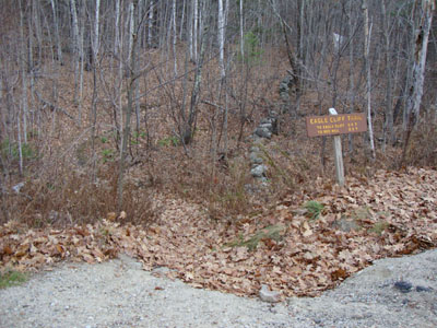
The Eagle Cliff Trail trailhead on Squam Lake Road

Looking at Mt. Tripyramid from one of the ledges near the Eagle Cliff summit

The sunset over Squam Lake

Directions to trailhead: From Route 113 in Center Sandwich, take Squam Lake Road west. The Eagle Cliff Trail trailhead is just around the corner from where Squam Lake gets close to the road for the second time. Parking available alongside the road.
Back to Eagle Cliff Profile
|