Home
States
Colorado
Connecticut
Maine
Massachusetts
New Hampshire
New York
Rhode Island
Utah
Vermont
View All
Lists
NE 4,000 Footers
NE 100 Highest
NH 4,000 Footers
NH 100 Highest
NH 52 With A View
NH Belknap Range
NH Ossipee 10
Links
Trail Conditions
Trip Log
Sunrises
Sunsets
About
|
Eagle Cliff
Sandwich, NH
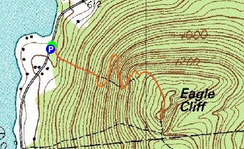
Trailheads, measurements, times, distances, and maps are all approximate and relative to the hike(s) as shown below.
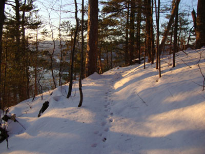
Looking up the Eagle Cliff Trail
Route: Eagle Cliff Trail, (Eagle Cliff), Eagle Cliff Trail
A cold, windy day - a short, sheltered hike was in store. After making some room in the snowbank to park, we headed up the Eagle Cliff Trail in our snowshoes. Other than a barebooter during the previous snowstorm, as well as numerous wild animals, no one had been up the trail - thus, we were breaking (though there wasn't that much snow). Reaching the cliffs, we decided to take the bypass route, rather than deal with traction. Reaching the first set of ledges, the wind was cold, but the views good.
The sunset was quite nice, even though there wasn't much in way of clouds to enhance colors. While it was tempting to linger for awhile and see if the horizon would go red, the near zero-degree temperature and gusty winds were enough to make that idea seem unappealing. Thus, it was a quick walk out.
| Hike Ratings |
|
Getting To Trailhead: |
Easy |
| Destination: |
Eagle Cliff |
|
Length: |
Easy |
|
Steepness: |
Difficult |
|
Navigation: |
Easy |
|
Views: |
Excellent |
|
Crowds: |
Minimal |
|
| Hike Stats |
|
Date Hiked: |
Thursday, December 17, 2009 |
| Hike Commenced: |
3:28 PM |
| Parking Elevation: |
590' |
| Destination: |
Eagle Cliff |
| Ascent Commenced: |
3:28 PM |
| Summit Reached: |
3:51 PM |
| Time Elapsed: |
00:23 |
| Trailhead Elevation: |
580' |
| Summit Elevation: |
1,270' |
| Distance: |
.7 miles |
| Vertical Gain: |
695' |
|
|
| Hike Ended: |
4:42 PM |
| Hike Time Elapsed: |
01:14 |
| Hike Distance: |
1.4 miles |
| Hike Vertical Gain: |
700' |
|
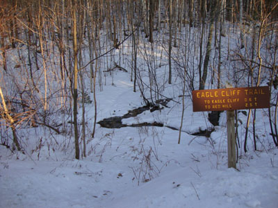
The Eagle Cliff Trail trailhead on Squam Lake Road
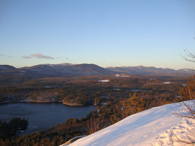
Looking at the Sandwich Range from one of the ledges near the Eagle Cliff summit

The sunset over Squam Lake

Directions to trailhead: From Route 113 in Center Sandwich, take Squam Lake Road west. The Eagle Cliff Trail trailhead is just around the corner from where Squam Lake gets close to the road for the second time. Parking available alongside the road, though the shoulder is not plowed in winter.
Back to Eagle Cliff Profile
|


