Home
States
Colorado
Connecticut
Maine
Massachusetts
New Hampshire
New York
Rhode Island
Utah
Vermont
View All
Lists
NE 4,000 Footers
NE 100 Highest
NH 4,000 Footers
NH 100 Highest
NH 52 With A View
NH Belknap Range
NH Ossipee 10
Links
Trail Conditions
Trip Log
Sunrises
Sunsets
About
|
Eagle Cliff
Sandwich, NH
Trailheads, measurements, times, distances, and maps are all approximate and relative to the hike(s) as shown below.
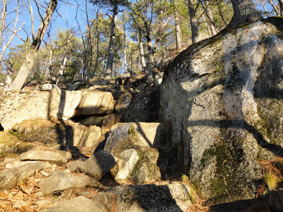
The Eagle Cliff Trail cliffs section
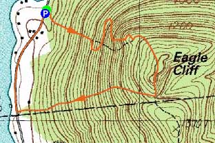
Route: Eagle Cliff Trail, (Eagle Cliff), Eagle Cliff Trail, Teedie Trail, roadwalk
With plenty of daylight remaining after a hike in the Squam Range, I stopped over to Eagle Cliff for a second hike.
Starting at the trailhead, I did some light bushwhacking, then attempted to scramble up a cliff that didn't want to be climbed. After wasting time on it, I went around it, back onto the trail, up the cliffs portion of the trail (a bit icy), then to the upper Eagle Cliff ledge.
From there, I jogged up to the height of land, then down to the Teedie Trail. The Teedie Trail appeared to be a bit mellow than the Eagle Cliff. In addition, it had some decent views through the trees with the leaves down. At the bottom of that trail, I jogged the road back to the Eagle Cliff trailhead.
| Hike Ratings |
|
Getting To Trailhead: |
Easy |
| Destination: |
Eagle Cliff |
|
Length: |
Easy |
|
Steepness: |
Very Difficult |
|
Navigation: |
Easy |
|
Views: |
Excellent |
|
Crowds: |
Minimal |
|
| Hike Stats |
|
Date Hiked: |
Saturday, December 4, 2010 |
| Hike Commenced: |
2:48 PM |
| Parking Elevation: |
580' |
| Destination: |
Eagle Cliff |
| Ascent Commenced: |
2:48 PM |
| Summit Reached: |
3:09 PM |
| Time Elapsed: |
00:21 |
| Trailhead Elevation: |
580' |
| Summit Elevation: |
1,270' |
| Distance: |
.6 miles |
| Vertical Gain: |
695' |
|
|
| Hike Ended: |
3:38 PM |
| Hike Time Elapsed: |
00:50 |
| Hike Vertical Gain: |
950' |
|
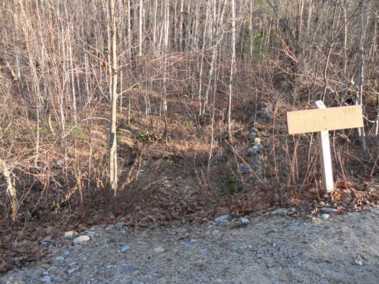
The Eagle Cliff Trail trailhead on Squam Lake Road
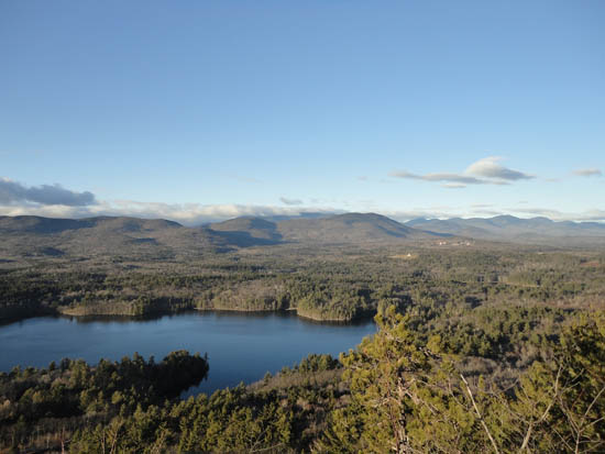
Looking at Mt. Israel from one of the ledges near the Eagle Cliff summit
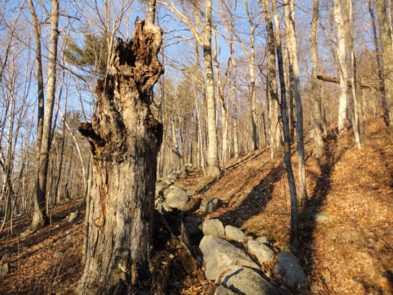
The Teedie Trail

Directions to trailhead: From Route 113 in Center Sandwich, take Squam Lake Road west. The Eagle Cliff Trail trailhead is just around the corner from where Squam Lake gets close to the road for the second time. Parking available alongside the road.
Back to Eagle Cliff Profile
|

