Home
States
Colorado
Connecticut
Maine
Massachusetts
New Hampshire
New York
Rhode Island
Utah
Vermont
View All
Lists
NE 4,000 Footers
NE 100 Highest
NH 4,000 Footers
NH 100 Highest
NH 52 With A View
NH Belknap Range
NH Ossipee 10
Links
Trail Conditions
Trip Log
Sunrises
Sunsets
About
|
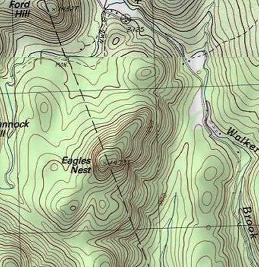
Eagles Nest
Danbury, NH, Wilmot, NH
Trailheads, measurements, times, distances, and maps are all approximate and relative to the hike(s) as shown below.
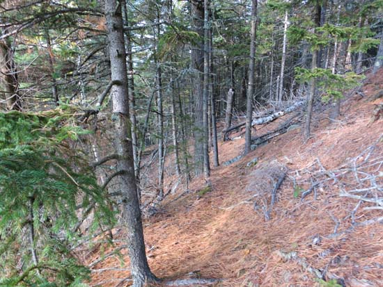
The herd path on the west side of Eagles Nest
Route: Bushwhack
Eagles Nest, southwest of downtown Danbury.
I hopped into the woods north northeast of the peak on Walker Brook Road (only posting on the edge was against hunting without permission) and slabbed up to the ridge. There appears to be some logging on either side of the ridge north of the peak. The woods were generally decent, though I had to get through a few small cliff bands.
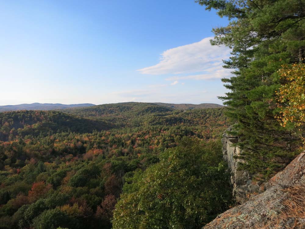
There are some tall cliffs near the summit that face south and west and have excellent views (Kearsarge, Monadnock). Also a few nicely colored trees in the valley below.
Atop one of the western cliffs, I picked up a herd path which initially headed north, then appeared to switchback under the cliffs. Presumably this goes somewhere west of the peak.
| Hike Ratings |
|
Getting To Trailhead: |
Difficult |
| Destination: |
Eagles Nest |
|
Length: |
Moderate |
|
Steepness: |
Moderate |
|
Navigation: |
Difficult |
|
Views: |
Excellent |
|
Crowds: |
Minimal |
|
| Hike Stats |
|
Date Hiked: |
Monday, October 6, 2014 |
| Parking Elevation: |
920' |
| Destination: |
Eagles Nest |
| Time Elapsed: |
00:30 |
| Trailhead Elevation: |
920' |
| Summit Elevation: |
1,473' |
| Vertical Gain: |
573' |
|
|
| Hike Time Elapsed: |
01:09 |
| Hike Vertical Gain: |
603' |
|

Looking northwest from the Eagles Nest cliffs

Back to Eagles Nest Profile
|