Home
States
Colorado
Connecticut
Maine
Massachusetts
New Hampshire
New York
Rhode Island
Utah
Vermont
View All
Lists
NE 4,000 Footers
NE 100 Highest
NH 4,000 Footers
NH 100 Highest
NH 52 With A View
NH Belknap Range
NH Ossipee 10
Links
Trail Conditions
Trip Log
Sunrises
Sunsets
About
|
Foss Mountain
Eaton, NH
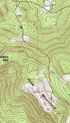
Trailheads, measurements, times, distances, and maps are all approximate and relative to the hike(s) as shown below.
Looking up the Foss Mountain Trail
Route: Foss Mountain Road, Foss Mountain Trail, (Foss Mountain North Peak), Foss Mountain Trail, bushwack, (Foss Mountain), bushwack, Foss Mountain Trail, Foss Mountain Road
For about a year I was curious what the treeless ridge above King Pine ski area was. After acquiring a local snowmobile club map, I was able to pinpoint roughly where a decent way to ascend Foss Mountain would be.
Things didn't start according to plan, however - I drove up Stewart Road only to find a snowbank part way up. Thinking this might be the 'winter parking' I had read about, I put on my snowshoes and continued up the road - only to find it met up with a plowed Foss Mountain Road. After consulting with my road map, I drove back down to Brownfield Road and over to Bull Pasture Road, then to Stewart Road, then to Foss Mountain Road.
The winter parking was well marked and had room for probably half a dozen other vehicles. From here, the steepest portion of the hike started - up a plowed dirt road.
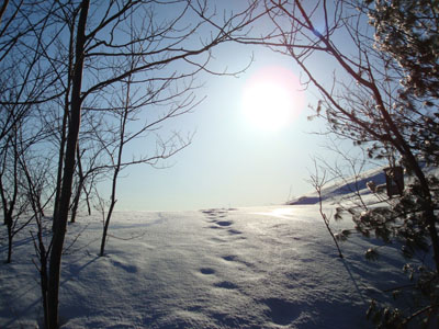
Soon, the plowed portion ended and I was snowshoeing up a snowmobile road.
Eventually seeing the fields of Foss Mountain, I saw a kiosk of sorts about halfway down the straightaway. This was the start of the Foss Mountain Trail, which moderately ascended through the fields, some brush, and some more fields up to the bald north peak.
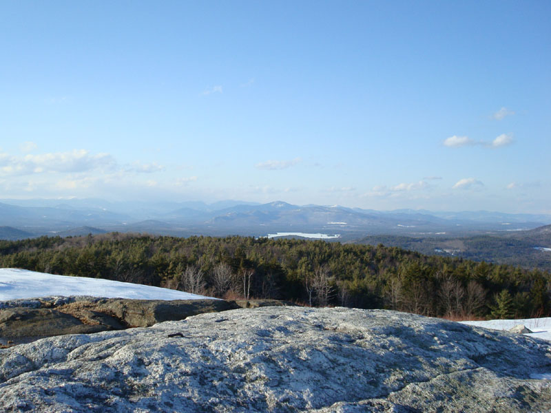
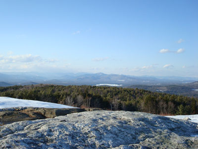
The views from the peak were excellent, despite the lingering clouds. From Green Mountain to the south to the Baldfaces up north, this has to be one of the nicest smaller mountain view points around.
After taking in the sights, I decided to head south along the ridge to the actual highpoint. The peak had no visible path or views. Since the fields are part of a blueberry operation, I would advise against meandering off the trail any other time of the year.
Once I found the high point, I bushwacked back to the fields and headed back. All in all, a nice hike, though I don't think I'll bother doing this one again until the road is plowed to the upper parking area.
| Hike Ratings |
|
Getting To Trailhead: |
Moderate |
| Destination: |
Foss Mountain (North Peak) |
|
Length: |
Moderate |
|
Steepness: |
Moderate |
|
Navigation: |
Easy |
|
Views: |
Excellent |
|
Crowds: |
Minimal |
| Destination: |
Foss Mountain |
|
Length: |
Moderate |
|
Steepness: |
Moderate |
|
Navigation: |
Difficult |
|
Views: |
Minimal |
|
Crowds: |
Minimal |
|
| Hike Stats |
|
Date Hiked: |
Wednesday, March 26, 2008 |
| Hike Commenced: |
4:56 PM |
| Parking Elevation: |
1,070' |
| Destination: |
Foss Mountain (North Peak) |
| Ascent Commenced: |
5:25 PM |
| Summit Reached: |
5:35 PM |
| Time Elapsed: |
00:10 |
| Trailhead Elevation: |
1,420' |
| Summit Elevation: |
1,647' |
| Distance: |
.5 mile |
| Vertical Gain: |
247' |
| Destination: |
Foss Mountain |
| Ascent Commenced: |
5:37 PM |
| Summit Reached: |
5:52 PM |
| Time Elapsed: |
00:15 |
| Trailhead Elevation: |
1,647' |
| Summit Elevation: |
1,657' |
| Vertical Gain: |
97' |
|
|
| Hike Ended: |
6:30 PM |
| Hike Time Elapsed: |
01:34 |
| Hike Vertical Gain: |
814' |
|
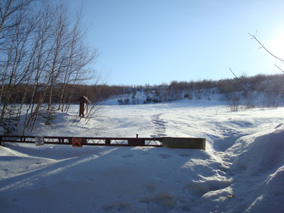
The Foss Mountain Trail trailhead next to the seasonal portion of Foss Mountain Road
Looking north at Kearsarge North Mountain from the north peak of Foss Mountain

Directions to trailhead: Take Route 153 North to Brownfield Road. Take a right onto Bull Pasture Road. Take a right onto Stewart Road. Take a left onto Foss Mountain Road. The winter parking area is up the road a bit on the right hand side. The Foss Mountain Trail trailhead is about a mile further up the road on the right.
Back to Foss Mountain Profile
|