Home
States
Colorado
Connecticut
Maine
Massachusetts
New Hampshire
New York
Rhode Island
Utah
Vermont
View All
Lists
NE 4,000 Footers
NE 100 Highest
NH 4,000 Footers
NH 100 Highest
NH 52 With A View
NH Belknap Range
NH Ossipee 10
Links
Trail Conditions
Trip Log
Sunrises
Sunsets
About
|
Foss Mountain
Eaton, NH
Trailheads, measurements, times, distances, and maps are all approximate and relative to the hike(s) as shown below.
Looking down the Foss Mountain Trail
Route: Foss Mountain Trail, (Foss Mountain North Peak), Foss Mountain Trail
While I had some bigger ideas for an afternoon hike, I ended up having to work late. No worries, since I decided to postpone until the next day. No worries, that was, until I checked the weather forecast after work - Friday went from 'mostly sunny' to 'mostly cloudly with a chance of showers.' Perhaps Barack Obama is doing the weather forecasting - I don't know how else to explain the sudden shifts all the time. Anyways, with the frustration of seeing two nice days of hiking potentially turn into zero, I hopped in my truck and headed to Page Hill for a short hike...and kept on driving to Foss Mountain for a sunset hike.
Arriving at the summer parking lot (a heck of a lot more convenient than the winter road walk!), I quickly set foot up (jogging a bit) the Foss Mountain Trail, stopping briefly to check out the kiosk at the trailhead - apparently the upper blueberry fields were open to picking! A trifecta - hike, sunset, and blueberries!
Just below the treeline, I was amazed to see a nice collection of wood lillies - orange and red - upwards of a dozen in a relatively small area. Nice!
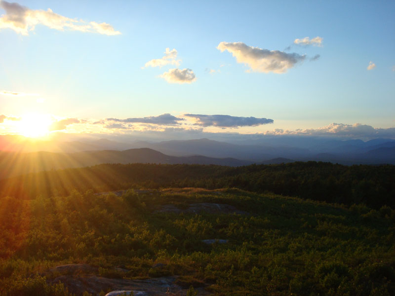
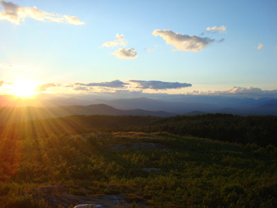
Arriving at the bald north peak (the highpoint of Foss Mountain is wooded and trailess), I could see the horizon was already starting to get sunset colors. While points to the north were burried in some clouds, the views to the east, south, and west were clear and excellent.
I spent about twenty minutes alternating between photographing the sun setting into the clouds and picking ripe blueberries. I have decided that Foss Mountain is perhaps the best non-lakeside sunset destination around - a bare summit with far reaching views (sunsets should be visible year round, as there aren't any trees or neighboring mountains that could be in the way), reachable via a short (non-winter/mud season) hike.
| Hike Ratings |
|
Getting To Trailhead: |
Easy |
| Destination: |
Foss Mountain (North Peak) |
|
Length: |
Easy |
|
Steepness: |
Moderate |
|
Navigation: |
Easy |
|
Views: |
Excellent |
|
Crowds: |
Minimal |
|
| Hike Stats |
|
Date Hiked: |
Thursday, July 10, 2008 |
| Hike Commenced: |
8:01 PM |
| Parking Elevation: |
1,420' |
| Destination: |
Foss Mountain (North Peak) |
| Ascent Commenced: |
8:01 PM |
| Summit Reached: |
8:07 PM |
| Time Elapsed: |
00:06 |
| Trailhead Elevation: |
1,420' |
| Summit Elevation: |
1,647' |
| Distance: |
.5 mile |
| Vertical Gain: |
247' |
|
|
| Hike Ended: |
8:30 PM |
| Hike Time Elapsed: |
00:29 |
| Hike Vertical Gain: |
267' |
|
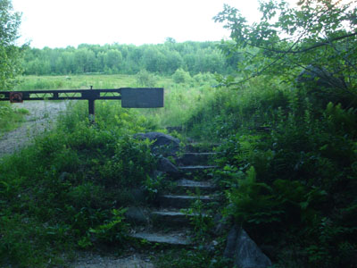
The Foss Mountain Trail trailhead next to the seasonal portion of Foss Mountain Road
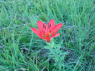
A wood lilly on the edge of one of the blueberry fields
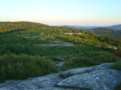
Looking northwest from the Foss Mountain north peak

The sunset as seen from the north peak of Foss Mountain
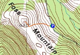

Directions to trailhead: Take Route 153 North to Brownfield Road. Take a right onto Bull Pasture Road. Take a right onto Stewart Road. Take a left onto Foss Mountain Road. The non-winter parking area is located a few miles up on the left and the trailhead is on the right, at the bottom of the blueberry fields.
Back to Foss Mountain Profile
|