Home
States
Colorado
Connecticut
Maine
Massachusetts
New Hampshire
New York
Rhode Island
Utah
Vermont
View All
Lists
NE 4,000 Footers
NE 100 Highest
NH 4,000 Footers
NH 100 Highest
NH 52 With A View
NH Belknap Range
NH Ossipee 10
Links
Trail Conditions
Trip Log
Sunrises
Sunsets
About
|
Foss Mountain
Eaton, NH
Trailheads, measurements, times, distances, and maps are all approximate and relative to the hike(s) as shown below.
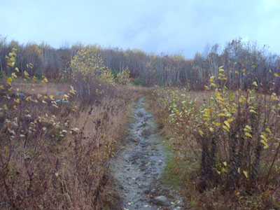
Looking up the Foss Mountain Trail
Route: Foss Mountain Trail, (Foss Mountain North Peak), Foss Mountain Trail
Looking at the satellite and radar imagery, it looked like the rain was going to subside. Soon, blue sky appeared overhead. In hopes of seeing a sunset, I headed to Foss Mountain.
While there was blue sky, some lower flying clouds quickly moved in from the south, which hadn't appeared on the satellite or radar imagery. Once in Eaton, it started to hail - fortunately this was short lived.
While the Foss Mountain Trail was a bit wet, it wasn't too bad. Arriving at the summit of the north peak, I was bombarded by wind. While I could see some very brief glimpses of blue sky, by and large the views were dominated by dark clouds. Nonetheless, the scenery was good - the Ossipees, Conway Lake, Ossipee Lake, and Green Mountain were all visible. Based upon the dark clouds and what sounded like thunder, I decided not to wait around for a potential sunset.
Nonetheless, it was nice to get out for a quick hike.
| Hike Ratings |
|
Getting To Trailhead: |
Easy |
| Destination: |
Foss Mountain (North Peak) |
|
Length: |
Easy |
|
Steepness: |
Moderate |
|
Navigation: |
Easy |
|
Views: |
Excellent |
|
Crowds: |
Minimal |
|
| Hike Stats |
|
Date Hiked: |
Tuesday, October 28, 2008 |
| Hike Commenced: |
5:31 PM |
| Parking Elevation: |
1,420' |
| Destination: |
Foss Mountain (North Peak) |
| Ascent Commenced: |
5:31 PM |
| Summit Reached: |
5:36 PM |
| Time Elapsed: |
00:05 |
| Trailhead Elevation: |
1,420' |
| Summit Elevation: |
1,647' |
| Distance: |
.5 mile |
| Vertical Gain: |
247' |
|
|
| Hike Ended: |
5:49 PM |
| Hike Time Elapsed: |
00:18 |
| Hike Vertical Gain: |
267' |
|
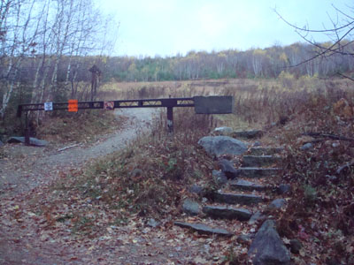
The Foss Mountain Trail trailhead next to the seasonal portion of Foss Mountain Road
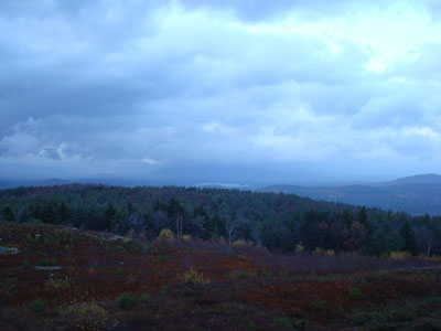
Looking at Conway Lake from the Foss Mountain north peak
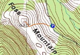

Directions to trailhead: Take Route 153 North to Brownfield Road. Take a right onto Bull Pasture Road. Take a right onto Stewart Road. Take a left onto Foss Mountain Road. The non-winter parking area is located a few miles up on the left and the trailhead is on the right, at the bottom of the blueberry fields.
Back to Foss Mountain Profile
|

