Home
States
Colorado
Connecticut
Maine
Massachusetts
New Hampshire
New York
Rhode Island
Utah
Vermont
View All
Lists
NE 4,000 Footers
NE 100 Highest
NH 4,000 Footers
NH 100 Highest
NH 52 With A View
NH Belknap Range
NH Ossipee 10
Links
Trail Conditions
Trip Log
Sunrises
Sunsets
About
|
Foss Mountain
Eaton, NH
Trailheads, measurements, times, distances, and maps are all approximate and relative to the hike(s) as shown below.
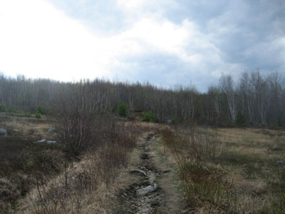
Looking up the Foss Mountain Trail as clouds roll in
Route: Foss Mountain Trail, (Foss Mountain North Peak), Foss Mountain Trail
The weather forecast didn't look good at all - clouds, rain, thunderstorms...yet, outside it looked good, and the radar and satellite imagery showed any potential cells being a few hours away. Thus, I decided to hike White Ledge.
Upon passing Chocorua Lake, dark clouds working their way north to south began to concern me. Thus, I changed course and headed to Foss Mountain for a quick hike.
Fortunately the summer parking area was now accessible, enabling a quick hike up the snow and ice free trail.
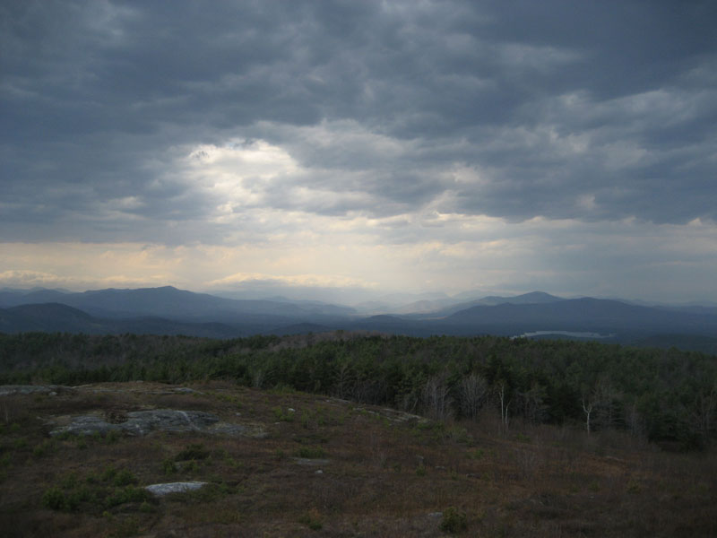
The views from the top, though somewhat cloudy and hazy, were nonetheless decent. The wind was surprisingly strong - if it wasn't for the near 90 degree temperature, it would have been a bit bitter. It was strong enough to almost knock me over - not something one would expect from a 1,600+ foot peak!
| Hike Ratings |
|
Getting To Trailhead: |
Easy |
| Destination: |
Foss Mountain (North Peak) |
|
Length: |
Easy |
|
Steepness: |
Moderate |
|
Navigation: |
Easy |
|
Views: |
Excellent |
|
Crowds: |
Minimal |
|
| Hike Stats |
|
Date Hiked: |
Tuesday, April 28, 2009 |
| Hike Commenced: |
3:39 PM |
| Parking Elevation: |
1,420' |
| Destination: |
Foss Mountain (North Peak) |
| Ascent Commenced: |
3:39 PM |
| Summit Reached: |
3:45 PM |
| Time Elapsed: |
00:06 |
| Trailhead Elevation: |
1,420' |
| Summit Elevation: |
1,647' |
| Distance: |
.5 mile |
| Vertical Gain: |
247' |
|
|
| Hike Ended: |
3:57 PM |
| Hike Time Elapsed: |
00:18 |
| Hike Vertical Gain: |
267' |
|
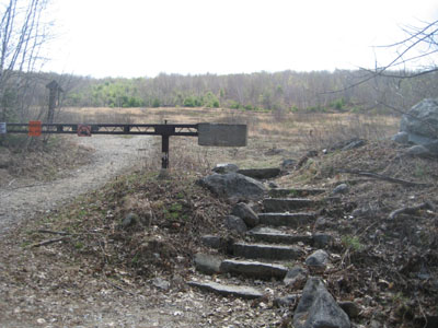
The Foss Mountain Trail trailhead next to the seasonal portion of Foss Mountain Road

Looking at the Mount Washington Valley from the Foss Mountain north peak
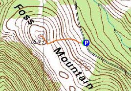

Directions to trailhead: Take Route 153 North to Brownfield Road. Take a right onto Bull Pasture Road. Take a right onto Stewart Road. Take a left onto Foss Mountain Road. The non-winter parking area is located a few miles up on the left and the trailhead is on the right, at the bottom of the blueberry fields.
Back to Foss Mountain Profile
|