Home
States
Colorado
Connecticut
Maine
Massachusetts
New Hampshire
New York
Rhode Island
Utah
Vermont
View All
Lists
NE 4,000 Footers
NE 100 Highest
NH 4,000 Footers
NH 100 Highest
NH 52 With A View
NH Belknap Range
NH Ossipee 10
Links
Trail Conditions
Trip Log
Sunrises
Sunsets
About
|
Galehead Mountain, South Twin Mountain
Bethlehem, NH, Franconia, NH
Trailheads, measurements, times, distances, and maps are all approximate and relative to the hike(s) as shown below.
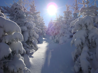
Looking up the Frost Trail near the Galehead Mountain summit
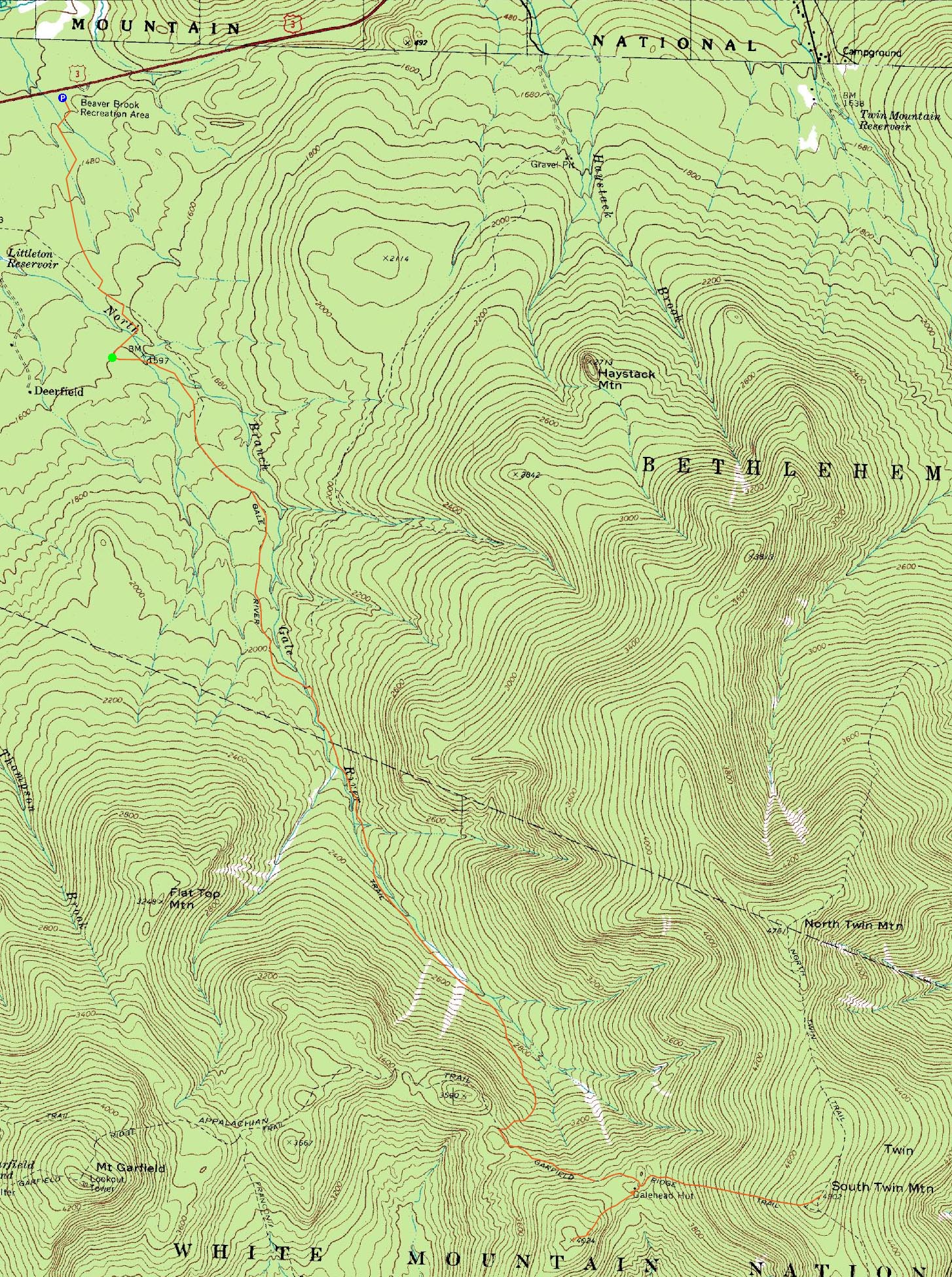
Route: Beaver Brook XC Ski Trail, connector trail, Gale River Road, Gale River Trail, Garfield Ridge Trail, Frost Trail, (Galehead Mountain), Frost Trail, (Galehead Hut), Frost Trail, Twinway, (South Twin Mountain), Twinway, (South Twin Mountain), Twinway, Frost Trail, (Galehead Hut), Frost Trail, Garfield Ridge Trail, Gale River Trail, Gale River Road, connector trail, Beaver Brook XC Ski Trail
Today's itinerary was to hit Galehead Mountain and South Twin, with perhaps North Twin as an add on if making really good time. Arriving at the Beaver Brook parking area, we soon set foot up the cross country ski trail, bearing right onto the counterclockwise loop. There were numerous laminated signs pointing hikers to Gale River Road. After some fairly flat snowshoeing, we arrived at a big open area adjacent to Gale River Road.
From there, it was an easy snowshoe on groomed snowmobile trail to the Gale River Trail trailhead. As we neared the trailhead, we were very happy to see the trail was broken out.
The first portion of the trail dragged on a bit - fairly flat and straight, not much to see. The water crossings were fortunately pretty much completely bridged, allowing for easy passage.
As the trail steepened after the second crossing, the group slowed a bit. Though the trail never gets extremely steep, it was a fairly decently slog up to the Garfield Ridge Trail.
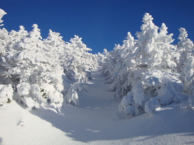
From previous experience, this section of the Garfield Ridge Trail drags on due to poor footing and a decent number of ups and downs. In packed snow conditions, however, the rocks are hidden. Add in some beautiful sun rays coming through the snow covered trees and a normally unpleasant trail becomes a nice walk.
At the boarded up hut, a few folks dropped packs in preparation for the somewhat short ascent up Galehead. Not far after the trail junction, we came across the group that had broken out the first four and a half miles of trail. Thankful for their effort, we leapfrogged them and broke out the rest of the way up to the summit of Galehead.
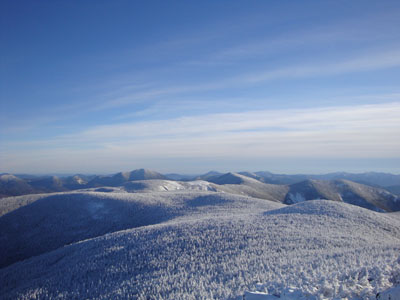
While Galehead isn't known for its views, I found the vista to be rather stunning on this clear winter day. In addition, the snowpack allowed for better angles for on trail views in some places. Although it still seems like a trivial peak in the scheme of things, it was rather enjoyable.
Back at the hut, we had a brief lunch and then headed up to South Twin. Like the Frost Trail to Galehead, the Twinway was not broken out. Though it's a considered a very challenging .8 miles, I once again didn't find this section of the Twinway to be as bad as its reputation suggests. The snowpack helped make it a rather smooth ascent and, with memories of breaking trail up to North Hancock in the rain fresh in my mind, it didn't seem like a bad ascent at all.
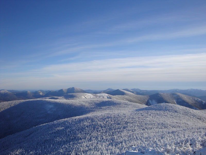
Though clouds were moving in from the south and west, the views from South Twin were still quite stunning. The eastern portion of the summit was the first place I felt any sort of measurable wind all day - seemingly coming out of the northeast. After taking a few photos, we started our way back down the trail. Meeting up with another group member a few hundred vertical feet down, we decided to resummit. The change in the views in only 45 minutes was stunning - the skies were starting to turn colors and many mountains were getting swallowed up in shadows.
The descent down Twinway was a bit interesting - the loose powder on top of hardpack in the steep sections made for some interesting snowshoe sliding. Back at the hut, we had some more snacks and prepared for the long haul back to our vehicles.
The Gale River Trail seemed to go on forever. While we seemed to arrive at the pre-water-crossing-I-like-hyphens-view-point in a reasonable amount of time, the rest of the hike dragged on. Dark, cold, and flat.
Finally back to the trailhead, we still had over a mile to go. After seeing some sleds pass, we put two headlamps in warning flasher mode and made our way back to the Beaver Brook ski trail system. While the trail seemed to drag on a little bit in the morning, it really dragged at this point in the dark. The silhouette of the parking area kiosk was a very welcome sight!
| Hike Ratings |
|
Getting To Trailhead: |
Difficult |
| Destination: |
Galehead Mountain |
|
Length: |
Moderate |
|
Steepness: |
Difficult |
|
Navigation: |
Easy |
|
Views: |
Excellent |
|
Crowds: |
Moderate |
| Destination: |
South Twin Mountain |
|
Length: |
Difficult |
|
Steepness: |
Difficult |
|
Navigation: |
Easy |
|
Views: |
Excellent |
|
Crowds: |
Minimal |
|
| Hike Stats |
|
Date Hiked: |
Saturday, January 10, 2009 |
| Hike Commenced: |
9:00 AM |
| Parking Elevation: |
1,420' |
| Destination: |
Galehead Mountain |
| Ascent Commenced: |
9:34 AM |
| Summit Reached: |
1:10 PM |
| Time Elapsed: |
03:36 |
| Trailhead Elevation: |
1,610' |
| Summit Elevation: |
4,024' |
| Distance: |
5.1 miles |
| Vertical Gain: |
2,609' |
| Destination: |
Galehead Hut |
| Descent Commenced: |
1:10 PM |
| Hut Reached: |
1:27 PM |
| Time Elapsed: |
00:17 |
| Trailhead Elevation: |
4,180' |
| Hut Elevation: |
3,800' |
| Distance: |
.5 miles |
| Vertical Gain: |
50' |
| Destination: |
South Twin Mountain |
| Ascent Commenced: |
1:37 PM |
| Summit Reached: |
2:37 PM |
| Time Elapsed: |
01:00 |
| Trailhead Elevation: |
3,800' |
| Summit Elevation: |
4,902' |
| Distance: |
.8 miles |
| Vertical Gain: |
1,137' |
|
|
| Hike Ended: |
7:14 PM |
| Hike Time Elapsed: |
10:14 |
| Hike Vertical Gain: |
4,596' |
|
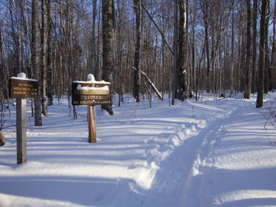
The Gale River Trail trailhead
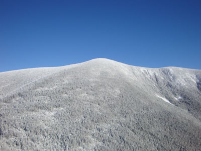
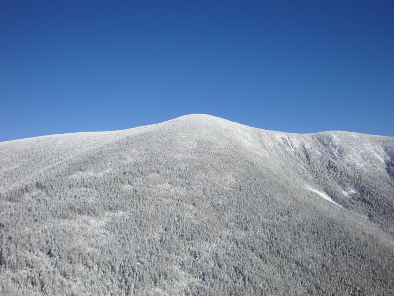
Looking at South Twin Mountain from the Galehead Mountain viewpoint
Looking up Twinway to South Twin Mountain
Looking at Carrigain and the Bonds from South Twin Mountain

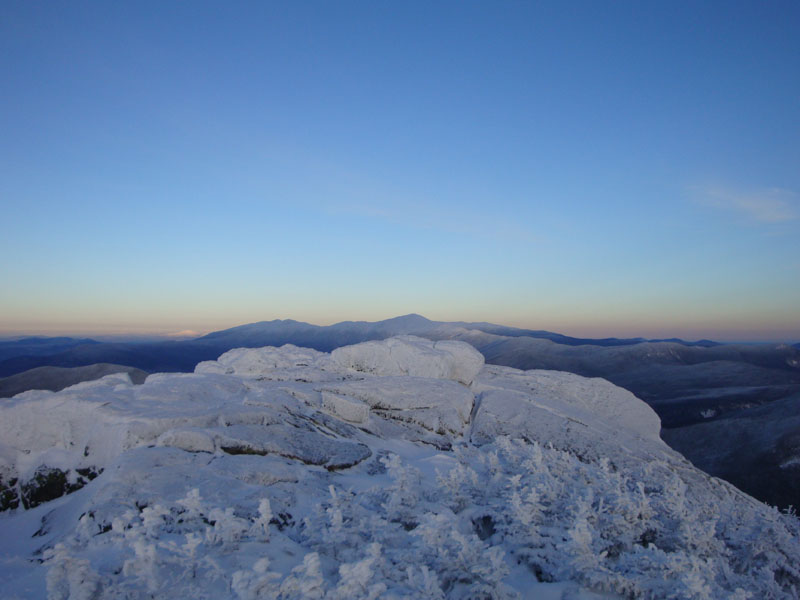
Looking at Mt. Washington from South Twin Mountain later in the day
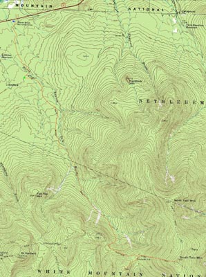

Directions to trailhead: Take Route 3 South from US 302. In the winter, take a left into the Beaver Brook WMNF fee parking area, just before the five corners. Follow the Beaver Brook cross country ski trail counterclockwise (some signs directing hikers to Gale River Road). A short path will lead from the cross country ski trail to an open field and to Gale River Road (go left onto it). Take a right shortly thereafter onto the loop road. The Gale River Trail trailhead will be on the left .3 miles thereafter.
Back to Galehead Mountain Profile
Back to South Twin Mountain Profile
|