Home
States
Colorado
Connecticut
Maine
Massachusetts
New Hampshire
New York
Rhode Island
Utah
Vermont
View All
Lists
NE 4,000 Footers
NE 100 Highest
NH 4,000 Footers
NH 100 Highest
NH 52 With A View
NH Belknap Range
NH Ossipee 10
Links
Trail Conditions
Trip Log
Sunrises
Sunsets
About
|
Galehead Mountain, South Twin Mountain, North Twin Mountain
Bethlehem, NH, Franconia, NH
Trailheads, measurements, times, distances, and maps are all approximate and relative to the hike(s) as shown below.
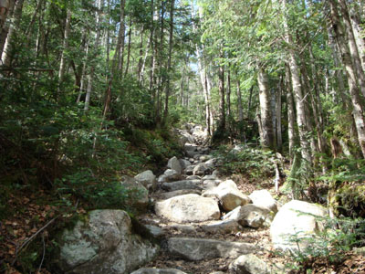
The Gale River Trail
Route: Gale River Trail, Garfield Ridge Trail, Frost Trail, (Galehead Mountain), Frost Trail, (Galehead Hut), Frost Trail, Twinway, (South Twin Mountain), North Twin Spur, (North Twin Mountain), North Twin Spur, (South Twin Mountain), Twinway, Frost Trail, (Galehead Hut), Frost Trail, Garfield Ridge Trail, Gale River Trail
At the end of a long weekend with lots of hiking, I was a bit fatigued. Nonetheless, I wanted to get up to the Twins for the first time in spring.
The Gale River Trail was quite busy with dozens of folks departing from the hut. Other than that, the water crossings were doable and the trail was snow free.
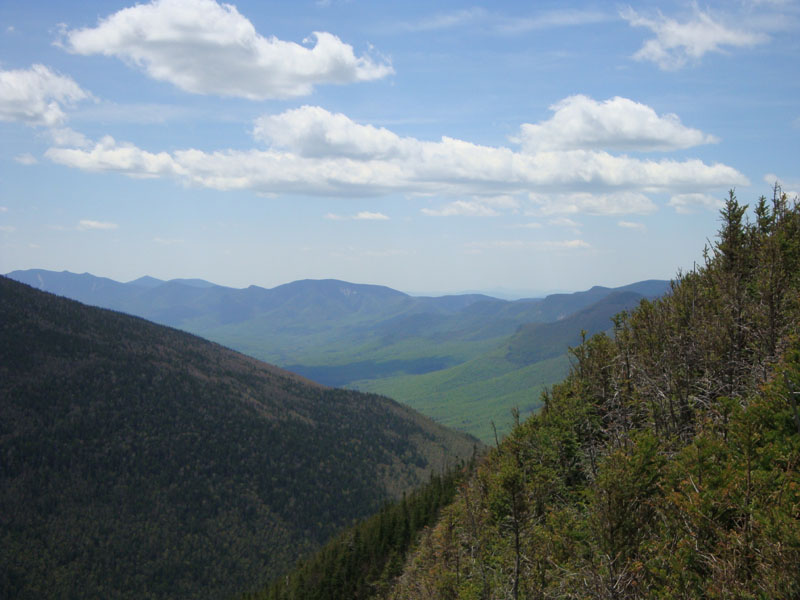
My first stop was Galehead. The views from near the summit were quite good. I followed a herd path from the summit to another potential vista, but it was fruitless without snowpack to lift me over the spruce in the way.
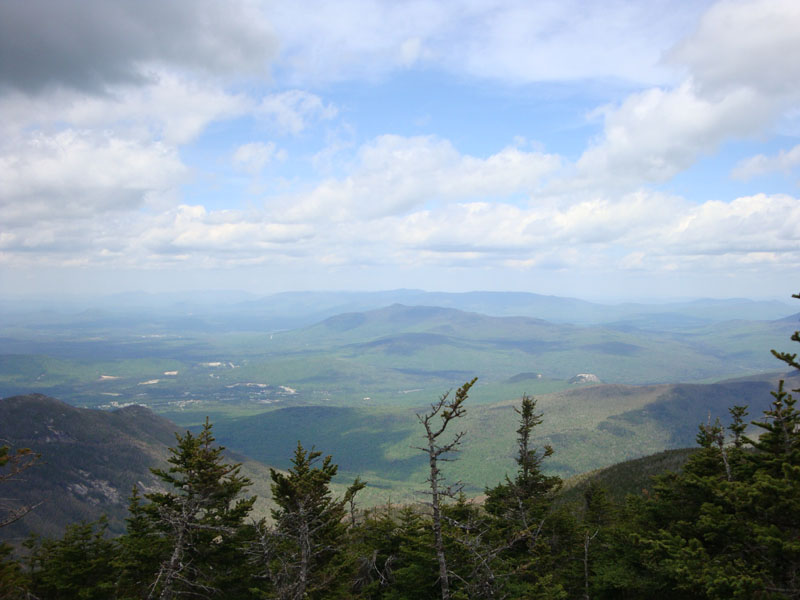
My sore achilles were non too happy with the steep Twinway, however the views from South Twin were quite good. Though windy, the temperatures weren't too bad.
Other than some snow in the col, the North Twin spur was snow free. Reaching the viewpoint, I followed a herd path to a northern vista - not too bad!
Backtracking, I stopped at the hut for a late lunch break, prior to heading down the Gale River Trail. While my feet were feeling the impact of lots of hiking, it was a nice day to get out.
| Hike Ratings |
|
Getting To Trailhead: |
Easy |
| Destination: |
Galehead Mountain |
|
Length: |
Moderate |
|
Steepness: |
Difficult |
|
Navigation: |
Easy |
|
Views: |
Moderate |
|
Crowds: |
Heavy |
| Destination: |
South Twin Mountain |
|
Length: |
Difficult |
|
Steepness: |
Difficult |
|
Navigation: |
Easy |
|
Views: |
Excellent |
|
Crowds: |
Minimal |
| Destination: |
North Twin Mountain |
|
Length: |
Difficult |
|
Steepness: |
Moderate |
|
Navigation: |
Easy |
|
Views: |
Excellent |
|
Crowds: |
Minimal |
|
| Hike Stats |
|
Date Hiked: |
Monday, May 25, 2009 |
| Hike Commenced: |
9:26 AM |
| Parking Elevation: |
1,610' |
| Destination: |
Galehead Mountain |
| Ascent Commenced: |
9:26 AM |
| Summit Reached: |
11:42 AM |
| Time Elapsed: |
02:16 |
| Trailhead Elevation: |
1,610' |
| Summit Elevation: |
4,024' |
| Distance: |
5.1 miles |
| Vertical Gain: |
2,609' |
| Destination: |
South Twin Mountain |
| Ascent Commenced: |
11:48 AM |
| Summit Reached: |
12:43 PM |
| Time Elapsed: |
00:55 |
| Trailhead Elevation: |
4,024' |
| Summit Elevation: |
4,902' |
| Distance: |
1.3 miles |
| Vertical Gain: |
1,187' |
| Destination: |
North Twin Mountain |
| Ascent Commenced: |
12:47 PM |
| Summit Reached: |
1:37 PM |
| Time Elapsed: |
00:50 |
| Trailhead Elevation: |
4,902' |
| Summit Elevation: |
4,761' |
| Distance: |
1.3 miles |
| Vertical Gain: |
321' |
|
|
| Hike Ended: |
5:39 PM |
| Hike Time Elapsed: |
08:13 |
| Hike Distance: |
14.4 miles |
| Hike Vertical Gain: |
4,754' |
|
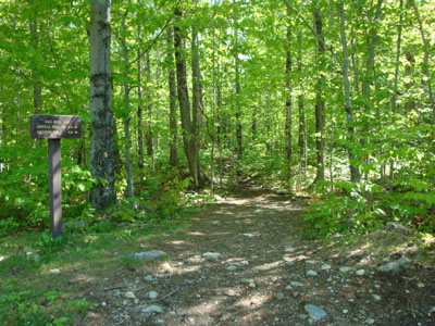
The Gale River Trail trailhead
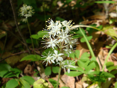
Wildflowers on the Gale River Trail

Looking south from near the summit of Galehead Mountain
Looking up Twinway to South Twin Mountain
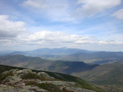
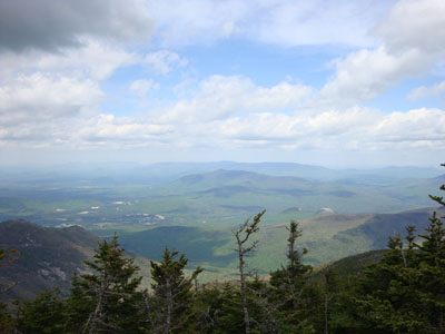
Looking at Mt. Washington from the South Twin Mountain summit
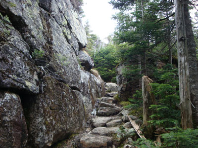
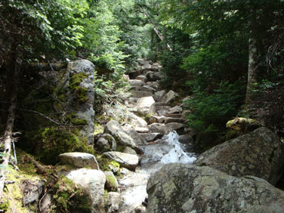
The North Twin Spur Trail on the way to North Twin Mountain
Looking north from near the summit of North Twin Mountain

Directions to trailhead: Take Route 3 South from US 302. Take a left for the Gale River camping/hiking area. Shortly after, bear left at the fork in the road. Continue down the road, then take a right at the hiker sign. The WMNF fee parking area is on the left. There is a Gale River Trail trailhead on the side of the parking area.
Back to Galehead Mountain Profile
Back to South Twin Mountain Profile
Back to North Twin Mountain Profile
|