Home
States
Colorado
Connecticut
Maine
Massachusetts
New Hampshire
New York
Rhode Island
Utah
Vermont
View All
Lists
NE 4,000 Footers
NE 100 Highest
NH 4,000 Footers
NH 100 Highest
NH 52 With A View
NH Belknap Range
NH Ossipee 10
Links
Trail Conditions
Trip Log
Sunrises
Sunsets
About
|
Galehead Mountain, Mt. Garfield
Bethlehem, NH, Franconia, NH
Trailheads, measurements, times, distances, and maps are all approximate and relative to the hike(s) as shown below.
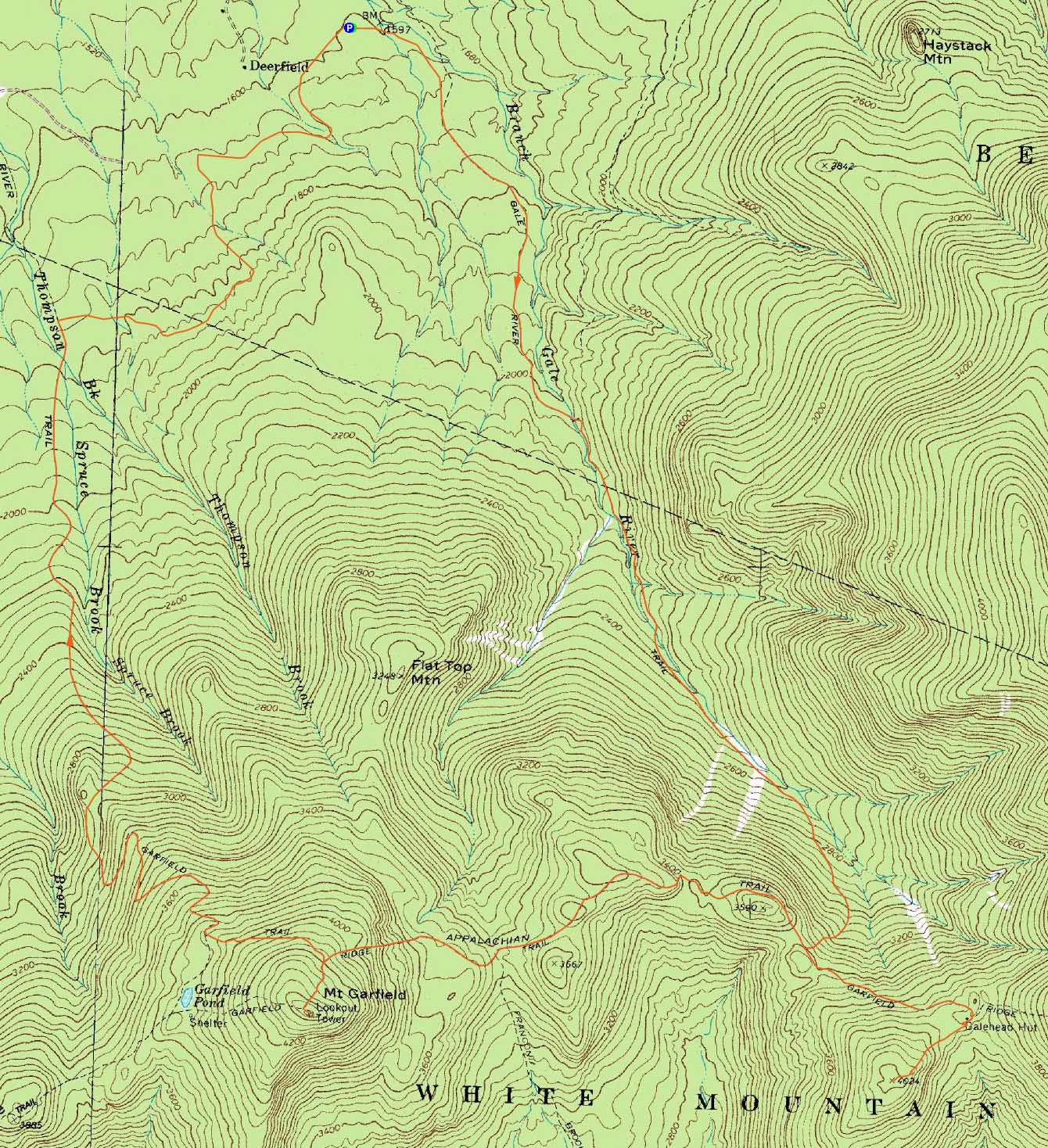
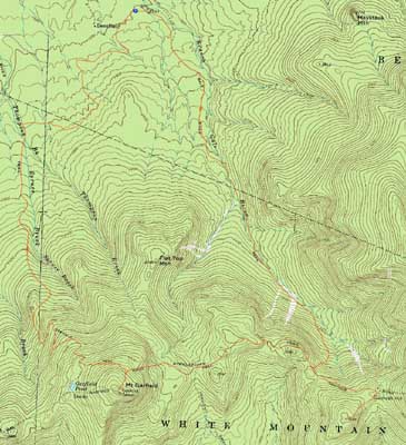
The Gale River Trail
Route: Gale River Trail, Garfield Ridge Trail, Frost Trail, (Galehead Mountain), Frost Trail, (Galehead Hut), Frost Trail, Garfield Ridge Trail, (Mt. Garfield), Garfield Ridge Trail, Garfield Trail, unknown road, Gale River Road
Having never hiked between Galehead and Garfield, I decided to give it a try on yet another wet June day.
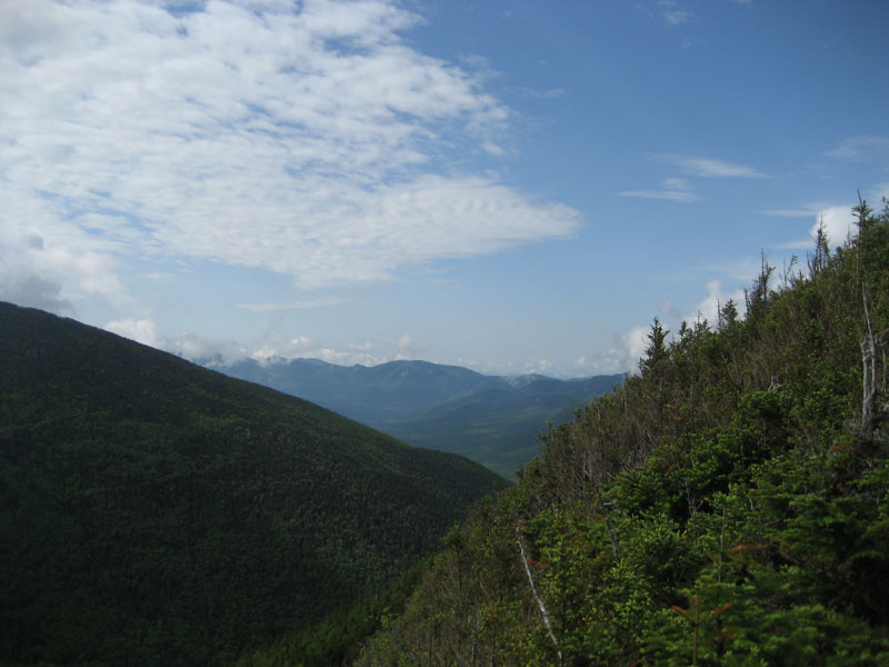
While things were cloudy at the start of the acent up the Gale River Trail (water crossings no problem), some blue sky emerged for awhile as I neared the Garfield Ridge Trail. Continuing to the hut and to the summit of Galehead, I had decent views from the near-summit viewpoint.
Back at the hut, I took a mid morning snack break.
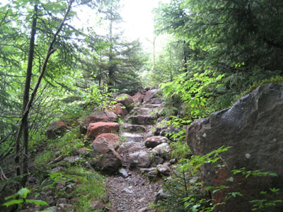
Once past the Gale River Trail junction, I was surprised to see the footing on the infamous Garfield Ridge Trail improved nicely. Though there were some slippery ledges/scrambles and various ups and downs, I found the section of trail between the Gale River Trail and Franconia Brook Trail to be relatively pleasant - much nicer than the section from the Frost Trail to the Gale River Trail. Beyond the Franconia Brook Trail junction, however, things roughened and steepend up quite quickly. With rain starting, the steep, rocky trail turned into a brook.
After climbing past the campground, things started to flatten out a bit, prior to the final short, steep climb to the summit.
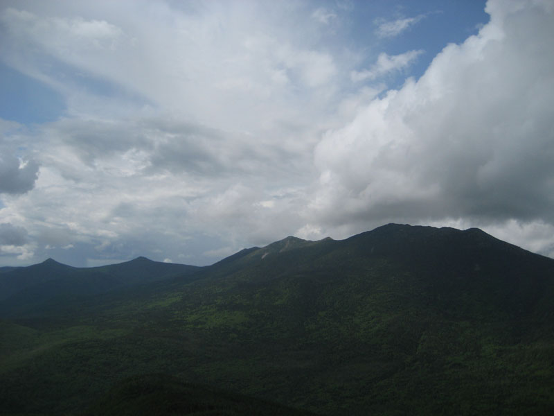
Despite a few sprinkles, the views from the summit were quite good - blue sky near the Franconia Ridge - amazing what a difference a few miles can make.
I descended the Garfield Trail down to the woods road crossing. Having never read or seen where the road went, I decided to follow it eastbound, thus hoping to reduce the Gale River Road walk. The woods road was fairly pleasant - all water crossings were bridged. The first section of trail was a little bit neglected (a few blowdowns), however after turning to the right and entering a field (with lots of wildflowers), it was clear sailing all the way down to Gale River Road. After just a tad over 15 minutes of road walking, I was back to the Gale River Trail trailhead.
| Hike Ratings |
|
Getting To Trailhead: |
Easy |
| Destination: |
Galehead Mountain |
|
Length: |
Moderate |
|
Steepness: |
Difficult |
|
Navigation: |
Easy |
|
Views: |
Excellent |
|
Crowds: |
Moderate |
| Destination: |
Mt. Garfield |
|
Length: |
Difficult |
|
Steepness: |
Very Difficult |
|
Navigation: |
Easy |
|
Views: |
Excellent |
|
Crowds: |
Moderate |
|
| Hike Stats |
|
Date Hiked: |
Saturday, June 27, 2009 |
| Hike Commenced: |
7:11 AM |
| Parking Elevation: |
1,610' |
| Destination: |
Galehead Mountain |
| Ascent Commenced: |
7:11 AM |
| Summit Reached: |
9:23 AM |
| Time Elapsed: |
02:12 |
| Trailhead Elevation: |
1,610' |
| Summit Elevation: |
4,024' |
| Distance: |
5.1 miles |
| Vertical Gain: |
2,609' |
| Destination: |
Galehead Hut |
| Descent Commenced: |
9:23 AM |
| Hut Reached: |
9:39 AM |
| Time Elapsed: |
00:16 |
| Trailhead Elevation: |
4,024' |
| Hut Elevation: |
3,800' |
| Distance: |
.5 miles |
| Vertical Gain: |
50' |
| Destination: |
Mt. Garfield |
| Ascent Commenced: |
9:52 AM |
| Summit Reached: |
11:43 AM |
| Time Elapsed: |
01:51 |
| Trailhead Elevation: |
3,800' |
| Summit Elevation: |
4,500' |
| Vertical Gain: |
1,245' |
|
|
| Hike Ended: |
2:24 PM |
| Hike Time Elapsed: |
07:13 |
| Hike Vertical Gain: |
4,174' |
|
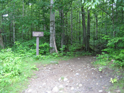
The Gale River Trail trailhead
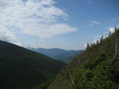
Looking south from near the summit of Galehead Mountain
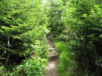
The Garfield Ridge Trail on the way to Mt. Garfield

Looking at the Franconia Ridge from Mt. Garfield
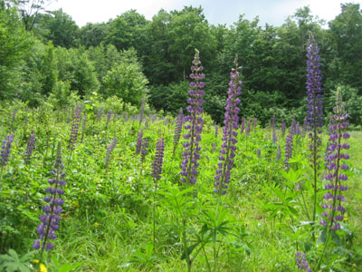
Wild flowers along the woods road near Gale River Road

Directions to trailhead: Take Route 3 South from US 302. Take a left for the Gale River camping/hiking area. Shortly after, bear left at the fork in the road. Continue down the road, then take a right at the hiker sign. The WMNF fee parking area is on the left. There is a Gale River Trail trailhead on the side of the parking area.
Back to Galehead Mountain Profile
Back to Mt. Garfield Profile
|