Home
States
Colorado
Connecticut
Maine
Massachusetts
New Hampshire
New York
Rhode Island
Utah
Vermont
View All
Lists
NE 4,000 Footers
NE 100 Highest
NH 4,000 Footers
NH 100 Highest
NH 52 With A View
NH Belknap Range
NH Ossipee 10
Links
Trail Conditions
Trip Log
Sunrises
Sunsets
About
|
Galehead Mountain, South Twin Mountain
Bethlehem, NH, Franconia, NH
Trailheads, measurements, times, distances, and maps are all approximate and relative to the hike(s) as shown below.
The Gale River Trail
Route: Gale River Trail, Garfield Ridge Trail, Frost Trail, (Galehead Mountain), Frost Trail, Twinway, (South Twin), Twinway, Garfield Ridge Trail, Gale River Trail
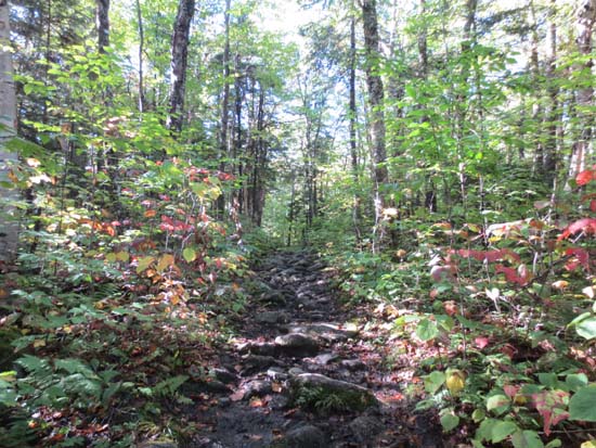
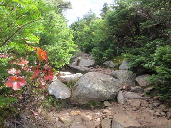
Trails were wet and mucky. First (original) part of Gale River Trail was wet with avoidable mud, but drying up a bit later in the day.
If you ever wondered what the result of an all you can eat bean burrito buffet would look like, the next section of trail gives a graphic image of it. The relo is essentially a nasty 6" deep continuous mud pit from near it's northern side to just before it crosses the Garfield Stream. I don't see anywhere near enough good rock or soil nearby to fix this, so I suspect it'll either need a bunch of bog bridging or else another relo if they want this to be a halfway decent section of trail. South of the stream it's quite muddy, not nearly as bad in comparison.
Once back on the old trail, there was running water, occasional mud, and slippery rocks. The Garfield Ridge Trail section, though featuring PUDs, has improved footing as compared to say half a decade ago, thanks to some staircases and waterbars.
The Frost Trail had some mud pits and slippery rock.
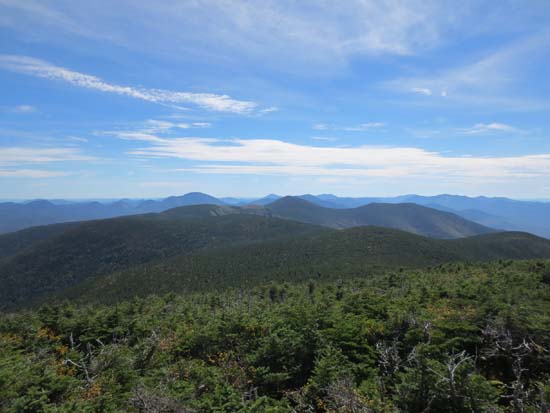
The Twinway had some slippery rock as well.
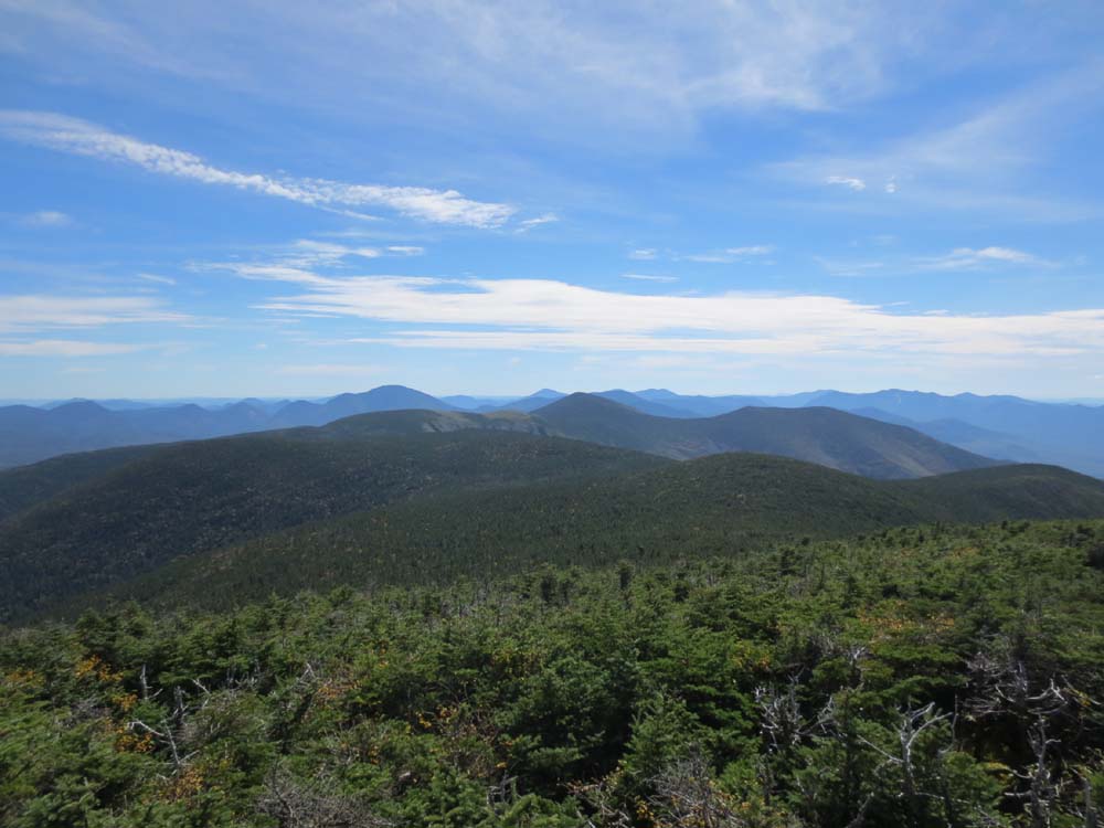
Brisk temperatures on South Twin, but excellent views, stretching south to the Belknaps, Kearsarge South, and possibly Monadnock, as well as northwest to Jay Peak.
Temperatures were more pleasant at the hut, so I decided to see what it's like to be a geezer and sat on the front porch for an extended amount of time. I was lacking a rocking chair and Werther's Originals unfortunately.
| Hike Ratings |
|
Getting To Trailhead: |
Easy |
| Destination: |
Galehead Mountain |
|
Length: |
Moderate |
|
Steepness: |
Difficult |
|
Navigation: |
Easy |
|
Views: |
Excellent |
|
Crowds: |
Heavy |
| Destination: |
South Twin Mountain |
|
Length: |
Difficult |
|
Steepness: |
Difficult |
|
Navigation: |
Easy |
|
Views: |
Excellent |
|
Crowds: |
Heavy |
|
| Hike Stats |
|
Date Hiked: |
Sunday, September 15, 2013 |
| Parking Elevation: |
1,610' |
| Destination: |
Galehead Mountain |
| Time Elapsed: |
02:29 |
| Trailhead Elevation: |
1,610' |
| Summit Elevation: |
4,024' |
| Distance: |
6.1 miles |
| Vertical Gain: |
2,759' |
| Destination: |
South Twin Mountain |
| Time Elapsed: |
00:54 |
| Trailhead Elevation: |
4,024' |
| Summit Elevation: |
4,902' |
| Distance: |
1.3 miles |
| Vertical Gain: |
1,187' |
|
|
| Hike Time Elapsed: |
7:51 |
| Hike Vertical Gain: |
4,266' |
|
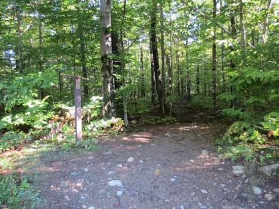
The Gale River Trail trailhead
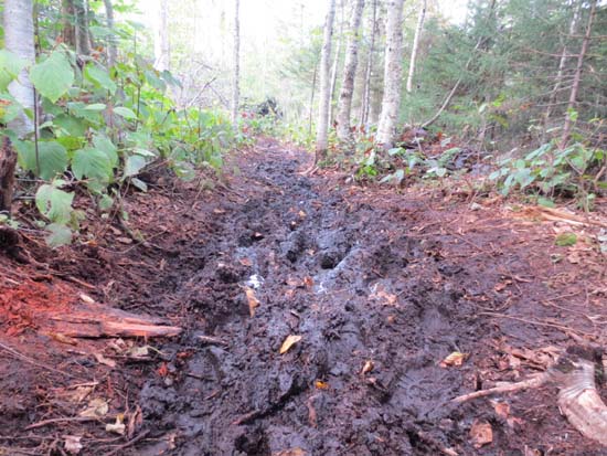
The Gale River Trail mudpit reroute
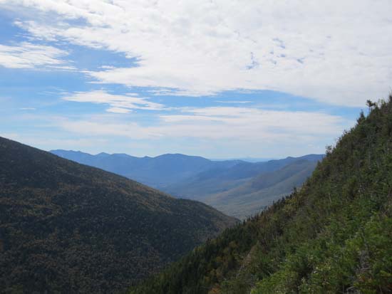
Looking south from near the summit of Galehead
Looking up the Twinway
Looking southeast toward the Bonds from South Twin
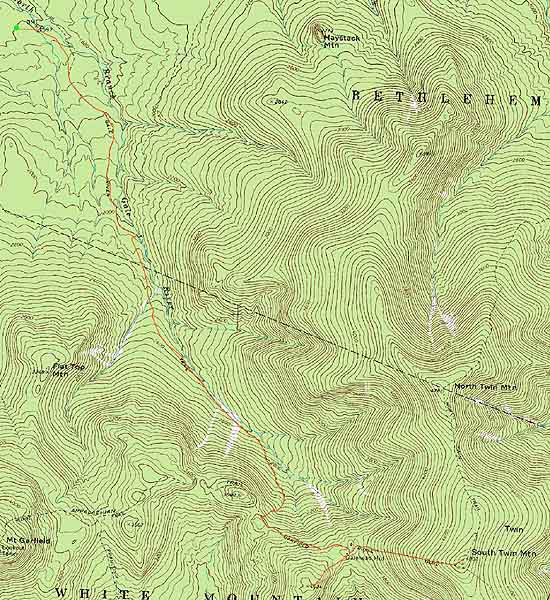

Directions to trailhead: Take Route 3 South from US 302. Take a left for the Gale River camping/hiking area. Shortly after, bear left at the fork in the road. Continue down the road, then take a right at the hiker sign. The WMNF fee parking area is on the left. There is a Gale River Trail trailhead on the side of the parking area.
Back to Galehead Mountain Profile
Back to South Twin Mountain Profile
|