Home
States
Colorado
Connecticut
Maine
Massachusetts
New Hampshire
New York
Rhode Island
Utah
Vermont
View All
Lists
NE 4,000 Footers
NE 100 Highest
NH 4,000 Footers
NH 100 Highest
NH 52 With A View
NH Belknap Range
NH Ossipee 10
Links
Trail Conditions
Trip Log
Sunrises
Sunsets
About
|
Garfield Ridge (West Peak), Garfield Ridge (East Peak)
Bethlehem, NH, Franconia, NH
Trailheads, measurements, times, distances, and maps are all approximate and relative to the hike(s) as shown below.
Garfield Ridge Trail on the way to the West Peak
Route: Beaver Brook XC Ski Trail, connector trail, Gale River Road, Gale River Trail, Garfield Ridge Trail, bushwhack, (Garfield Ridge West Peak), bushwhack, Garfield Ridge Trail, herd path, (Garfield Ridge East Peak), herd path, Garfield Ridge Trail, Gale River Trail, Gale River Road, connector trail, Beaver Brook XC Ski Trail
Trails are now well packed for snowshoe use. Maybe 6 inches of powder increasing to close to a foot up high. Snowpack up high close to 2 feet. Found a cut herd path leading to east peak.
| Hike Ratings |
|
Getting To Trailhead: |
Difficult |
| Destination: |
Garfield Ridge - West Peak |
|
Length: |
Moderate |
|
Steepness: |
Difficult |
|
Navigation: |
Difficult |
|
Views: |
Moderate |
|
Crowds: |
Moderate |
| Destination: |
Garfield Ridge - East Peak |
|
Length: |
Difficult |
|
Steepness: |
Difficult |
|
Navigation: |
Difficult |
|
Views: |
Excellent |
|
Crowds: |
Minimal |
|
| Hike Stats |
|
Date Hiked: |
Saturday, February 8, 2014 |
| Time to Trailhead: |
00:26 |
| Parking Elevation: |
1,420' |
| Destination: |
Garfield Ridge - West Peak |
| Time Elapsed: |
03:28 |
| Trailhead Elevation: |
1,610' |
| Summit Elevation: |
3,667' |
| Vertical Gain: |
2,457' |
| Destination: |
Garfield Ridge - East Peak |
| Time Elapsed: |
00:48 |
| Trailhead Elevation: |
3,667' |
| Summit Elevation: |
3,590' |
| Vertical Gain: |
410' |
|
|
| Hike Time Elapsed: |
7:32 |
| Hike Vertical Gain: |
3,237' |
|
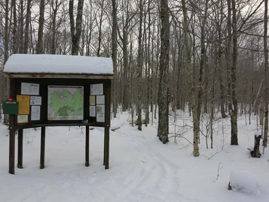
The Gale River Trail trailhead
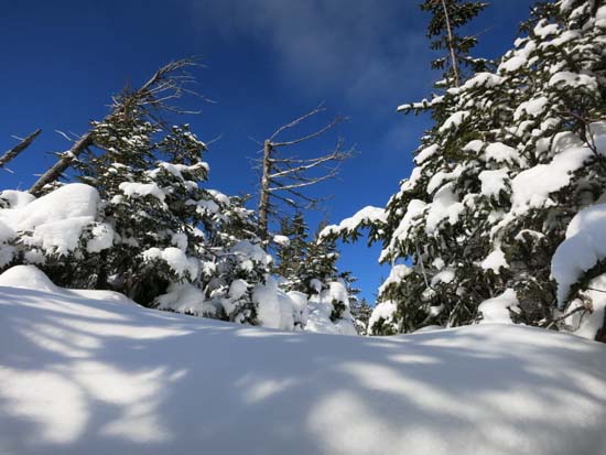
Looking toward South Twin from near the summit of Garfield Ridge West Peak
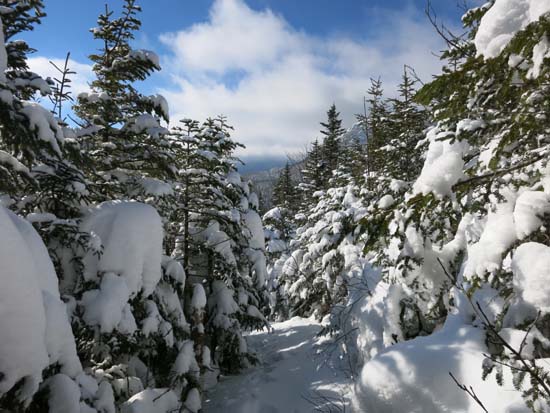
The Garfield Ridge Trail between the peaks
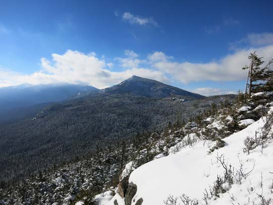
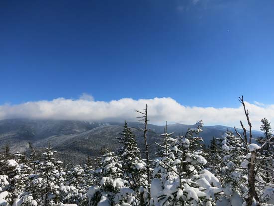
Looking at Mt. Garfield from Garfield Ridge East Peak
Directions to trailhead: Take Route 3 South from US 302. In the winter, take a left into the Beaver Brook WMNF fee parking area, just before the five corners. Follow the Beaver Brook cross country ski trail counterclockwise. A short path will lead from the cross country ski trail to an open field and to Gale River Road (go left onto it). Take a right shortly thereafter onto the loop road. The Gale River Trail trailhead will be on the left .3 miles thereafter.
Back to Garfield Ridge (West Peak) Profile
Back to Garfield Ridge (East Peak) Profile
|


