Home
States
Colorado
Connecticut
Maine
Massachusetts
New Hampshire
New York
Rhode Island
Utah
Vermont
View All
Lists
NE 4,000 Footers
NE 100 Highest
NH 4,000 Footers
NH 100 Highest
NH 52 With A View
NH Belknap Range
NH Ossipee 10
Links
Trail Conditions
Trip Log
Sunrises
Sunsets
About
|
Great Hill
Tamworth, NH
Trailheads, measurements, times, distances, and maps are all approximate and relative to the hike(s) as shown below.
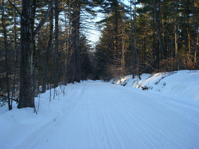
Looking down the trail to Great Hill
Since it was such a nice afternoon outside, I decided to do a sunset hike to Great Hill. To add a slight twist, I hiked up in my alpine ski boots with my skis and poles.
With the trail well packed by snowmobilers, I took a few brief runs as I waited for the sunset - basically, it's like a short, narrow beginner run.
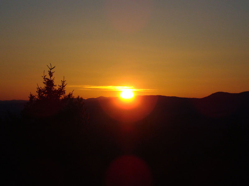
The sunset was a nice one. Almost as enjoyable was skiing down to the bottom after the sunset - so much faster than walking!
| Hike Ratings |
|
Getting To Trailhead: |
Easy |
| Destination: |
Great Hill |
|
Length: |
Easy |
|
Steepness: |
Easy |
|
Navigation: |
Moderate |
|
Views: |
Excellent |
|
Crowds: |
Minimal |
|
| Hike Stats |
|
Date Hiked: |
Monday, January 28, 2008 |
| Hike Commenced: |
4:10 PM |
| Parking Elevation: |
1,020' |
| Destination: |
Great Hill |
| Ascent Commenced: |
4:10 PM |
| Summit Reached: |
4:23 PM |
| Time Elapsed: |
00:13 |
| Trailhead Elevation: |
1,025' |
| Summit Elevation: |
1,270' |
| Vertical Gain: |
250' |
|
|
| Hike Ended: |
5:00 PM |
| Hike Time Elapsed: |
00:50 |
| Hike Vertical Gain: |
320' |
|
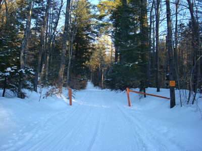
Trailhead to Great Hill summit
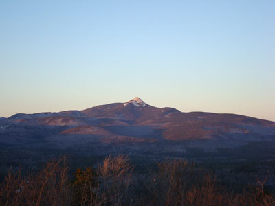
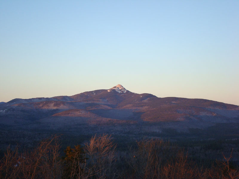
Looking at Mt. Chocorua from the Great Hill firetower

The sunset as seen from the Great Hill firetower
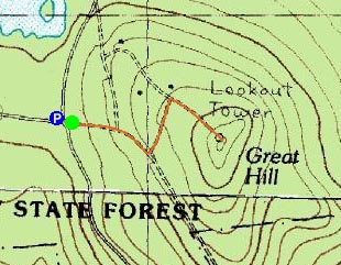

Directions to trailhead: Take Great Hill Road from Tamworth Village. Parking area a few miles up once road turns to dirt. Trail to firetower starts at orange gate on uphill side of parking area.
Back to Great Hill Profile
|