Home
States
Colorado
Connecticut
Maine
Massachusetts
New Hampshire
New York
Rhode Island
Utah
Vermont
View All
Lists
NE 4,000 Footers
NE 100 Highest
NH 4,000 Footers
NH 100 Highest
NH 52 With A View
NH Belknap Range
NH Ossipee 10
Links
Trail Conditions
Trip Log
Sunrises
Sunsets
About
|
Great Hill
Tamworth, NH
Trailheads, measurements, times, distances, and maps are all approximate and relative to the hike(s) as shown below.
Looking up the Peg King Spur Trail
Route: Betty Steele Loop Trail, Peg King Spur Trail, (Great Hill), Peg King Spur Trail, Betty Steele Loop Trail
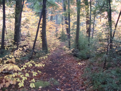
With not much time and mediocre weather again, I decided to try a new-to-me approach to Great Hill. Starting at 113A, I jogged down to the river and across a very nice bridge. From there, I took the west side of the Betty Steele Loop Trail. The trail was generally gradual, working its way through woods filled with big pine trees.
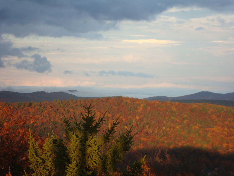
From the upper loop junction, I continued on the Peg King Spur Trail, which was generally gradual until a steady climb up to the fire tower. Though it had been pouring only an hour or two earlier, the fog was lifting in the immediate area, revealing nice views.
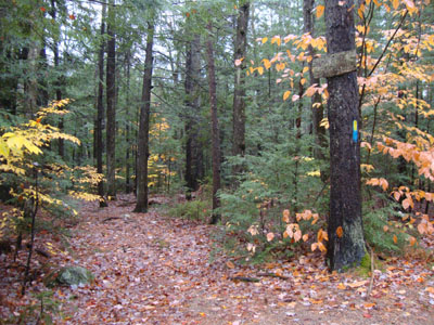
For the descent, I took the eastern branch of the Betty Steele Loop Trail, which was a little more rugged and lengthy than the west branch, just still generally tame.
| Hike Ratings |
|
Getting To Trailhead: |
Easy |
| Destination: |
Great Hill |
|
Length: |
Moderate |
|
Steepness: |
Moderate |
|
Navigation: |
Easy |
|
Views: |
Excellent |
|
Crowds: |
Minimal |
|
| Hike Stats |
|
Date Hiked: |
Wednesday, October 27, 2010 |
| Hike Commenced: |
4:52 PM |
| Parking Elevation: |
730' |
| Destination: |
Great Hill |
| Ascent Commenced: |
4:52 PM |
| Summit Reached: |
5:10 PM |
| Time Elapsed: |
00:18 |
| Trailhead Elevation: |
730' |
| Summit Elevation: |
1,270' |
| Vertical Gain: |
570' |
|
|
| Hike Ended: |
5:41 PM |
| Hike Time Elapsed: |
00:49 |
| Hike Vertical Gain: |
650' |
|
The Big Pines trailhead off Route 113A

Looking northeast as fog lifts from south of Conway as seen from the Great Hill fire tower
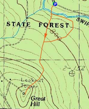

Directions to trailhead: Take Route 113A west from Tamworth village. The Big Pines area will eventually be on the left.
Back to Great Hill Profile
|