Home
States
Colorado
Connecticut
Maine
Massachusetts
New Hampshire
New York
Rhode Island
Utah
Vermont
View All
Lists
NE 4,000 Footers
NE 100 Highest
NH 4,000 Footers
NH 100 Highest
NH 52 With A View
NH Belknap Range
NH Ossipee 10
Links
Trail Conditions
Trip Log
Sunrises
Sunsets
About
|
Hedgehog Mountain
Albany, NH
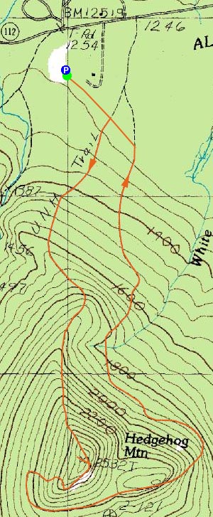
Trailheads, measurements, times, distances, and maps are all approximate and relative to the hike(s) as shown below.
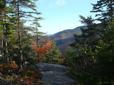
Looking down the UNH Trail near the summit of Hedgehog Mountain
Route: UNH Trail
With the days continuing to get shorter, I was hoping to get in a hike without using my headlamp. With mosquito season done, I decided to head over to Hedgehog Mountain.
Arriving a bit later than I had hoped at the trailhead due to the drive-40-in-a-50-leaf-peepers clogging the roads, I made decent time on the flats, but slowed down a bit as I started to ascend the mountain, as I decided to do some blowdown removal.
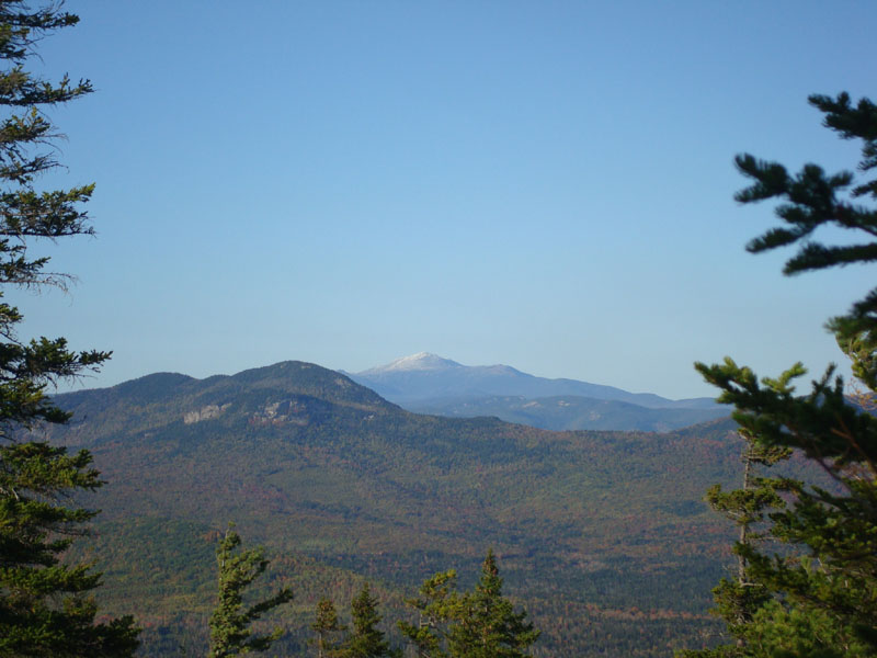
Near the summit, I was struck by the views of a white Mt. Washington. At the actual summit, the views were also quite strong - though the foliage was past peak, Mt. Chocorua looked great.
The east portion of the loop, though scenic, was a bit of a drag, as the lower portion (which is expected to be rerouted in the near future) was a bit muddy.
Though it was a bit dark by the time I made it back to the parking lot, I was able to avoid needing to use my headlamp. With the vast west facing ledges near the summit, I may need to check this out as a sunset hike someday.
| Hike Ratings |
|
Getting To Trailhead: |
Easy |
| Destination: |
Hedgehog Mountain |
|
Length: |
Moderate |
|
Steepness: |
Moderate |
|
Navigation: |
Moderate |
|
Views: |
Excellent |
|
Crowds: |
Minimal |
|
| Hike Stats |
|
Date Hiked: |
Tuesday, October 7, 2008 |
| Hike Commenced: |
3:49 PM |
| Parking Elevation: |
1,265' |
| Destination: |
Hedgehog Mountain |
| Ascent Commenced: |
3:49 PM |
| Summit Reached: |
4:38 PM |
| Time Elapsed: |
00:49 |
| Trailhead Elevation: |
1,270' |
| Summit Elevation: |
2,532' |
| Distance: |
1.9 miles |
| Vertical Gain: |
1,302' |
|
|
| Hike Ended: |
6:34 PM |
| Hike Time Elapsed: |
02:45 |
| Hike Distance: |
4.8 miles |
| Hike Vertical Gain: |
1,537' |
|
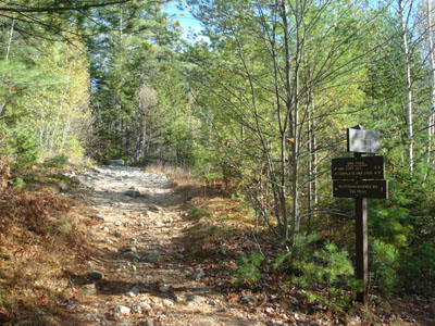
UNH Trail trailhead

Looking at Mt. Washington from near the Hedgehog Mountain summit
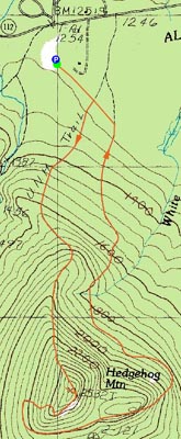

Directions to trailhead: Take Route 112 West from Conway. A bit after Bear Notch Road, look for the sign for the entrance to the UNH Trail (amongst others) Parking on the left. WMNF fee parking area.
Back to Hedgehog Mountain Profile
|