Home
States
Colorado
Connecticut
Maine
Massachusetts
New Hampshire
New York
Rhode Island
Utah
Vermont
View All
Lists
NE 4,000 Footers
NE 100 Highest
NH 4,000 Footers
NH 100 Highest
NH 52 With A View
NH Belknap Range
NH Ossipee 10
Links
Trail Conditions
Trip Log
Sunrises
Sunsets
About
|
Hedgehog Mountain
Albany, NH
Trailheads, measurements, times, distances, and maps are all approximate and relative to the hike(s) as shown below.
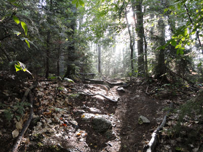
Looking up the UNH Trail after the downpour
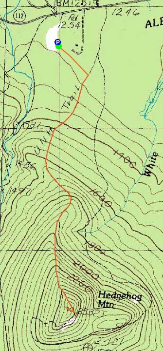
Route: UNH Trail
With nicer weather moving in after on and off rain, I headed up to the Kanc for a quick afternoon hike.
Starting at the trailhead, I had sunny skies overhead and some nice early fall foliage colours. After jogging up to the Allen's Ledge spur junction, I switched over to a walking pace for the balance of the ascent as it steepened and became a bit rougher. Nearing the summit, I could see dark clouds to the west.
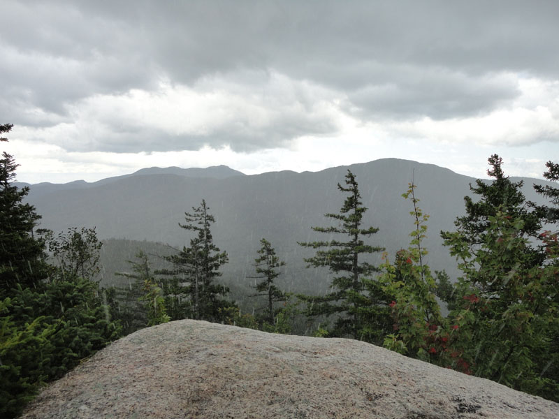
Sure enough, as I reached the summit, it started to downpour. Though I was carrying a light pack, I did fortunately bring a rain jacket - once on, I waited out the brief, five minute downpour. With views re-emerging, I turned around and headed back down the western branch of the loop (I find the lower eastern branch to be very eroded and not rewarding enough, as nice as the ledges on the south side of it are).
Back at the Allen's Ledge junction, I headed out to that vista for the first time. Sure enough, at the lower ledges, there were tremendous views east - a very nice perspective not offered from the summit.
| Hike Ratings |
|
Getting To Trailhead: |
Easy |
| Destination: |
Hedgehog Mountain |
|
Length: |
Moderate |
|
Steepness: |
Moderate |
|
Navigation: |
Easy |
|
Views: |
Excellent |
|
Crowds: |
Moderate |
|
| Hike Stats |
|
Date Hiked: |
Thursday, August 26, 2010 |
| Hike Commenced: |
3:40 PM |
| Parking Elevation: |
1,265' |
| Destination: |
Hedgehog Mountain |
| Ascent Commenced: |
3:40 PM |
| Summit Reached: |
4:15 PM |
| Time Elapsed: |
00:35 |
| Trailhead Elevation: |
1,270' |
| Summit Elevation: |
2,532' |
| Distance: |
1.9 miles |
| Vertical Gain: |
1,302' |
|
|
| Hike Ended: |
5:20 PM |
| Hike Time Elapsed: |
01:40 |
| Hike Distance: |
3.8 miles |
| Hike Vertical Gain: |
1,347' |
|
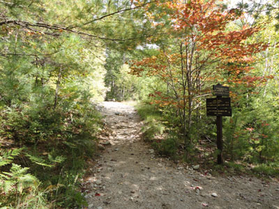
UNH Trail trailhead
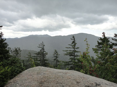
Looking at Mt. Chocorua and Mt. Paugus from Hedgehog Mountain as the downpour begins
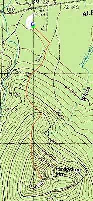

Directions to trailhead: Take Route 112 West from Conway. A bit after Bear Notch Road, look for the sign for the entrance to the UNH Trail (amongst others) Parking on the left. WMNF fee parking area.
Back to Hedgehog Mountain Profile
|