Home
States
Colorado
Connecticut
Maine
Massachusetts
New Hampshire
New York
Rhode Island
Utah
Vermont
View All
Lists
NE 4,000 Footers
NE 100 Highest
NH 4,000 Footers
NH 100 Highest
NH 52 With A View
NH Belknap Range
NH Ossipee 10
Links
Trail Conditions
Trip Log
Sunrises
Sunsets
About
|
Hersey Mountain
New Hampton, NH, Sanbornton, NH
Trailheads, measurements, times, distances, and maps are all approximate and relative to the hike(s) as shown below.
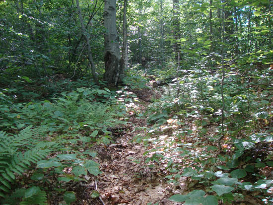
The herd path to Hersey Mountain
Route: Logging road, unknown trail, (Hersey Mountain), unknown trail, logging road
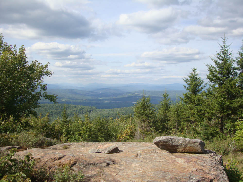
With the bugs finally going away, I headed back to Hersey Mountain. The herd path above the old logging roads was a bit vague, but followable. Reaching the summit, I poked around and found three strong viewpoints - a ledge looking at the Whites, a quasi-ledge looking south of the lakes, and a view looking at Kearsarge and Ragged.
| Hike Ratings |
|
Getting To Trailhead: |
Easy |
| Destination: |
Hersey Mountain |
|
Length: |
Moderate |
|
Steepness: |
Difficult |
|
Navigation: |
Difficult |
|
Views: |
Excellent |
|
Crowds: |
Minimal |
|
| Hike Stats |
|
Date Hiked: |
Wednesday, August 24, 2011 |
| Parking Elevation: |
1,105' |
| Destination: |
Hersey Mountain |
| Time Elapsed: |
00:33 |
| Trailhead Elevation: |
1,110' |
| Summit Elevation: |
2,001' |
| Vertical Gain: |
911' |
|
|
| Hike Time Elapsed: |
01:24 |
| Hike Vertical Gain: |
936' |
|
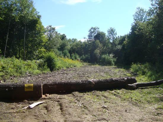
The logging landing at the corner of George Duncan State Forest

Looking at the Whites from one of the Hersey Mountain vistas


Directions to trailhead: From I-93 in New Hampton, take Route 104 West. Take a left onto Route 132. Shortly thereafter, take a right onto Old Bristol Road. Awhile down this road, take a left onto Carter Mountain Road. There will eventually be a Class IV road sign, with adjacent gate. Vehicles with low clearance should be parked near this gate. One can continue down the road, passing straight through snowmobile junction D. Shortly thereafter, there is a logging landing on the right (at the border of George Duncan State Forest). A quasi trail heads uphill on an increasingly faint logging road from this landing (ignore a chained road on the left at the lower landing).
Back to Hersey Mountain Profile
|