Home
States
Colorado
Connecticut
Maine
Massachusetts
New Hampshire
New York
Rhode Island
Utah
Vermont
View All
Lists
NE 4,000 Footers
NE 100 Highest
NH 4,000 Footers
NH 100 Highest
NH 52 With A View
NH Belknap Range
NH Ossipee 10
Links
Trail Conditions
Trip Log
Sunrises
Sunsets
About
|
Hersey Mountain
New Hampton, NH, Sanbornton, NH
Trailheads, measurements, times, distances, and maps are all approximate and relative to the hike(s) as shown below.
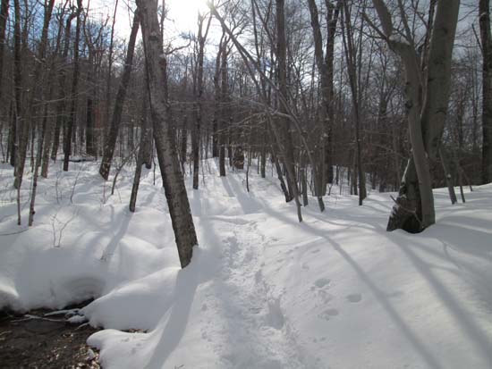
Looking up the trail to Hersey Mountain
Route: Carter Mountain Road, logging road, unknown trail, (Hersey Mountain), unknown trail, logging road, Carter Mountain Road
Carter Mountain Road walk was packed out by a few snowmobiles, but snowshoes were the best bet there. Snowbank blocked that road is almost 6 feet tall, so it may be awhile until its driveable this spring.
There hadn't been any traffic on the herd path since the last storm, so we ended up breaking all the way to the summit. The surface was more of a wet powder as opposed to a granular, and we sank maybe 8-10 inches in our snowshoes. Our tracks seemed to be setting up well, so hopefully this will be a nice packed snowshoe trough. Snowpack is probably 2-3 feet.
Passing snow obscured the excellent views to the Whites, however we could see Newfound Lake, Winnipesaukee, and Kearsarge from the three vistas adjacent to the summit
| Hike Ratings |
|
Getting To Trailhead: |
Moderate |
| Destination: |
Hersey Mountain |
|
Length: |
Moderate |
|
Steepness: |
Difficult |
|
Navigation: |
Difficult |
|
Views: |
Excellent |
|
Crowds: |
Minimal |
|
| Hike Stats |
|
Date Hiked: |
Saturday, March 22, 2014 |
| Parking Elevation: |
1,120' |
| Time to Trailhead: |
00:18 |
| Destination: |
Hersey Mountain |
| Time Elapsed: |
00:48 |
| Trailhead Elevation: |
1,110' |
| Summit Elevation: |
2,001' |
| Vertical Gain: |
911' |
|
|
| Hike Time Elapsed: |
02:39 |
| Hike Vertical Gain: |
1,061' |
|
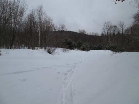
The logging landing at the corner of George Duncan State Forest
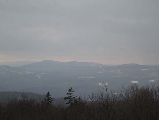
Looking at Ragged Mountain from Hersey Mountain
Directions to trailhead: From I-93 in New Hampton, take Route 104 West. Take a left onto Route 132. Shortly thereafter, take a right onto Old Bristol Road. Awhile down this road, take a left onto Carter Mountain Road. There will eventually be a Class IV road sign, with adjacent gate. In winter, there is limited plowed parking to the right of this gate, as well as further up the main road. One can continue down the road on foot, passing straight through snowmobile junction D. Shortly thereafter, there is a logging landing on the right (at the border of George Duncan State Forest). A quasi trail heads uphill on an increasingly faint logging road from this landing (ignore a chained road on the left at the lower landing).
Back to Hersey Mountain Profile
|

