Home
States
Colorado
Connecticut
Maine
Massachusetts
New Hampshire
New York
Rhode Island
Utah
Vermont
View All
Lists
NE 4,000 Footers
NE 100 Highest
NH 4,000 Footers
NH 100 Highest
NH 52 With A View
NH Belknap Range
NH Ossipee 10
Links
Trail Conditions
Trip Log
Sunrises
Sunsets
About
|
Kearsarge North Mountain
Bartlett, NH, Chatham, NH
Trailheads, measurements, times, distances, and maps are all approximate and relative to the hike(s) as shown below.

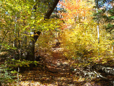
Heading up the Kearsarge North Trail
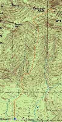
Route: Kearsarge North Trail
After a busy start to the weekend and a late arrival back from Massachusetts earlier in the morning, my energy was at a minimum. Not wanting to pass up a nice fall day, I decided to do a somewhat local hike - Kearsarge North Mountain.
Arriving at the parking area in the early afternoon, I was able to get a parking space thanks in part to the early risers already being done for the day.
The first part of the trail is pretty easy going - mostly level with a few short moderate sections as it meanders to the mountainside. Once the brook is visible from the trail, things change, as the trail quickly steepens up.
Once the first set of ledges is reached, things ease up and the views start to improve big time. I'm pretty confident that in this area there is a spur trail to Bartlett Mountain, however I couldn't figure out which herd path it is. Future hike, possibly.
After the passing the col, things steepen up again as the trail ascends the back side of the mountain. It's a bit rockier here and, due to the exposure, wetter.
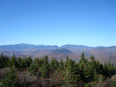
Soon, I was ascending the summit ledges - what a nice day it was! Quickly climbing the one flight of stairs to the fire tower deck, I could see for dozens of miles in all directions - and there was literally not a cloud to be seen. With upper 60 degree temperatures, I couldn't help but loiter around for awhile. Despite the day, the time of the season, and the peak that it is, the crowds weren't bad at all at the summit - in fact I had the tower to myself.
The descent was pleasant - the sun shining down as I descended down the ledges. Weezer's Blue album provided some entertainment once I made it to the lower woods.
As tired as I was, I'm glad I made it out - definitely a hike to remember.
| Hike Ratings |
|
Getting To Trailhead: |
Easy |
| Destination: |
Kearsarge North Mountain |
|
Length: |
Moderate |
|
Steepness: |
Difficult |
|
Navigation: |
Easy |
|
Views: |
Excellent |
|
Crowds: |
Minimal |
|
| Hike Stats |
|
Date Hiked: |
Sunday, October 21, 2007 |
| Hike Commenced: |
1:18 PM |
| Parking Elevation: |
685' |
| Destination: |
Kearsarge North Mountain |
| Ascent Commenced: |
1:18 PM |
| Summit Reached: |
2:45 PM |
| Time Elapsed: |
01:27 |
| Trailhead Elevation: |
685' |
| Summit Elevation: |
3,268' |
| Distance: |
3.1 miles |
| Vertical Gain: |
2,618' |
|
|
| Hike Ended: |
4:59 PM |
| Hike Time Elapsed: |
03:41 |
| Hike Distance: |
6.2 miles |
| Hike Vertical Gain: |
2,653' |
|

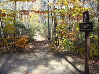
Kearsarge North Trail trailhead on Hurricane Mountain Road

Looking northwest at Mt. Washington, the Wildcats, and the Carters from Kearsarge North Mountain


Directions to trailhead: On Route 16 North, take a right after North Conway onto Hurricane Mountain Road. The trailhead and small parking lot will be up the road on the left (before the fork in the road).
Back to Kearsarge North Mountain Profile
|