Home
States
Colorado
Connecticut
Maine
Massachusetts
New Hampshire
New York
Rhode Island
Utah
Vermont
View All
Lists
NE 4,000 Footers
NE 100 Highest
NH 4,000 Footers
NH 100 Highest
NH 52 With A View
NH Belknap Range
NH Ossipee 10
Links
Trail Conditions
Trip Log
Sunrises
Sunsets
About
|
Kearsarge North Mountain
Bartlett, NH, Chatham, NH
Trailheads, measurements, times, distances, and maps are all approximate and relative to the hike(s) as shown below.
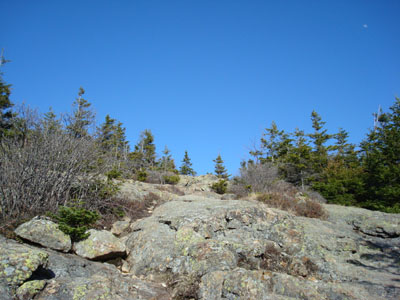
Looking up the Kearsarge North Trail near the summit
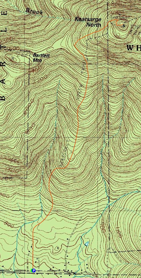
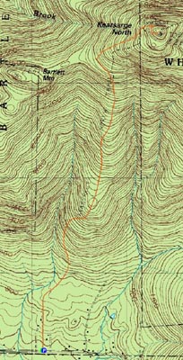
Route: Kearsarge North Trail
With a good weather forecast, I decided to head up to one of the best good-weather mountains - Kearsarge North.
While I wasn't the only one in the parking lot, I would soon pass three hikers heading downhill - thus, I had the rest of the ascent to myself.
Much of the trail was bare and dry. Down low the leaves and flowers were taking over. Up high, just after the trail reached around the back side of the mountain, there were patches of snow, 1-20" deep.
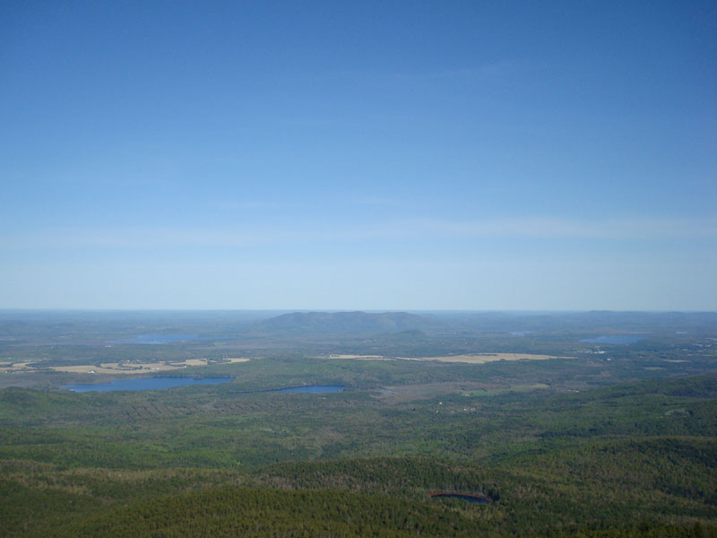
Once the trail wrapped back around to the front side of the mountain, it was summer again. Arriving at the tower, the views were tremendous - from the Ossipees to Pleasant Mountain to a still-partially-white Mt. Washington.
After sitting in the tower for a few minutes, I decided to call it a day. Another awesome day for views on Kearsarge North.
| Hike Ratings |
|
Getting To Trailhead: |
Easy |
| Destination: |
Kearsarge North Mountain |
|
Length: |
Moderate |
|
Steepness: |
Difficult |
|
Navigation: |
Easy |
|
Views: |
Excellent |
|
Crowds: |
Minimal |
|
| Hike Stats |
|
Date Hiked: |
Tuesday, May 13, 2008 |
| Hike Commenced: |
3:47 PM |
| Parking Elevation: |
685' |
| Destination: |
Kearsarge North Mountain |
| Ascent Commenced: |
3:47 PM |
| Summit Reached: |
5:14 PM |
| Time Elapsed: |
01:27 |
| Trailhead Elevation: |
685' |
| Summit Elevation: |
3,268' |
| Distance: |
3.1 miles |
| Vertical Gain: |
2,618' |
|
|
| Hike Ended: |
6:55 PM |
| Hike Time Elapsed: |
03:08 |
| Hike Distance: |
6.2 miles |
| Hike Vertical Gain: |
2,653' |
|
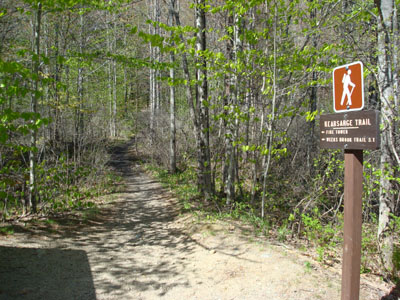
Kearsarge North Trail trailhead on Hurricane Mountain Road
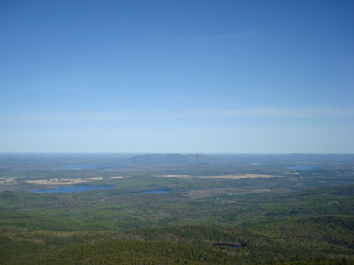
Looking at Pleasant Mountain from the Kearsarge North Mountain fire tower

Directions to trailhead: On Route 16 North, take a right after North Conway onto Hurricane Mountain Road. The trailhead and small parking lot will be up the road on the left (before the fork in the road).
Back to Kearsarge North Mountain Profile
|