Home
States
Colorado
Connecticut
Maine
Massachusetts
New Hampshire
New York
Rhode Island
Utah
Vermont
View All
Lists
NE 4,000 Footers
NE 100 Highest
NH 4,000 Footers
NH 100 Highest
NH 52 With A View
NH Belknap Range
NH Ossipee 10
Links
Trail Conditions
Trip Log
Sunrises
Sunsets
About
|
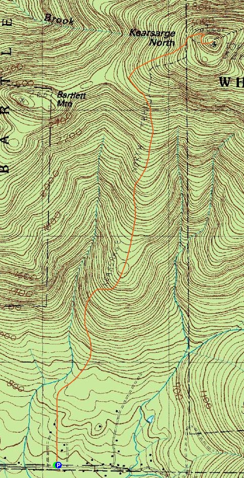
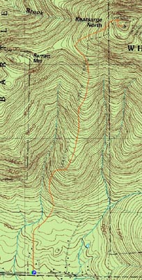
Kearsarge North Mountain
Bartlett, NH, Chatham, NH
Trailheads, measurements, times, distances, and maps are all approximate and relative to the hike(s) as shown below.
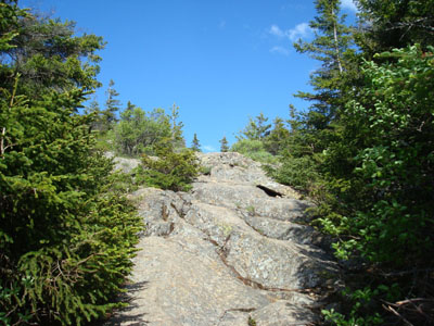
Looking up the Kearsarge North Trail near the summit
Route: Kearsarge North Trail
Even though the weather wasn't quite as good as I like it to be for hiking Kearsarge North, I nonetheless wanted to head up there again.
Arriving at an empty trailhead parking area, I signed in at the new log book (apparently there for a WMNF usage study) and was on my way. While the mosquitoes were pesky, they weren't nearly as bad as they had been in my recent southeastern Sandwich Range hikes.
The trail was fairly dry, though there was still plenty of runoff from the recent rain.
The views from the top, though strong, were not as great as usual, due to the cloud cover and slight haze. Nonetheless, the scenery was still tremendous.
I did not see a single hiker.
| Hike Ratings |
|
Getting To Trailhead: |
Easy |
| Destination: |
Kearsarge North Mountain |
|
Length: |
Moderate |
|
Steepness: |
Difficult |
|
Navigation: |
Easy |
|
Views: |
Excellent |
|
Crowds: |
Minimal |
|
| Hike Stats |
|
Date Hiked: |
Wednesday, June 11, 2008 |
| Hike Commenced: |
3:53 PM |
| Parking Elevation: |
685' |
| Destination: |
Kearsarge North Mountain |
| Ascent Commenced: |
3:53 PM |
| Summit Reached: |
5:07 PM |
| Time Elapsed: |
01:14 |
| Trailhead Elevation: |
685' |
| Summit Elevation: |
3,268' |
| Distance: |
3.1 miles |
| Vertical Gain: |
2,618' |
|
|
| Hike Ended: |
6:44 PM |
| Hike Time Elapsed: |
02:51 |
| Hike Distance: |
6.2 miles |
| Hike Vertical Gain: |
2,653' |
|
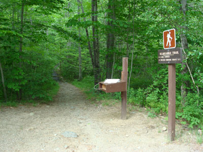
Kearsarge North Trail trailhead on Hurricane Mountain Road
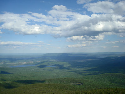
Looking at Pleasant Mountain from the Kearsarge North Mountain fire tower

Directions to trailhead: On Route 16 North, take a right after North Conway onto Hurricane Mountain Road. The trailhead and small parking lot will be up the road on the left (before the fork in the road).
Back to Kearsarge North Mountain Profile
|