Home
States
Colorado
Connecticut
Maine
Massachusetts
New Hampshire
New York
Rhode Island
Utah
Vermont
View All
Lists
NE 4,000 Footers
NE 100 Highest
NH 4,000 Footers
NH 100 Highest
NH 52 With A View
NH Belknap Range
NH Ossipee 10
Links
Trail Conditions
Trip Log
Sunrises
Sunsets
About
|
Kearsarge North Mountain, Bartlett Mountain
Bartlett, NH, Chatham, NH
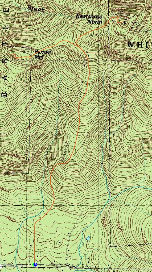
Trailheads, measurements, times, distances, and maps are all approximate and relative to the hike(s) as shown below.
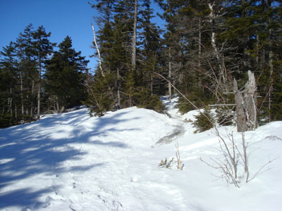
Looking down the Kearsarge North Trail near the summit
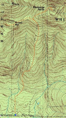
Route: Kearsarge North Trail, (Kearsarge North Mountain), Kearsarge North Trail, Bartlett Path, (Bartlett Mountain), Bartlett Path, Kearsarge North Trail
All is quiet on New Year's Day. Except the wind, of course. Apparently that didn't fit in well with Bono's rhyme, so perhaps that U2 song isn't completely relevant.
Arriving at the Kearsarge North Trail trailhead, the temperature was 4 degrees and the winds up high were howling. Seeing the trail was packed out well, I put on my Microspikes, stuck left my snowshoes on my pack for later use, and took off jogging up the flatter portion of the Kearsarge North Trail. As was the case in my previous ascent, the trail was littered with downed branches. After passing the lower ledges, things began to get much colder as the winds started to directly hit. Once at the summit, I quickly hurried into the cab and changed into some warmer attire - the ambient temperature outside had to be a few degrees below zero before including the rattling winds. Talking briefly to a few folks who had spent the night in the cab on my way up the trail, the overnight winds were so fierce that the tower was literally shaking and swaying. I guess the gist of this is that, while I wasn't the first person on Kearsarge North Mountain in 2009, I was the first to ascend it. I hope I get a prize.
While my original intent had been to do a bushwhack over to Bartlett Mountain after ascending Kearsarge North Mountain, I wasn't digging the brutal weather too much. Since I had been eyeing Bartlett Mountain for quite some time, I decided to hold on out making a decision until I reached the col.
At the col, the winds were much more reasonable and the temperature a bit warmer - thus I decided to put on my snowshoes and head over to Bartlett Mountain. Seeing some snowshoe prints roughly where I expected to start the bushwhack, I decided to follow. A few dozen feet later, I looked to my right and saw an old wooden sign with an arrow crudely carved into it. Vaguely recalling my 1934 AMC Guide, I started to wonder if I had stumbled upon the long gone Bartlett Path.
As I continued along the ridge following the tracks, I could see that there had been recent blowdown maintenance and axe blazing. In addition, I found a few faded painted blazes and another old sign or two (illegible). While much of the path seemed to be somewhat obvious, it did look like a few portions perhaps went through some spruce shrubs - I wonder how obvious it is in the summer? The path provided some interesting views along the way, including looks back at Kearsarge North Mountain.
After weaving over a few seemingly open areas, the trail soon reached some vast ledges just below the summit of Bartlett Mountain. Surprisingly, there were hoards of fairly fresh bootprints. The zigzag pattern of the trail these prints seemed to follow seems to remind me of the top access for the old CCC ski trail.
Following the prints uphill, I soon arrived at what seemed to me to be the highest point - and, as I rounded the corner, I found two signings - "Bartlett Mtn." and "Summit 2,661.'" Continuing past the summit, I arrived at another beautiful set of ledges - these providing great views of the Presidentials and surrounding peaks. Absolutely amazing, especially considering this peak isn't in the AMC Guide or on any hiking lists that I know of!
On the way back, I checked out (only a few dozen feet each) a few of the other tracks I had seen - by my estimation, there are perhaps four other trails in addition to the Bartlett Path segment I followed. Perhaps some future exploring will be necessary!
While it has quite a lot to live up to considering its neighbor, Bartlett Mountain features absolutely amazing views. This peak may become a fixture of most of my future trips to Kearsarge North Mountain.
| Hike Ratings |
|
Getting To Trailhead: |
Easy |
| Destination: |
Kearsarge North Mountain |
|
Length: |
Moderate |
|
Steepness: |
Difficult |
|
Navigation: |
Easy |
|
Views: |
Excellent |
|
Crowds: |
Minimal |
| Destination: |
Bartlett Mountain |
|
Length: |
Moderate |
|
Steepness: |
Difficult |
|
Navigation: |
Moderate |
|
Views: |
Excellent |
|
Crowds: |
Minimal |
|
| Hike Stats |
|
Date Hiked: |
Thursday, January 1, 2009 |
| Hike Commenced: |
8:30 AM |
| Parking Elevation: |
685' |
| Destination: |
Kearsarge North Mountain |
| Ascent Commenced: |
8:30 AM |
| Summit Reached: |
9:55 AM |
| Time Elapsed: |
01:25 |
| Trailhead Elevation: |
685' |
| Summit Elevation: |
3,268' |
| Distance: |
3.1 miles |
| Vertical Gain: |
2,618' |
| Destination: |
Bartlett Mountain |
| Ascent Commenced: |
10:10 AM |
| Summit Reached: |
11:03 AM |
| Time Elapsed: |
00:53 |
| Trailhead Elevation: |
3,268' |
| Summit Elevation: |
2,661' |
| Vertical Gain: |
241' |
|
|
| Hike Ended: |
1:19 PM |
| Hike Time Elapsed: |
04:49 |
| Hike Vertical Gain: |
3,064' |
|
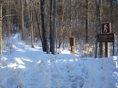
Kearsarge North Trail trailhead on Hurricane Mountain Road

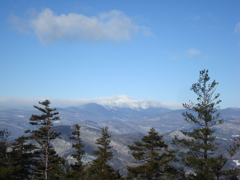
Looking at Mt. Washington from the Kearsarge North Mountain fire tower
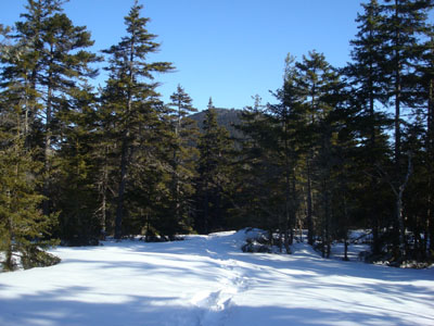
The Bartlett Path starts left, while the Kearsarge North Trail goes right
Looking down the Bartlett Path
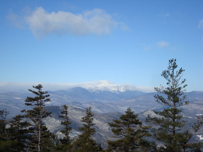
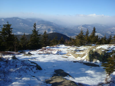
Looking at Mt. Washington from near the Bartlett Mountain summit

Directions to trailhead: On Route 16 North, take a right after North Conway onto Hurricane Mountain Road. The trailhead and small parking lot will be up the road on the left (before the fork in the road).
Back to Kearsarge North Mountain Profile
Back to Bartlett Mountain Profile
|