Home
States
Colorado
Connecticut
Maine
Massachusetts
New Hampshire
New York
Rhode Island
Utah
Vermont
View All
Lists
NE 4,000 Footers
NE 100 Highest
NH 4,000 Footers
NH 100 Highest
NH 52 With A View
NH Belknap Range
NH Ossipee 10
Links
Trail Conditions
Trip Log
Sunrises
Sunsets
About
|
Kings Hill
Sutton, NH
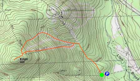
Trailheads, measurements, times, distances, and maps are all approximate and relative to the hike(s) as shown below.
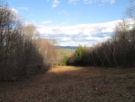
Looking down an abandoned ski trail
Route: Penacook Path, ski trails, bushwhack
Finally found a way to hike the former King Ridge ski area without trespassing. While the main lodge area of the old ski area is posted, large portions of it have been put into conservation and can be accessed from other roads.
The Penacook Path is essentially an old woods road that leads up to near where the original King Ridge triple chairlift started. Nice walk with brooks and stonewalls.
From the landing the road leads to, continued on ski trails, bearing left and crossing a brook (bridged) to where the triple chairlift was. Opted to ascend the (looking uphill) left ski trail, which is still being mowed. Came across three porcupine and three or four deer.
Two communications towers are located at the top of the old ski area, however the highpoint is beyond there. Some significant logging just over the stonewall (seems really nicely done though - mulched, no slash, relatively smooth walking). Highpoint seems to be in the woods to the south of the logging. Directional view roughly west from the logging. Very nice views of Kearsarge and Ragged from the ski trails.
| Hike Ratings |
|
Getting To Trailhead: |
Easy |
| Destination: |
Kings Hill |
|
Length: |
Moderate |
|
Steepness: |
Moderate |
|
Navigation: |
Moderate |
|
Views: |
Excellent |
|
Crowds: |
Minimal |
|
| Hike Stats |
|
Date Hiked: |
Friday, May 2, 2014 |
| Parking Elevation: |
920' |
| Destination: |
Kings Hill |
| Time Elapsed: |
00:38 |
| Trailhead Elevation: |
960' |
| Summit Elevation: |
1,930' |
| Vertical Gain: |
990' |
|
|
| Hike Time Elapsed: |
01:17 |
| Hike Vertical Gain: |
1,050' |
|
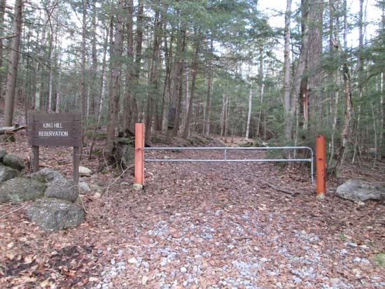
The Penacook Path trailhead
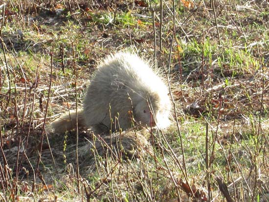
A porcupine on the old ski trail
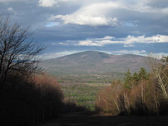
Looking at Mt. Kearsarge from near the top of the old ski area

Directions to trailhead: From Exit 11 of I-89, take Route 11 East, then take a right onto Hominy Pot Road. Take a right onto Penacook Road. Bear right to continue on King Hill Road. The Maple Leaf Natural Area parking lot will eventually be on the right. From there, continue on King Hill Road over a bridge. The King Hill Reservation entrance will be on the right.
Back to Kings Hill Profile
|

