Home
States
Colorado
Connecticut
Maine
Massachusetts
New Hampshire
New York
Rhode Island
Utah
Vermont
View All
Lists
NE 4,000 Footers
NE 100 Highest
NH 4,000 Footers
NH 100 Highest
NH 52 With A View
NH Belknap Range
NH Ossipee 10
Links
Trail Conditions
Trip Log
Sunrises
Sunsets
About
|
Kinsman Mountain (North Peak), Kinsman Mountain (South Peak)
Easton, NH, Lincoln, NH
Trailheads, measurements, times, distances, and maps are all approximate and relative to the hike(s) as shown below.
Looking up the new section of the Mt. Kinsman Trail
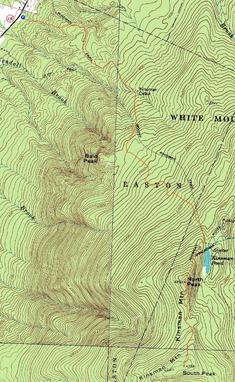
Route: Mt. Kinsman Trail, Kinsman Ridge Trail, (Kinsman Mountain North Peak), Kinsman Ridge Trail, (Kinsman Mountain South Peak), Kinsman Ridge Trail, (Kinsman Mountain North Peak), Kinsman Ridge Trail, Mt. Kinsman Trail
With another nice day forecasted, I decided to head out a few hours early and check out the new Mt. Kinsman Trail trailhead. Located just south of Tamarack Camp, the grassy parking area appears to provide room for many cars, depending upon how they are parked.
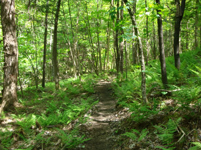
The new trail segment went from a mixed forest into a softwood forest, crossing a seasonal drainage as it worked its way to the old trail, meeting it just before the sugar house. Other than a few sappling stumps, the footing of the new trail segment was smooth.
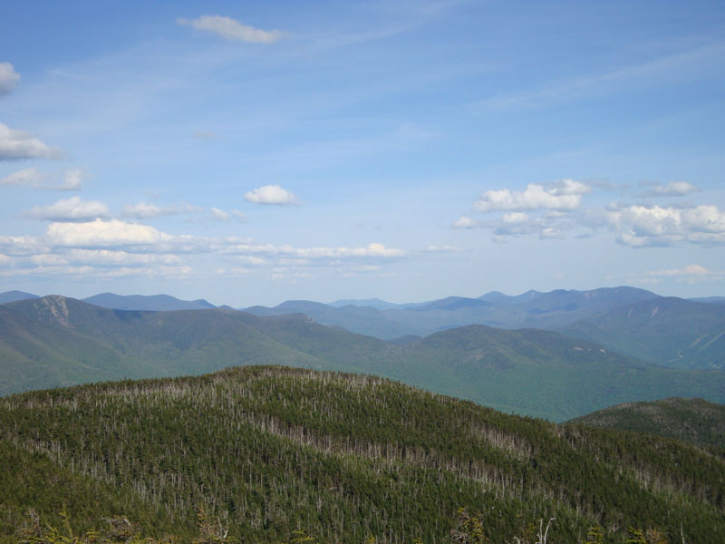
Not only was there no snow, but there were very few bugs to deal with as well. The views from the ledges on North Kinsman were quite good - it would have been a great day to be above treeline!
My next stop was the south peak. The short segment of trail seemed to drag on as I worked my way to the peak. The views from the south peak were also quite good.
While it was tempting to do some side trips on the way back, I wanted to be on the road prior to sunset, so I ended up skipping Bald Peak.
| Hike Ratings |
|
Getting To Trailhead: |
Easy |
| Destination: |
Kinsman Mountain (North Peak) |
|
Length: |
Moderate |
|
Steepness: |
Difficult |
|
Navigation: |
Easy |
|
Views: |
Excellent |
|
Crowds: |
Moderate |
| Destination: |
Kinsman Mountain (South Peak) |
|
Length: |
Moderate |
|
Steepness: |
Difficult |
|
Navigation: |
Easy |
|
Views: |
Excellent |
|
Crowds: |
Minimal |
|
| Hike Stats |
|
Date Hiked: |
Thursday, June 4, 2009 |
| Hike Commenced: |
2:34 PM |
| Parking Elevation: |
1,060' |
| Destination: |
Kinsman Mountain (North Peak) |
| Ascent Commenced: |
2:34 PM |
| Summit Reached: |
4:32 PM |
| Time Elapsed: |
01:58 |
| Trailhead Elevation: |
1,060' |
| Summit Elevation: |
4,293'' |
| Vertical Gain: |
3,263' |
| Destination: |
Kinsman Mountain (South Peak) |
| Ascent Commenced: |
4:50 PM |
| Summit Reached: |
5:16 PM |
| Time Elapsed: |
00:26 |
| Trailhead Elevation: |
4,293' |
| Summit Elevation: |
4,358' |
| Distance: |
.9 mile |
| Vertical Gain: |
373' |
|
|
| Hike Ended: |
7:39 PM |
| Hike Time Elapsed: |
05:05 |
| Hike Vertical Gain: |
3,994' |
|
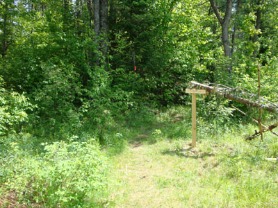
The new Mt. Kinsman Trail trailhead off Route 116
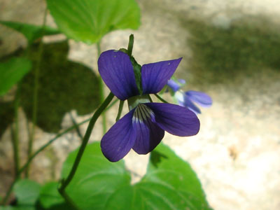
A violet on the Mt. Kinsman Trail
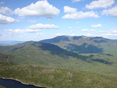
Cannon Mountain and the Franconia Ridge as seen from the ledge near the summit of Kinsman Mountain's North Peak
The Kinsman Ridge Trail between the peaks

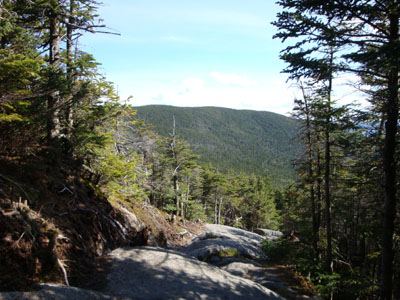
Looking toward Mt. Chocorua from near the summit of Kinsman Mountain's South Peak

Directions to trailhead: Take Route 112 West from Lincoln to Route 116 North. The short road to the Mt. Kinsman Trail trailhead and parking area will eventually be on the right, just before Tamarack Camp.
Back to Kinsman Mountain (North Peak) Profile
Back to Kinsman Mountain (South Peak) Profile
|