Home
States
Colorado
Connecticut
Maine
Massachusetts
New Hampshire
New York
Rhode Island
Utah
Vermont
View All
Lists
NE 4,000 Footers
NE 100 Highest
NH 4,000 Footers
NH 100 Highest
NH 52 With A View
NH Belknap Range
NH Ossipee 10
Links
Trail Conditions
Trip Log
Sunrises
Sunsets
About
|
Kinsman Mountain (North Peak), Kinsman Mountain (South Peak)
Easton, NH, Lincoln, NH
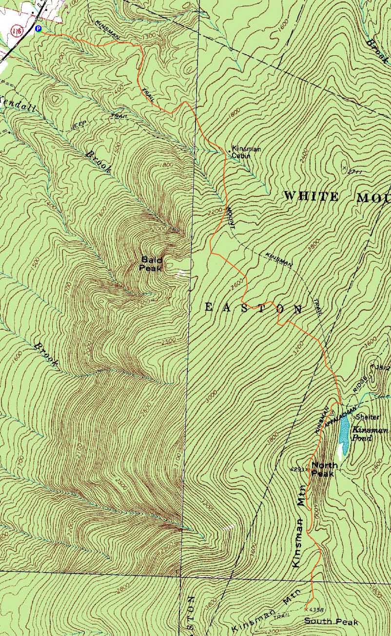
Trailheads, measurements, times, distances, and maps are all approximate and relative to the hike(s) as shown below.
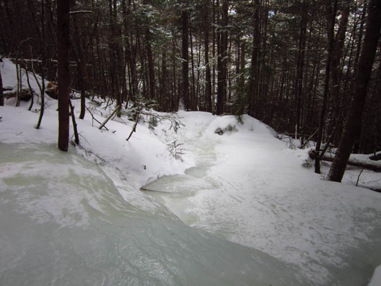
Ice on the Mt. Kinsman Trail
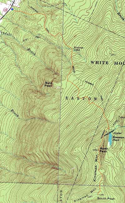
Route: Mt. Kinsman Trail, Kinsman Ridge Trail, (Kinsman Mountain North Peak), Kinsman Ridge Trail, (Kinsman Mountain South Peak), Kinsman Ridge Trail, (Kinsman Mountain North Peak), Kinsman Ridge Trail, Mt. Kinsman Trail
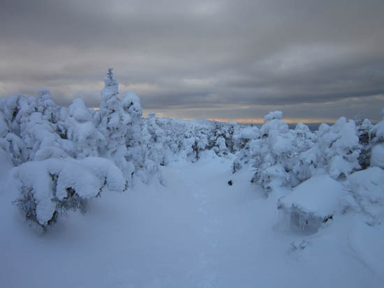
Almost a nice sunset from North Kinsman, but snow flurries moved in and obscured it.
| Hike Ratings |
|
Getting To Trailhead: |
Easy |
| Destination: |
Kinsman Mountain (North Peak) |
|
Length: |
Moderate |
|
Steepness: |
Difficult |
|
Navigation: |
Easy |
|
Views: |
Excellent |
|
Crowds: |
Minimal |
| Destination: |
Kinsman Mountain (South Peak) |
|
Length: |
Moderate |
|
Steepness: |
Difficult |
|
Navigation: |
Easy |
|
Views: |
Excellent |
|
Crowds: |
Minimal |
|
| Hike Stats |
|
Date Hiked: |
Friday, February 17, 2012 |
| Parking Elevation: |
1,060' |
| Destination: |
Kinsman Mountain (North Peak) |
| Time Elapsed: |
01:59 |
| Trailhead Elevation: |
1,060' |
| Summit Elevation: |
4,293' |
| Vertical Gain: |
3,263' |
| Destination: |
Kinsman Mountain (South Peak) |
| Time Elapsed: |
00:24 |
| Trailhead Elevation: |
4,293' |
| Summit Elevation: |
4,358' |
| Distance: |
.9 mile |
| Vertical Gain: |
373' |
|
|
| Hike Time Elapsed: |
04:33 |
| Hike Vertical Gain: |
3,994' |
|
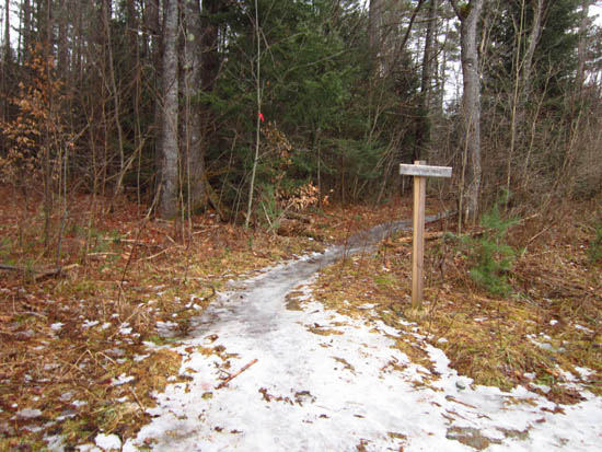
The Mt. Kinsman Trail trailhead off Route 116
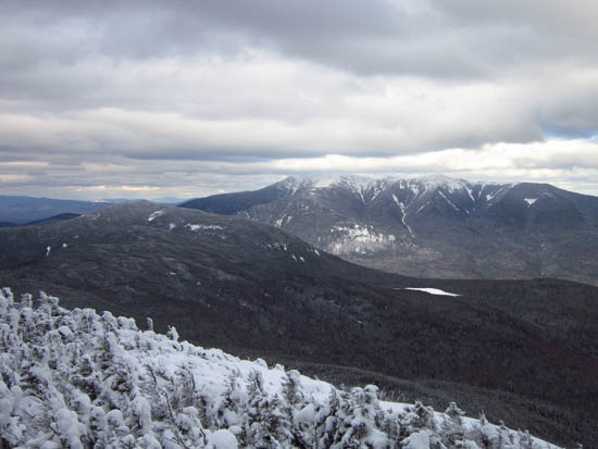
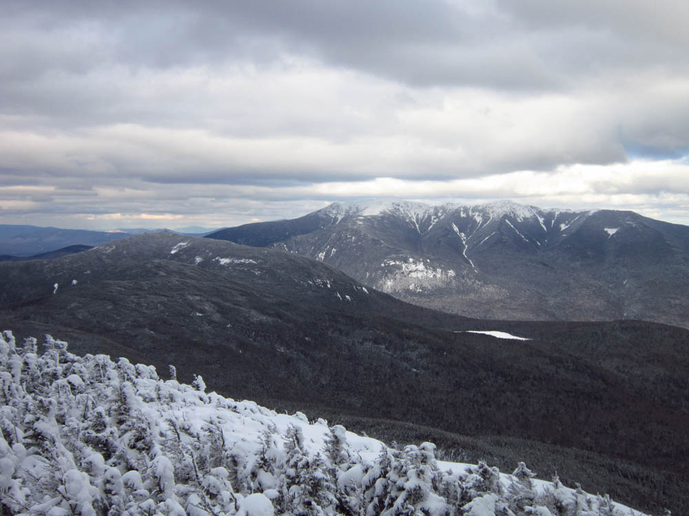
Looking at Kinsman Pond and the Franconia Ridge from the North Kinsman view ledge
The Kinsman Ridge Trail between the peaks

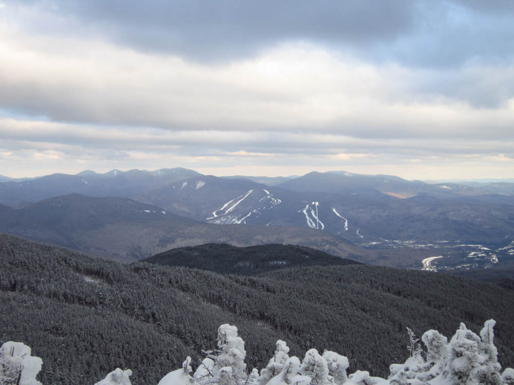
Loon Mountain as seen from South Kinsman

Directions to trailhead: Take Route 112 West from Lincoln to Route 116 North. The short road to the Mt. Kinsman Trail trailhead and parking area will eventually be on the right, just before Tamarack Camp.
Back to Kinsman Mountain (North Peak) Profile
Back to Kinsman Mountain (South Peak) Profile
|