Home
States
Colorado
Connecticut
Maine
Massachusetts
New Hampshire
New York
Rhode Island
Utah
Vermont
View All
Lists
NE 4,000 Footers
NE 100 Highest
NH 4,000 Footers
NH 100 Highest
NH 52 With A View
NH Belknap Range
NH Ossipee 10
Links
Trail Conditions
Trip Log
Sunrises
Sunsets
About
|
Kinsman Mountain (North Peak), Kinsman Mountain (South Peak)
Lincoln, NH, Franconia, NH
Trailheads, measurements, times, distances, and maps are all approximate and relative to the hike(s) as shown below.

The heavily eroded Lonesome Lake Trail
Route: Lonesome Lake Trail, Cascade Brook Trail, Fishin' Jimmy Trail, Kinsman Ridge Trail, (North Kinsman), Kinsman Ridge Trail, (South Kinsman), Kinsman Ridge Trail, (North Kinsman Trail), Kinsman Ridge Trail, Fishin' Jimmy Trail, Cascade Brook Trail, Lonesome Lake Trail
Lonesome Lake Trail was generally dry with some minor mud. First time up without snow since the major trail work was done. Many new steps and efforts to stop trail creep. A significant portion of the trail is still very rough and eroded, however.
Cascade Brook Trail was a little mucky and has some badly worn bog bridging. With all of the traffic on this short stretch, it may be time to use the Acadia design and have bumpouts (e.g. 3-4 boards wide) every so often so that hikers can pass each other without stepping off the bog bridging.
Fishin' Jimmy had some areas of mud and wet ledge. One of the wood steps pinned to the ledge is no longer there, making passage a bit more difficult. Noted some additional rock steps added since the last time I did this without snow.
Kinsman Ridge Trail above the Mt. Kinsman Trail junction to North Kinsman is a disaster with lots of trail creep and erosion as the ledge scrambles. Time to put in some ladders, rungs, and/or steps. Ditto some areas between the peaks.
Refreshingly nice weather today in the midst of this wet, hot summer. Despite being a weekday afternoon/evening, the trails were very busy. Must have seen between 100 and 200 hikers.
| Hike Ratings |
|
Getting To Trailhead: |
Easy |
| Destination: |
Kinsman Mountain (North Peak) |
|
Length: |
Moderate |
|
Steepness: |
Difficult |
|
Navigation: |
Easy |
|
Views: |
Excellent |
|
Crowds: |
Heavy |
| Destination: |
Kinsman Mountain (South Peak) |
|
Length: |
Moderate |
|
Steepness: |
Difficult |
|
Navigation: |
Easy |
|
Views: |
Excellent |
|
Crowds: |
Heavy |
|
| Hike Stats |
|
Date Hiked: |
Friday, August 10, 2018 |
| Parking Elevation: |
1,770' |
| Destination: |
Kinsman Mountain (North Peak) |
| Time Elapsed: |
01:39 |
| Trailhead Elevation: |
1,780' |
| Summit Elevation: |
4,293' |
| Vertical Gain: |
2,708' |
| Destination: |
Kinsman Mountain (South Peak) |
| Time Elapsed: |
00:22 |
| Trailhead Elevation: |
4,293' |
| Summit Elevation: |
4,358' |
| Distance: |
.9 mile |
| Vertical Gain: |
373' |
|
|
| Hike Time Elapsed: |
04:27 |
| Hike Vertical Gain: |
3,664' |
|
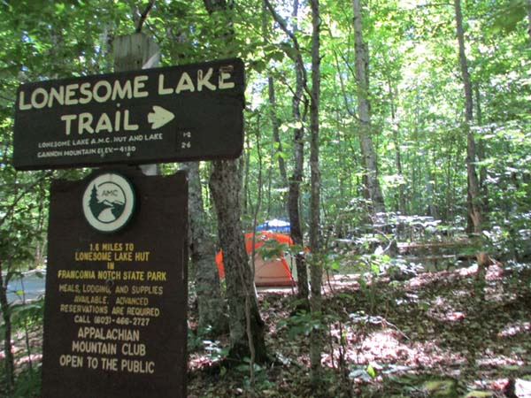
The Lonesome Lake Trail trailhead in the Lafayette Place campground
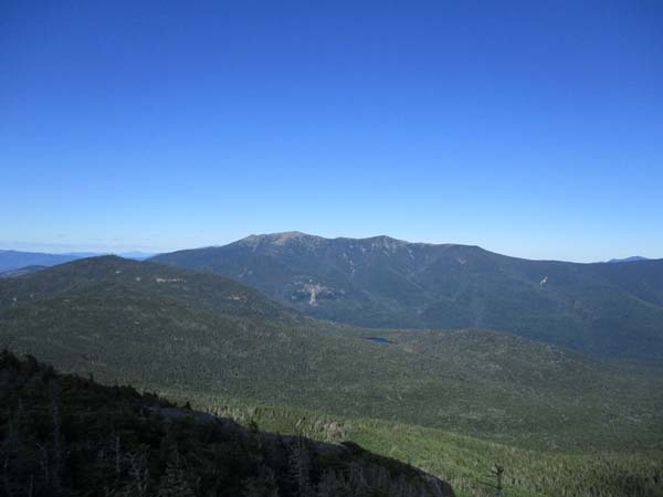
Cannon Mountain and the Franconia Ridge as seen from the North Kinsman vista
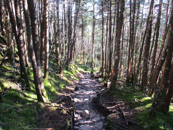
The Kinsman Ridge Trail between the Kinsmans

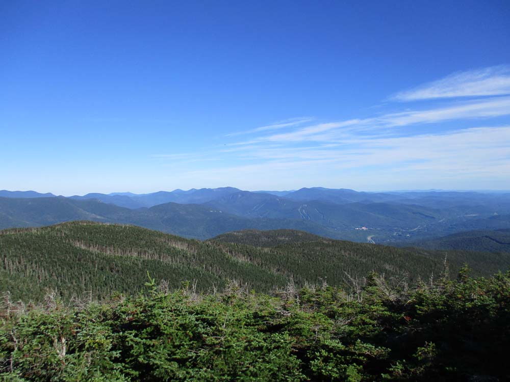
Lincoln and points south as seen from South Kinsman
Directions to trailhead: Take I-93 to the Lafayette Place exit. One walk across the campground to the Lonesome Lake Trail trailhead, which is just beyond the (seasonally closed) restroom building.
Back to Kinsman Mountain (North Peak) Profile
Back to Kinsman Mountain (South Peak) Profile
|