Home
States
Colorado
Connecticut
Maine
Massachusetts
New Hampshire
New York
Rhode Island
Utah
Vermont
View All
Lists
NE 4,000 Footers
NE 100 Highest
NH 4,000 Footers
NH 100 Highest
NH 52 With A View
NH Belknap Range
NH Ossipee 10
Links
Trail Conditions
Trip Log
Sunrises
Sunsets
About
|
Kinsman Mountain (North Peak), Kinsman Mountain (South Peak)
Easton, NH, Lincoln, NH
Trailheads, measurements, times, distances, and maps are all approximate and relative to the hike(s) as shown below.
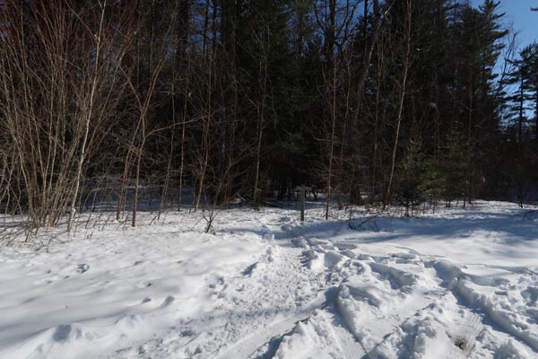
The Kinsman Ridge Trail on the way to North Kinsman
Route: Mt. Kinsman Trail, Kinsman Ridge Trail, (Kinsman Mountain North Peak), Kinsman Ridge Trail, (Kinsman Mountain South Peak), Kinsman Ridge Trail, (Kinsman Mountain North Peak), Kinsman Ridge Trail, Mt. Kinsman Trail
Snowshoes roundtrip with full snowpack.
The initial trail (relo) from the parking lot to the sugar house has full snow cover, but I suspect the upcoming warm weather will zap significant portions of this stretch. Snowpack increases gradually thereafter, reaching multiple feet deep by the first water crossing. Trail was decently packed out to the Bald Peak junction and firm granular this evening, but looked like it could get soft pretty quickly as the warm weather arrives. Most recent users had been snowshoers, thankfully.
Unfortunately, above the Bald Peak junction, the only usage of the last few days was a single parasitic postholer. A few inches of powder/drifted powder on top of a previously packed powder snowshoe track. Countless divets and postholes. I was able to repair a lot of this damage with my snowshoes, but there are still a few nasty postholes. The snowpack is deep, so heading up here without snowshoes in the coming days will be a foolhardy endeavor.
The trail sign at the junction with the Kinsman Ridge Trail was partially buried. The Kinsman Ridge Trail to the summit was fairly well packed out. The snowpack is deep enough that the usual ice bulge/scramble areas are fully filled in with snow and currently easy to get past.
Trail is not as consolidated between the peaks. Many feet of snow, as the average blaze is about 2 inches about the snowpack. One part of the current packed route near the col deviates from the trail, over a drift on top of spruce trees. If you posthole here in the warm weather, you may go in up to your neck, literally.
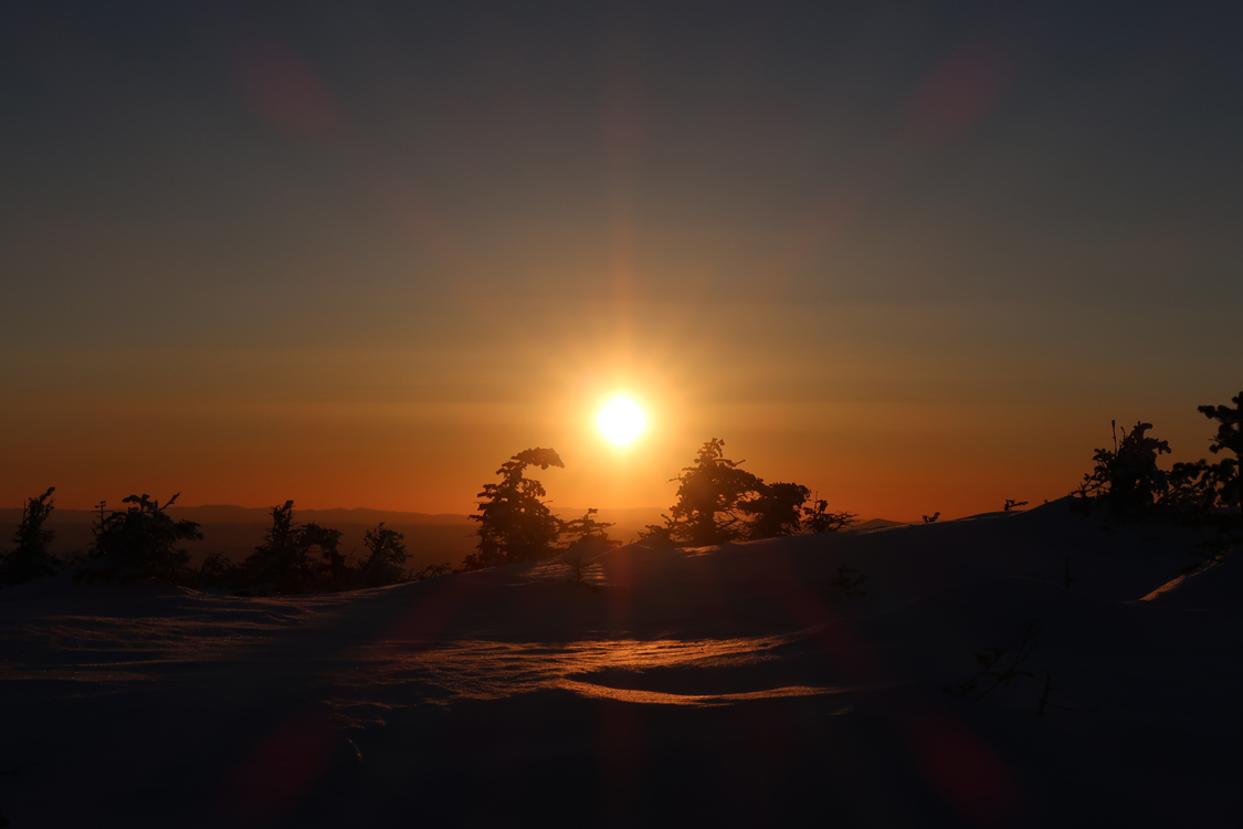
Nice sunset on the ridge, as the wind died down just in time. Great views from the added snowpack.
| Hike Ratings |
|
Getting To Trailhead: |
Easy |
| Destination: |
Kinsman Mountain (North Peak) |
|
Length: |
Moderate |
|
Steepness: |
Difficult |
|
Navigation: |
Easy |
|
Views: |
Excellent |
|
Crowds: |
Minimal |
| Destination: |
Kinsman Mountain (South Peak) |
|
Length: |
Moderate |
|
Steepness: |
Difficult |
|
Navigation: |
Moderate |
|
Views: |
Excellent |
|
Crowds: |
Minimal |
|
| Hike Stats |
|
Date Hiked: |
Tuesday, March 26, 2019 |
| Parking Elevation: |
1,060' |
| Destination: |
Kinsman Mountain (North Peak) |
| Time Elapsed: |
02:03 |
| Trailhead Elevation: |
1,060' |
| Summit Elevation: |
4,293' |
| Vertical Gain: |
3,263' |
| Destination: |
Kinsman Mountain (South Peak) |
| Time Elapsed: |
00:26 |
| Trailhead Elevation: |
4,293' |
| Summit Elevation: |
4,358' |
| Distance: |
.9 mile |
| Vertical Gain: |
373' |
|
|
| Hike Time Elapsed: |
04:23 |
| Hike Vertical Gain: |
3,994' |
|
The Mt. Kinsman Trail trailhead off Route 116
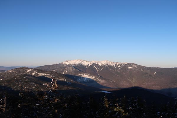
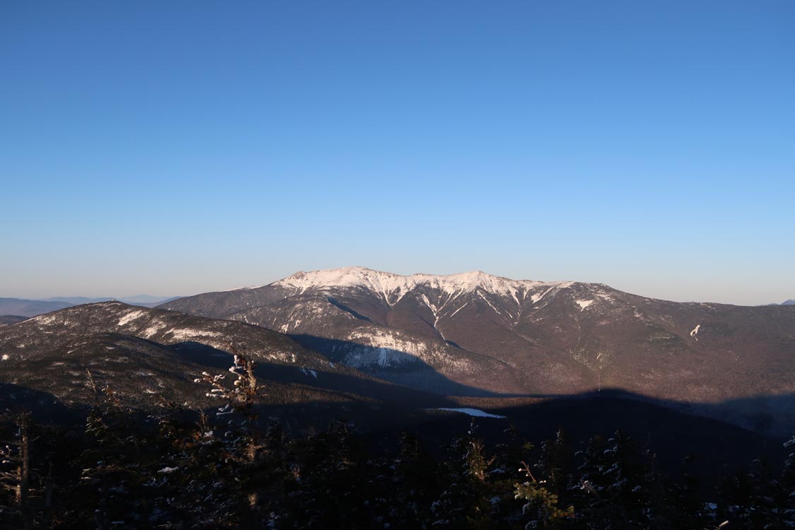
Looking at Franconia Ridge from the North Kinsman view ledge
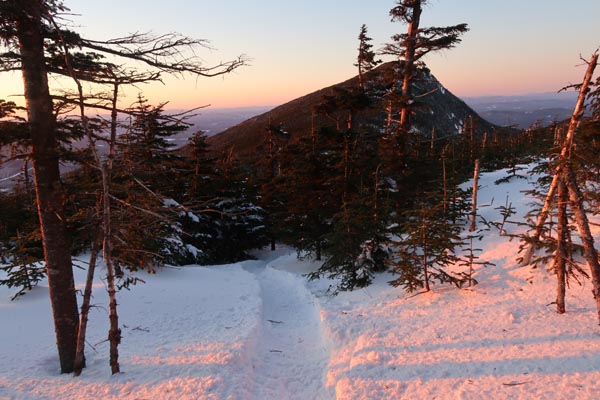
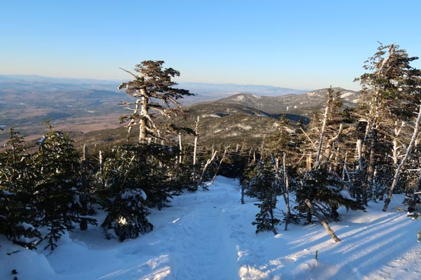
The Kinsman Ridge Trail between the peaks

The sunset as seen from South Kinsman
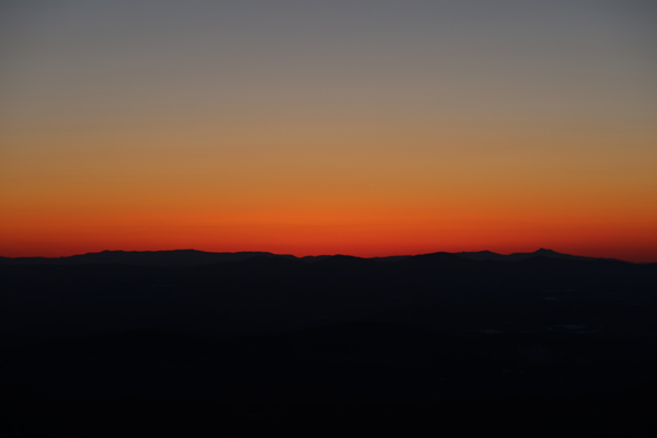
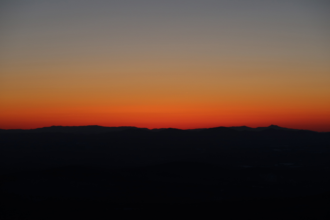
Sunset colors as seen from North Kinsman
Directions to trailhead: Take Route 112 West from Lincoln to Route 116 North. The short road to the Mt. Kinsman Trail trailhead and parking area will eventually be on the right, just before Tamarack Camp.
Back to Kinsman Mountain (North Peak) Profile
Back to Kinsman Mountain (South Peak) Profile
|