Home
States
Colorado
Connecticut
Maine
Massachusetts
New Hampshire
New York
Rhode Island
Utah
Vermont
View All
Lists
NE 4,000 Footers
NE 100 Highest
NH 4,000 Footers
NH 100 Highest
NH 52 With A View
NH Belknap Range
NH Ossipee 10
Links
Trail Conditions
Trip Log
Sunrises
Sunsets
About
|
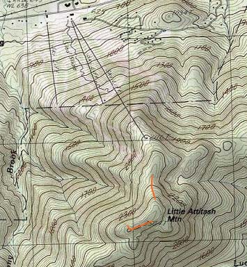
Little Attitash Mountain
Bartlett, NH
Trailheads, measurements, times, distances, and maps are all approximate and relative to the hike(s) as shown below.
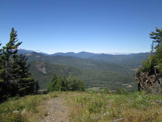
Looking down the ski trails
Route: Ski trails, unnamed trail, bushwhack, unnamed trail, (Little Attitash Mountain)
Ski trails were generally dry. Ascended via a work road at looker's left to the top of the summit chairlift and descended skier's left (not as good of an option due to growth on slopes, as well as steeps and traprock, though there are some quasi-hidden fourwheeler switchbacks to the left). Some rough walking in places (not as smooth as Wildcat/Waterville, but still much better than the mess at Cannon).
From the top of the summit triple, a herd path enters the woods to the right of the ski patrol shack, just to the right of a pile of decking that is used for summer time triple chairlift ops (that lift is closed for maintenance this off season). The path is a little vague as it descends briefly to the col (some stepover blowdowns), but generally easy to follow as far as herd paths go up to a set of ledges. Occasional old red blazes.
As noted in recent conditions reports, the herd path peters out at the ledges, about a quarter of a mile walk from the ski area. I did see a blaze in the woods heading east, but no visible path remaining. If it indeed was the trail, I suspect it may circle around to some eastern ledges, then rejoin the ridge before the summit.
From the ledges were the path petered out, I bushwhacked south along the ridge, eventually reaching ledges looking at North Moat and North Conway. Somewhere in this vicinity I also picked up traces of what I believe to be the long abandoned Humphreys Ledge Trail, with occasional cairns (plenty of rogue ones as well) and evidence of old brushing. The recognized highpoint is on the middle peak as displayed on the 7.5 minute USGS topo, a neat boxy crag. Also noted some old wire on the immediate backside of this block, perhaps from the old fire lookout (never saw any concrete footings).
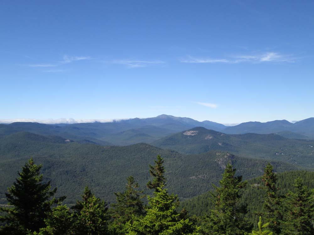
From the highpoint, I continued west briefly to more ledges with looks at Carrigain and surrounding peaks. From there, I bushwhacked briefly north to another small crag, which had really nice views of Mt. Washington and Carter Notch.
| Hike Ratings |
|
Getting To Trailhead: |
Moderate |
| Destination: |
Little Attitash Mountain |
|
Length: |
Moderate |
|
Steepness: |
Difficult |
|
Navigation: |
Difficult |
|
Views: |
Excellent |
|
Crowds: |
Heavy |
|
| Hike Stats |
|
Date Hiked: |
Sunday, September 14, 2014 |
| Parking Elevation: |
625' |
| Destination: |
Little Attitash Mountain |
| Time Elapsed: |
01:22 |
| Trailhead Elevation: |
625' |
| Summit Elevation: |
2,518' |
| Vertical Gain: |
1,993' |
|
|
| Hike Time Elapsed: |
03:23 |
| Hike Vertical Gain: |
2,193' |
|
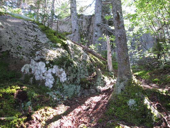
The old trail above the ski area

Looking at Mt. Washington from one of the Little Attitash ledges

Directions to trailhead: Attitash Mountain Resort is located off US 302, east of Bartlett.
Back to Little Attitash Mountain Profile
|