Home
States
Colorado
Connecticut
Maine
Massachusetts
New Hampshire
New York
Rhode Island
Utah
Vermont
View All
Lists
NE 4,000 Footers
NE 100 Highest
NH 4,000 Footers
NH 100 Highest
NH 52 With A View
NH Belknap Range
NH Ossipee 10
Links
Trail Conditions
Trip Log
Sunrises
Sunsets
About
|
Little Ball Mountain, Big Ball Mountain
Tuftonboro, NH
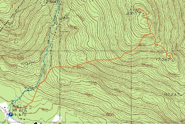
Trailheads, measurements, times, distances, and maps are all approximate and relative to the hike(s) as shown below.
Looking down the Banana Trail at Little Ball Mountain
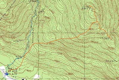
Route: Mt. Shaw Trail, Tate Mountain Trail, Banana Trail, herd path, (Little Ball Mountain), herd path, Banana Trail, (Big Ball Mountain), Banana Trail, Tate Mountain Trail, Mt. Shaw Trail
By the looks of the forecasts, Tuesday seemed like the best possibility for a sunset hike, with clearing skies. Unfortunately, after plans were made, the clouds seemed to straddle the Sandwich Range, thus leaving the Ossipees in the dark. Nonetheless, we decided to take our chances anyways and were soon on our way up the Mt. Shaw Trail.
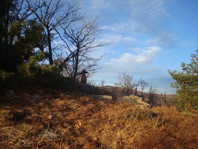
Though there had been a lot of thawing in the warmth a day earlier, there was still a decent amount of ice on the Mt. Shaw Trail and the beginning of the Tate Mountain Trail. Beyond that, however, there were only small patches.
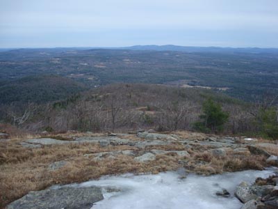
Arriving at the Banana Trail with time to spare, we headed down to Little Ball Mountain. As we made our way down the trail, blue sky opened up overhead, giving us some welcome sunshine. The views from Little Ball Mountain were rather good in all directions.
Back on the Banana Trail, we could see clouds were starting to approach from the west - not particularly a good thing for a sunset hike. Reaching the tricky steep dip into the col between the Big Ball Mountain peaks, we decided to do a bushwhack around them, rather than put on ice equipment for all of 10-15 feet of trail. While it took some traversing to get around thicker spruce and the cliffs, we found a relatively easy way and were soon at the summit of Big Ball Mountain.
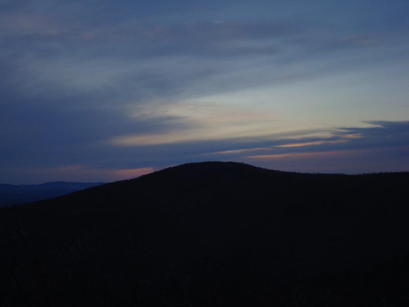
While the views from Big Ball were good, it was pretty obvious that the clouds were going to prevent any sort of display of colors. While we had a very minimal amount of color to the northwest, we were basically staring at overcast most of the time.
For the descent, all took slightly different yet successful routes up the steep, icy scramble. Beyond that, we were able to make it most of the way down the Banana and Tate Mountain Trails prior to turning on our headlamps. The various blinking lights around the lake, as well as some of the night skiing lights at Gunstock, made for some neat scenery.
While there wasn't a sunset per se, it was still another nice hike to Big Ball Mountain.
| Hike Ratings |
|
Getting To Trailhead: |
Easy |
| Destination: |
Little Ball Mountain |
|
Length: |
Moderate |
|
Steepness: |
Difficult |
|
Navigation: |
Moderate |
|
Views: |
Excellent |
|
Crowds: |
Minimal |
| Destination: |
Big Ball Mountain |
|
Length: |
Moderate |
|
Steepness: |
Difficult |
|
Navigation: |
Moderate |
|
Views: |
Excellent |
|
Crowds: |
Minimal |
|
| Hike Stats |
|
Date Hiked: |
Tuesday, December 16, 2008 |
| Hike Commenced: |
2:09 PM |
| Parking Elevation: |
670' |
| Destination: |
Little Ball Mountain |
| Ascent Commenced: |
2:09 PM |
| Summit Reached: |
3:19 PM |
| Time Elapsed: |
01:10 |
| Trailhead Elevation: |
675' |
| Summit Elevation: |
1,710' |
| Vertical Gain: |
1,310' |
| Destination: |
Big Ball Mountain |
| Ascent Commenced: |
3:26 PM |
| Summit Reached: |
3:53 PM |
| Time Elapsed: |
00:27 |
| Trailhead Elevation: |
1,710' |
| Summit Elevation: |
2,060' |
| Vertical Gain: |
420' |
|
|
| Hike Ended: |
5:25 PM |
| Hike Time Elapsed: |
03:16 |
| Hike Vertical Gain: |
1,810' |
|
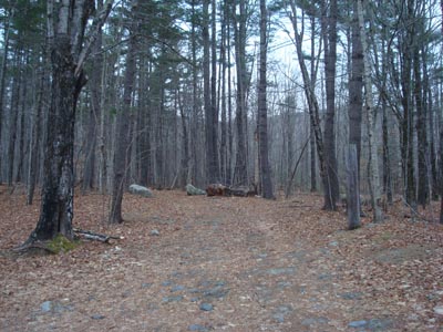
The Mt. Shaw Trail trailhead
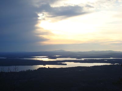
Looking at Kearsarge Mountain from Little Ball Mountain
Looking the herd path from Little Ball Mountain to the Banana Trail on the way to Big Ball Mountain
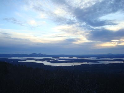
Looking at the Belknaps from the summit of Big Ball Mountain
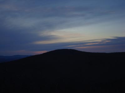
Slight sunset colors over Turtleback Mountain as seen from Big Ball Mountain

Directions to trailhead: Take 171 southeast from Route 25, past Castle in the Clouds. Shortly after crossing the Tuftonboro town line, there is a bridge/brook crossing. Immediately after this, there is an informal parking lot on the left (maybe 4 cars). The unmarked trail starts at the back of this lot.
Back to Little Ball Mountain Profile
Back to Big Ball Mountain Profile
|