Home
States
Colorado
Connecticut
Maine
Massachusetts
New Hampshire
New York
Rhode Island
Utah
Vermont
View All
Lists
NE 4,000 Footers
NE 100 Highest
NH 4,000 Footers
NH 100 Highest
NH 52 With A View
NH Belknap Range
NH Ossipee 10
Links
Trail Conditions
Trip Log
Sunrises
Sunsets
About
|
Little Haystack Mountain, Mt. Lincoln, Mt. Truman, Mt. Lafayette
Franconia, NH, Lincoln, NH
Trailheads, measurements, times, distances, and maps are all approximate and relative to the hike(s) as shown below.
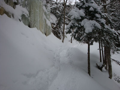
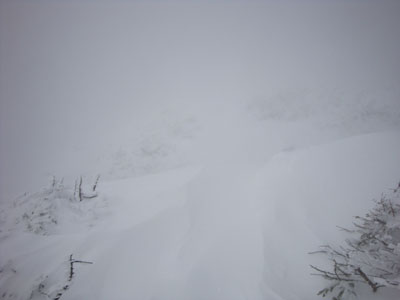
Looking up the Falling Waters Trail
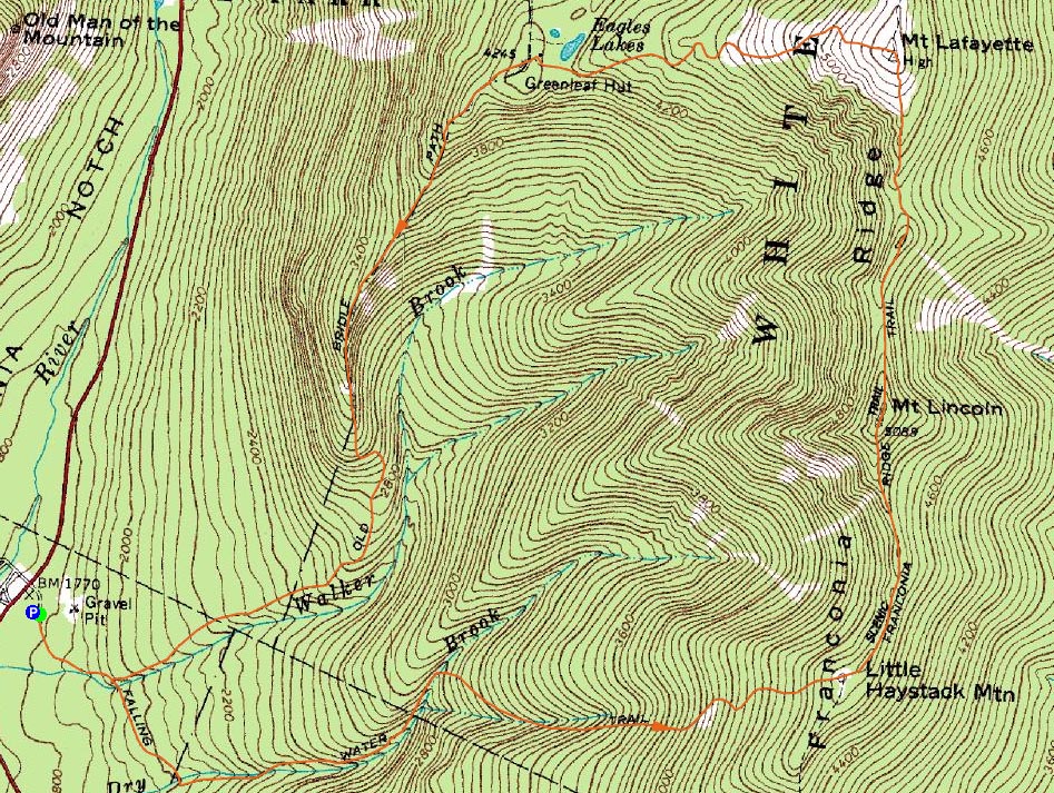
Route: Old Bridle Path, Falling Waters Trail, (Little Haystack Mountain), Franconia Ridge Trail, (Mt. Lincoln), Franconia Ridge Trail, (Mt. Truman), Franconia Ridge Trail, (Mt. Lafayette), Greenleaf Trail, Old Bridle Path
Throughout much of the week, the forecast looked fairly decent for this day. One day out, however, things didn't look quite as favorable. Nonetheless, we decided to give the Franconia Ridge a go. I personally was a bit concerned about my injured foot, however an ever-evolving taping technique seemed to minimize the pain for this hike.
Arriving at a somewhat empty Lafayette Place parking area, we geared up and headed out on the Falling Waters Trail. Fortunately, the trail had seen a little bit of traffic since the previous snowstorm, thus making it fairly good going. With the water crossings snowbridged and the rocky portions of the trail covered, things were much smoother than in the summer. The frozen waterfalls were particularly neat to see.
Just prior to the treeline, we stopped and geared up. Emerging from the trees, we knew we were going to be in for a somewhat rough ridge traverse, should we decide to continue.
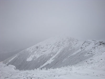
Other than brief glimpses toward Liberty, Flume, Cannon, and Owl's Head near Little Haystack, there wasn't much to see. Just after Little Haystack as well as just before Mt. Lincoln, we encounted some bitter wind gusts, hurling snow in our faces. Though things didn't look to be getting much better in the distance, we decided on Lincoln to push onward and upward. While things were harsh leading up to and beyond Mt. Truman, perhaps the worst wind was around Mt. Lafayette. The nearer we came to the summit, the less visibility we head. Though some folks had snowshoed in the opposite direction minutes earlier, there was no sign of their tracks - without previous knowledge of the trail, it would have been a tough trek.
The worst winds of the day were just beyond Mt. Lafayette - as we started to descend the Greenleaf Trail, the wind was directly in our faces, hurling snow and limiting visibility. This continued for a bit, before we dropped a few hundred vertical feet - suddenly, some clouds lifted and we had some nice views and sunshine.
Finally at the hut after traversing the vague, snowcovered slopes above treeline, we had some lunch and regrouped a bit. Beyond the hut, the Old Bridle Path was a fairly tame, sunny, and much less windy stroll. Nonetheless, we were very grateful to see the bridge marking the Falling Waters Trail junction - only minutes away from hopping into a vehicle and cranking the heat!
| Hike Ratings |
|
Getting To Trailhead: |
Easy |
| Destination: |
Little Haystack Mountain |
|
Length: |
Moderate |
|
Steepness: |
Difficult |
|
Navigation: |
Easy |
|
Views: |
Moderate (due to weather) |
|
Crowds: |
Minimal |
| Destination: |
Mt. Lincoln |
|
Length: |
Moderate |
|
Steepness: |
Difficult |
|
Navigation: |
Moderate |
|
Views: |
Minimal (due to weather) |
|
Crowds: |
Minimal |
| Destination: |
Mt. Truman |
|
Length: |
Difficult |
|
Steepness: |
Moderate |
|
Navigation: |
Moderate |
|
Views: |
Minimal (due to weather) |
|
Crowds: |
Moderate |
| Destination: |
Mt. Lafayette |
|
Length: |
Difficult |
|
Steepness: |
Moderate |
|
Navigation: |
Difficult |
|
Views: |
Minimal (due to weather) |
|
Crowds: |
Minimal |
|
| Hike Stats |
|
Date Hiked: |
Saturday, January 31, 2009 |
| Hike Commenced: |
9:34 AM |
| Parking Elevation: |
1,770' |
| Destination: |
Little Haystack Mountain |
| Ascent Commenced: |
9:36 AM |
| Summit Reached: |
12:18 PM |
| Time Elapsed: |
02:42 |
| Trailhead Elevation: |
1,785' |
| Summit Elevation: |
4,780' |
| Vertical Gain: |
3,195' |
| Destination: |
Mt. Lincoln |
| Ascent Commenced: |
12:18 PM |
| Summit Reached: |
12:46 PM |
| Time Elapsed: |
00:28 |
| Trailhead Elevation: |
4,780' |
| Summit Elevation: |
5,089' |
| Vertical Gain: |
469' |
| Destination: |
Mt. Truman |
| Ascent Commenced: |
12:51 PM |
| Summit Reached: |
1:07 PM |
| Time Elapsed: |
00:16 |
| Trailhead Elevation: |
5,089' |
| Summit Elevation: |
5,000' |
| Vertical Gain: |
130' |
| Destination: |
Mt. Lafayette |
| Ascent Commenced: |
1:07 PM |
| Summit Reached: |
1:27 PM |
| Time Elapsed: |
00:20 |
| Trailhead Elevation: |
5,000' |
| Summit Elevation: |
5,260' |
| Vertical Gain: |
380' |
|
|
| Hike Ended: |
3:49 PM |
| Hike Time Elapsed: |
06:15 |
| Hike Distance: |
9 miles |
| Hike Vertical Gain: |
4,354' |
|
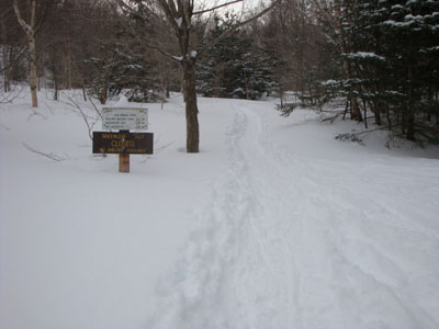
Old Bridle Path trailhead
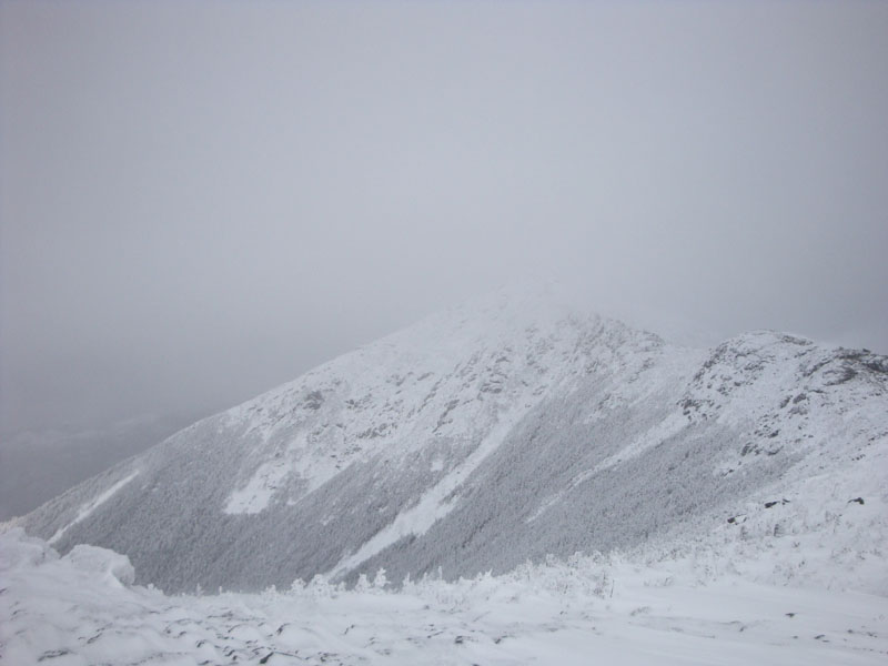
Looking toward Mt. Lincoln from near the summit of Little Haystack Mountain
The Franconia Ridge Trail on the way to Mt. Lincoln

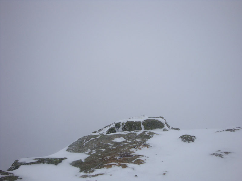
Lack of views on Mt. Lincoln

The Franconia Ridge Trail on the way to Mt. Truman

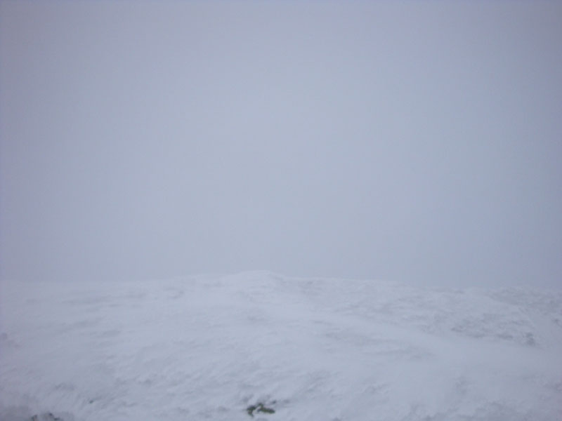
Lack of views from the Mt. Truman summit
Looking up the Franconia Ridge Trail near Mt. Lafayette
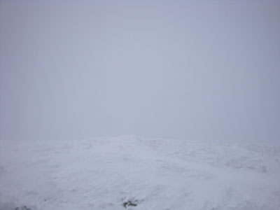
Lack of views from the Mt. Lafayette summit
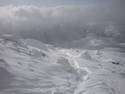
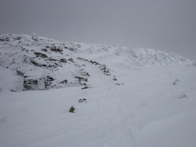
The Greenleaf Trail below Mt. Lafayette
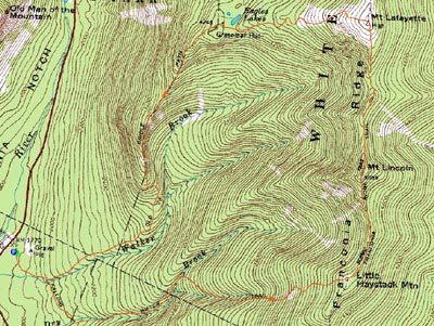

Directions to trailhead: Take Interstate 93 north from Lincoln to the Lafayette Place exit.
Back to Little Haystack Mountain Profile
Back to Mt. Lincoln Profile
Back to Mt. Truman Profile
Back to Mt. Lafayette Profile
|