Home
States
Colorado
Connecticut
Maine
Massachusetts
New Hampshire
New York
Rhode Island
Utah
Vermont
View All
Lists
NE 4,000 Footers
NE 100 Highest
NH 4,000 Footers
NH 100 Highest
NH 52 With A View
NH Belknap Range
NH Ossipee 10
Links
Trail Conditions
Trip Log
Sunrises
Sunsets
About
|
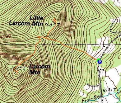
Little Larcom Mountain, Larcom Mountain
Tamworth, NH
Trailheads, measurements, times, distances, and maps are all approximate and relative to the hike(s) as shown below.
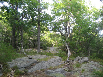
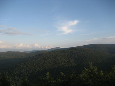
Looking up the trail to Little Larcom Mountain
Route: Unknown trail, (Little Larcom Mountain), unknown trail, (Larcom Mountain), unknown trail
After having done a small hike in southern Maine, I decided I wanted to get out for another quick hike if the weather cooperated. While things were a bit cloudy and hazy, it looked like there wouldn't be much rain hitting the northern Ossipee Mountains.
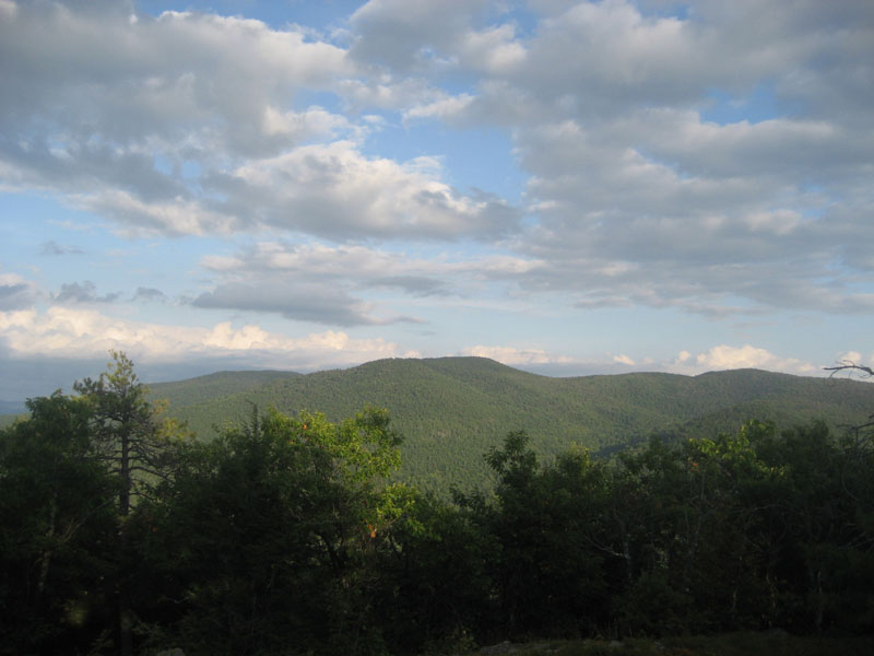
Arriving at the small parking area across the street from the apple orchard, I quickly set foot up the left side of the field, soon reaching the quasi-logging road at the top. Heading up this logging road, I hit a flagged junction at a height of land after a few minutes. Taking a right, I headed up a trail that soon arrived at the somewhat ledgy summit of Little Larcom Mountain. Though hazy, there were decent views of Kearsarge North and some of the northern Ossipee Mountains. After looking around a bit, I headed back down the trail to the junction, then headed straight, descending slightly, the ascending sharply in places.
For a relatively unknown trail, it looks like it does get some use. There are a variety of markings, ranging from old ax blazes to faded painted blazes to surveying tape to painted wooded arrows.
The summit of Larcom was a surprise - there were multiple ledges and even some old surveying pins. Once again, the views were a bit hazy, but the Sandwich Range, part of the lake, and many Ossipee peaks were visisble. My favorite viewpoint, looking toward Mt. Shaw, came from a nice long ledge located a little bit below the highpoint.
While the views were slowly improving, night was quickly approaching, so I decided to head back while I was ahead in the game. What a neat hike!
| Hike Ratings |
|
Getting To Trailhead: |
Easy |
| Destination: |
Little Larcom Mountain |
|
Length: |
Easy |
|
Steepness: |
Difficult |
|
Navigation: |
Moderate |
|
Views: |
Excellent |
|
Crowds: |
Minimal |
| Destination: |
Larcom Mountain |
|
Length: |
Moderate |
|
Steepness: |
Difficult |
|
Navigation: |
Moderate |
|
Views: |
Excellent |
|
Crowds: |
Minimal |
|
| Hike Stats |
|
Date Hiked: |
Saturday, September 13, 2008 |
| Hike Commenced: |
5:23 PM |
| Parking Elevation: |
1,050' |
| Destination: |
Little Larcom Mountain |
| Ascent Commenced: |
5:23 PM |
| Summit Reached: |
5:39 PM |
| Time Elapsed: |
00:16 |
| Trailhead Elevation: |
1,050' |
| Summit Elevation: |
1,685' |
| Vertical Gain: |
650' |
| Destination: |
Larcom Mountain |
| Ascent Commenced: |
5:44 PM |
| Summit Reached: |
6:02 PM |
| Time Elapsed: |
00:18 |
| Trailhead Elevation: |
1,685' |
| Summit Elevation: |
2,093' |
| Vertical Gain: |
533' |
|
|
| Hike Ended: |
6:38 PM |
| Hike Time Elapsed: |
01:15 |
| Hike Vertical Gain: |
1,198' |
|
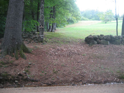
The beginning of the trail on Mountain Road

Looking at Bald Mountain from near the Little Larcom Mountain summit
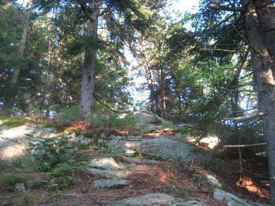
Looking up the trail near the Larcom Mountain summit
Looking at at Mt. Shaw from near the Larcom Mountain summit

Directions to trailhead: ---Please note, as of Winter 2009, this trailhead is reportedly closed to hikers.--- Take Route 25 west from West Ossipee to South Tamworth. Just after hitting the reduced speed limit, take a left onto Mountain Road. Drive up this road, cross a bridge, then head up to the height of land (apple orchard and a small shack on the right). Just after the height of land and at the south edge of the field that contains the apple orchard, there is a small parking area on the left. The trail starts on the right, following the edge of the field, then entering the woods at the top.
Back to Little Larcom Mountain Profile
Back to Larcom Mountain Profile
|